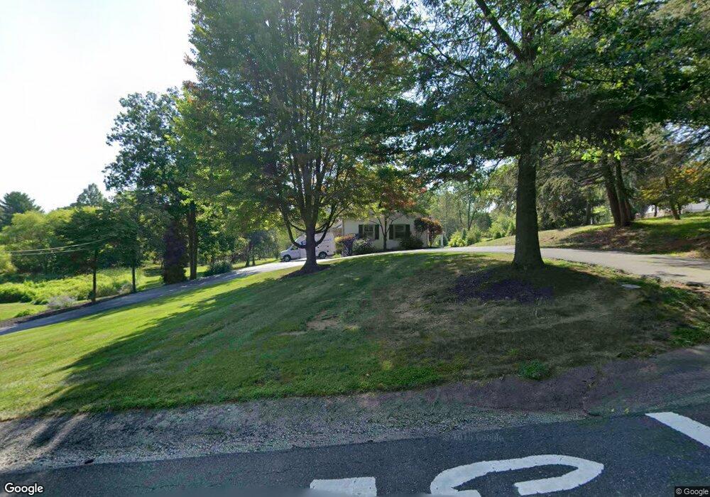
1702 Landis Rd Worcester, PA 19490
Estimated Value: $713,000 - $984,000
5
Beds
5
Baths
5,000
Sq Ft
$175/Sq Ft
Est. Value
About This Home
This home is located at 1702 Landis Rd, Worcester, PA 19490 and is currently estimated at $875,123, approximately $175 per square foot. 1702 Landis Rd is a home located in Montgomery County with nearby schools including Worcester Elementary School, Skyview Upper Elementary School, and Arcola Intermediate School.
Ownership History
Date
Name
Owned For
Owner Type
Purchase Details
Closed on
Feb 21, 2013
Sold by
Koch Joseph and Koch Christine
Bought by
Koch Christine
Current Estimated Value
Home Financials for this Owner
Home Financials are based on the most recent Mortgage that was taken out on this home.
Original Mortgage
$349,000
Outstanding Balance
$245,767
Interest Rate
3.57%
Mortgage Type
New Conventional
Estimated Equity
$629,356
Purchase Details
Closed on
Jul 17, 2003
Sold by
Berardelli Carol and Berardelli Robert
Bought by
Koch Christine and Koch Joseph
Purchase Details
Closed on
Jan 29, 1999
Sold by
Meszaros Joseph
Bought by
Koch Joseph and Koch Christine
Create a Home Valuation Report for This Property
The Home Valuation Report is an in-depth analysis detailing your home's value as well as a comparison with similar homes in the area
Home Values in the Area
Average Home Value in this Area
Purchase History
| Date | Buyer | Sale Price | Title Company |
|---|---|---|---|
| Koch Christine | -- | None Available | |
| Koch Christine | -- | -- | |
| Koch Joseph | $225,000 | -- |
Source: Public Records
Mortgage History
| Date | Status | Borrower | Loan Amount |
|---|---|---|---|
| Open | Koch Christine | $349,000 |
Source: Public Records
Tax History Compared to Growth
Tax History
| Year | Tax Paid | Tax Assessment Tax Assessment Total Assessment is a certain percentage of the fair market value that is determined by local assessors to be the total taxable value of land and additions on the property. | Land | Improvement |
|---|---|---|---|---|
| 2025 | $12,534 | $330,910 | -- | -- |
| 2024 | $12,534 | $330,910 | -- | -- |
| 2023 | $11,786 | $324,410 | $93,440 | $230,970 |
| 2022 | $11,558 | $324,410 | $93,440 | $230,970 |
| 2021 | $11,330 | $324,410 | $93,440 | $230,970 |
| 2020 | $11,120 | $324,410 | $93,440 | $230,970 |
| 2019 | $11,011 | $324,410 | $93,440 | $230,970 |
| 2018 | $1,265 | $324,410 | $93,440 | $230,970 |
| 2017 | $10,588 | $324,410 | $93,440 | $230,970 |
| 2016 | $10,462 | $324,410 | $93,440 | $230,970 |
| 2015 | $10,189 | $324,410 | $93,440 | $230,970 |
| 2014 | $10,090 | $324,410 | $93,440 | $230,970 |
Source: Public Records
Map
Nearby Homes
- 1716 Landis Rd
- LOT 28 Heebner Rd
- 3180 Zacharias Rd
- 1534 N Trooper Rd
- 2725 Skippack Pike
- 2967 Township Line Rd
- 1811 Hollow Rd
- 3235 Heebner Rd
- 2 Capri Ln Unit KINSLEY
- 2624 Hawthorn Dr
- 1507 Potshop Rd
- 2203 Weber Rd
- 1921 Whitehall Rd
- 3053 Sunny Ayre Dr
- 3333 Stump Hall Rd
- 2564 W Skippack Pike
- 1939 Penngrove Terrace
- 2806 Morris Rd
- 1241 & 1243 Valley Forge Rd
- 2099 Deep Meadow Ln
- 1650 Landis Rd
- 2888 Crest Terrace
- 1703 Landis Rd
- 1720 Landis Rd
- 1653 Landis Rd
- 1715 Landis Rd
- 1648 Landis Rd
- 2888 Crest Terrace
- 1644 Landis Rd
- 1645 Landis Rd
- 1721 Landis Rd
- 2892 Crest Terrace
- 2884 Crest Terrace
- 2888 Hickory Hill Rd
- 2896 Hickory Hill Rd
- 1637 Landis Rd
- 1636 Landis Rd
- 2885 Crest Terrace
- 2880 Crest Terrace
- 2902 Hickory Hill Rd