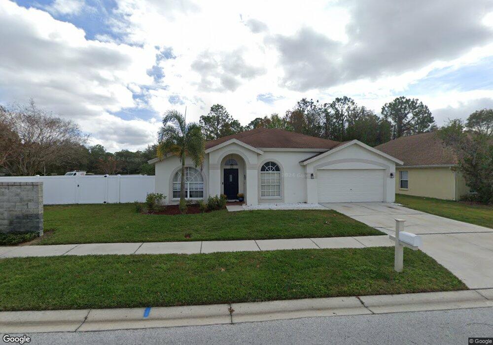
1702 Stetson Dr Wesley Chapel, FL 33543
Estimated Value: $377,000 - $471,000
Studio
2
Baths
1,846
Sq Ft
$224/Sq Ft
Est. Value
About This Home
This home is located at 1702 Stetson Dr, Wesley Chapel, FL 33543 and is currently estimated at $412,907, approximately $223 per square foot. 1702 Stetson Dr is a home located in Pasco County with nearby schools including Sand Pine Elementary School, Dr. John Long Middle School, and Wiregrass Ranch High School.
Ownership History
Date
Name
Owned For
Owner Type
Purchase Details
Closed on
Feb 3, 2011
Sold by
Kirby Robert Lee
Bought by
Laverty Michael and Laverly Karen T
Current Estimated Value
Purchase Details
Closed on
Dec 20, 1999
Sold by
Ih New Tampa Homes Inc
Bought by
Kirby Robert L
Home Financials for this Owner
Home Financials are based on the most recent Mortgage that was taken out on this home.
Original Mortgage
$120,550
Interest Rate
7.85%
Mortgage Type
New Conventional
Purchase Details
Closed on
Oct 10, 1994
Sold by
Trout Creek Dev Corp
Bought by
Atlantic Homes Tampa Bay
Create a Home Valuation Report for This Property
The Home Valuation Report is an in-depth analysis detailing your home's value as well as a comparison with similar homes in the area
Home Values in the Area
Average Home Value in this Area
Purchase History
| Date | Buyer | Sale Price | Title Company |
|---|---|---|---|
| Laverty Michael | -- | None Available | |
| Kirby Robert L | $160,600 | -- | |
| Atlantic Homes Tampa Bay | $26,400 | -- |
Source: Public Records
Mortgage History
| Date | Status | Borrower | Loan Amount |
|---|---|---|---|
| Previous Owner | Kirby Robert L | $120,550 |
Source: Public Records
Tax History
| Year | Tax Paid | Tax Assessment Tax Assessment Total Assessment is a certain percentage of the fair market value that is determined by local assessors to be the total taxable value of land and additions on the property. | Land | Improvement |
|---|---|---|---|---|
| 2026 | $3,611 | $162,210 | -- | -- |
| 2025 | $3,611 | $162,210 | -- | -- |
| 2024 | $3,611 | $153,200 | -- | -- |
| 2023 | $3,399 | $148,740 | $0 | $0 |
| 2022 | $3,019 | $144,410 | $0 | $0 |
| 2021 | $2,964 | $140,210 | $57,787 | $82,423 |
| 2020 | $2,941 | $138,280 | $35,037 | $103,243 |
| 2019 | $2,858 | $135,180 | $0 | $0 |
| 2018 | $2,820 | $132,664 | $0 | $0 |
| 2017 | $2,758 | $132,664 | $0 | $0 |
| 2016 | $3,041 | $127,262 | $0 | $0 |
| 2015 | $3,062 | $126,377 | $0 | $0 |
| 2014 | $2,987 | $165,067 | $28,457 | $136,610 |
Source: Public Records
Map
Nearby Homes
- 29619 Allegro Dr Unit 2
- 1832 Sassafras Dr
- 1331 Deerbourne Dr
- 1747 Ravenridge St
- 30059 Granda Hills Ct
- 1931 Sassafras Dr
- 1837 Ravenridge St
- 30101 Emmetts Ct
- 30115 Emmetts Ct
- 30119 Wellesley Way Unit 1
- 1250 Redondo Way
- 30134 Barnaby Ln
- 29430 Sea Dahlia Pass
- 1429 Sedgwick Dr
- 29943 Ganga Way
- 1246 Charlesworth Dr
- 29947 Yamuna Way
- 30315 Lettingwell Cir
- 1211 Haddington Way
- 29454 Crossland Dr
- 1648 Stetson Dr
- 1642 Stetson Dr Unit 2
- 29727 Eagle Station Dr
- 1636 Stetson Dr
- 29724 Eagle Station Dr
- 29721 Eagle Station Dr
- 29812 Morwen Place
- 29806 Morwen Place Unit 3
- 29748 Morwen Place
- 29718 Eagle Station Dr
- 29742 Morwen Place
- 1628 Stetson Dr
- 29715 Eagle Station Dr
- 29715 Forest Glen Dr
- 29736 Morwen Place
- 29818 Morwen Place
- 29710 Eagle Station Dr
- 29709 Forest Glen Dr
- 29728 Morwen Place
- 29709 Eagle Station Dr
Your Personal Tour Guide
Ask me questions while you tour the home.