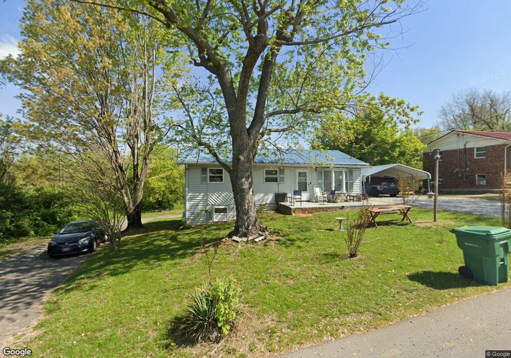
1702 Thomas R James Dr Morristown, TN 37813
Estimated Value: $138,091 - $198,000
--
Bed
2
Baths
912
Sq Ft
$196/Sq Ft
Est. Value
About This Home
This home is located at 1702 Thomas R James Dr, Morristown, TN 37813 and is currently estimated at $178,523, approximately $195 per square foot. 1702 Thomas R James Dr is a home located in Hamblen County with nearby schools including Lincoln Heights Elementary School, Lincoln Heights Middle School, and Morristown West High School.
Ownership History
Date
Name
Owned For
Owner Type
Purchase Details
Closed on
Sep 22, 2008
Sold by
Drinnon James F
Bought by
Broyles Patricia
Current Estimated Value
Purchase Details
Closed on
Aug 14, 2008
Sold by
Dohrman Teresa L
Bought by
Drinnon James F
Purchase Details
Closed on
Jun 7, 1982
Bought by
Dohrman Teresa L
Purchase Details
Closed on
Oct 23, 1980
Bought by
English Mack and English Carolyn
Purchase Details
Closed on
Feb 10, 1979
Bought by
Garrett Wayne and Garrett Lois
Purchase Details
Closed on
Aug 29, 1977
Bought by
Bank Of Commerce
Create a Home Valuation Report for This Property
The Home Valuation Report is an in-depth analysis detailing your home's value as well as a comparison with similar homes in the area
Home Values in the Area
Average Home Value in this Area
Purchase History
| Date | Buyer | Sale Price | Title Company |
|---|---|---|---|
| Broyles Patricia | -- | -- | |
| Drinnon James F | -- | -- | |
| Dohrman Teresa L | $25,600 | -- | |
| English Mack | $23,000 | -- | |
| Garrett Wayne | $20,300 | -- | |
| Bank Of Commerce | $13,700 | -- |
Source: Public Records
Tax History Compared to Growth
Tax History
| Year | Tax Paid | Tax Assessment Tax Assessment Total Assessment is a certain percentage of the fair market value that is determined by local assessors to be the total taxable value of land and additions on the property. | Land | Improvement |
|---|---|---|---|---|
| 2024 | $279 | $15,875 | $3,300 | $12,575 |
| 2023 | $279 | $15,875 | $0 | $0 |
| 2022 | $501 | $15,875 | $3,300 | $12,575 |
| 2021 | $501 | $15,875 | $3,300 | $12,575 |
| 2020 | $501 | $15,875 | $3,300 | $12,575 |
| 2019 | $517 | $15,225 | $3,275 | $11,950 |
| 2018 | $479 | $15,225 | $3,275 | $11,950 |
| 2017 | $472 | $15,225 | $3,275 | $11,950 |
| 2016 | $451 | $15,225 | $3,275 | $11,950 |
| 2015 | $419 | $15,225 | $3,275 | $11,950 |
| 2014 | -- | $15,225 | $3,275 | $11,950 |
| 2013 | -- | $17,175 | $0 | $0 |
Source: Public Records
Map
Nearby Homes
- 440 S Fairmont Ave
- 1530 Rayburn Dr
- 837 Pauline Ave
- 1476 Darbee Dr
- 1211 W 6th St N
- Darwin Plan at Southwood
- Penwell Plan at Southwood
- Elston Plan at Southwood
- Robie Plan at Southwood
- Cali Plan at Southwood
- Belhaven Plan at Southwood
- 1049 Greenway Dr
- 2018 Southwood Cir
- 203 Lincoln Ave
- 731 Lennie Ave
- 1002 Watercrest St
- 816 W 2nd St N
- 1442 Darbee Dr
- 707 Walters Dr
- 722 W 2nd St N
- 1700 Thomas R James Dr
- 0 Thomas R James Dr
- 1703 Thomas R James Dr
- 1660 Thomas R James Dr
- 1719 Thomas R James Dr
- 1656 Thomas R James Dr
- 1840 Thomas R James Dr
- 909 Neikirk Dr
- 1821 Thomas R James Dr
- 0 Neikirk Dr
- 1655 Thomas R James Dr
- 1882 Thomas R James Dr
- 1853 Thomas R James Dr
- 1651 Thomas R James Dr
- 910 Neikirk Dr
- 961 Neikirk Dr
- 1647 Thomas R James Dr
- 918 Neikirk Dr
- 962 Neikirk Dr
- 1887 Thomas R James Dr