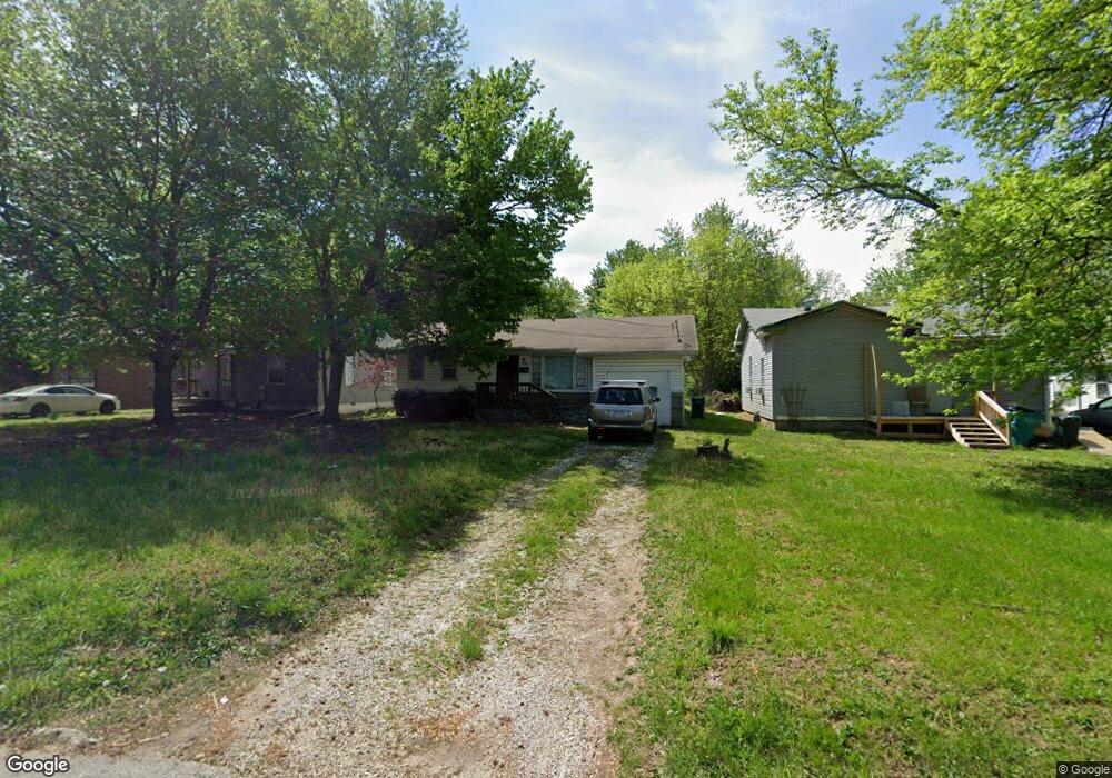
1702 W High St Springfield, MO 65803
Tom Watkins NeighborhoodEstimated Value: $115,068 - $140,000
3
Beds
1
Bath
1,014
Sq Ft
$126/Sq Ft
Est. Value
About This Home
This home is located at 1702 W High St, Springfield, MO 65803 and is currently estimated at $127,517, approximately $125 per square foot. 1702 W High St is a home located in Greene County with nearby schools including Williams Elementary School, Reed Academy, and Hillcrest High School.
Ownership History
Date
Name
Owned For
Owner Type
Purchase Details
Closed on
Oct 1, 2025
Sold by
Dfb Properties Llc
Bought by
Dfb Rentals Llc
Current Estimated Value
Home Financials for this Owner
Home Financials are based on the most recent Mortgage that was taken out on this home.
Original Mortgage
$106,400
Outstanding Balance
$106,305
Interest Rate
6.58%
Mortgage Type
New Conventional
Estimated Equity
$21,212
Purchase Details
Closed on
Jan 7, 2021
Sold by
Alcorn Shawn M
Bought by
Dfb Properties Llc
Home Financials for this Owner
Home Financials are based on the most recent Mortgage that was taken out on this home.
Original Mortgage
$55,000
Interest Rate
2.65%
Mortgage Type
New Conventional
Purchase Details
Closed on
Nov 20, 2014
Sold by
Robinson Tena Lea
Bought by
Alcorn Shawn M
Home Financials for this Owner
Home Financials are based on the most recent Mortgage that was taken out on this home.
Original Mortgage
$47,200
Interest Rate
4.14%
Mortgage Type
New Conventional
Purchase Details
Closed on
Jul 22, 2009
Sold by
Glenn Emma L
Bought by
Glenn Emma L
Create a Home Valuation Report for This Property
The Home Valuation Report is an in-depth analysis detailing your home's value as well as a comparison with similar homes in the area
Home Values in the Area
Average Home Value in this Area
Purchase History
| Date | Buyer | Sale Price | Title Company |
|---|---|---|---|
| Dfb Rentals Llc | -- | None Listed On Document | |
| Dfb Properties Llc | -- | None Available | |
| Alcorn Shawn M | -- | None Available | |
| Glenn Emma L | -- | None Available |
Source: Public Records
Mortgage History
| Date | Status | Borrower | Loan Amount |
|---|---|---|---|
| Open | Dfb Rentals Llc | $106,400 | |
| Previous Owner | Dfb Properties Llc | $55,000 | |
| Previous Owner | Dfb Properties Llc | $55,000 | |
| Previous Owner | Alcorn Shawn M | $47,200 |
Source: Public Records
Tax History
| Year | Tax Paid | Tax Assessment Tax Assessment Total Assessment is a certain percentage of the fair market value that is determined by local assessors to be the total taxable value of land and additions on the property. | Land | Improvement |
|---|---|---|---|---|
| 2025 | $630 | $12,640 | $2,850 | $9,790 |
| 2024 | $598 | $11,150 | $1,900 | $9,250 |
| 2023 | $595 | $11,150 | $1,900 | $9,250 |
| 2022 | $561 | $10,280 | $1,900 | $8,380 |
| 2021 | $561 | $10,280 | $1,900 | $8,380 |
| 2020 | $541 | $9,480 | $1,900 | $7,580 |
| 2019 | $526 | $9,480 | $1,900 | $7,580 |
| 2018 | $535 | $9,650 | $1,900 | $7,750 |
| 2017 | $530 | $9,650 | $1,900 | $7,750 |
| 2016 | $529 | $9,650 | $1,900 | $7,750 |
| 2015 | $524 | $9,650 | $1,900 | $7,750 |
| 2014 | $528 | $9,650 | $1,900 | $7,750 |
Source: Public Records
Map
Nearby Homes
- 2117 N Lexington Ave
- 2234 N Fay Ave
- 2130 N Elizabeth Ave
- 2253 N Fay Ave
- 1634 W Lee St
- 2306 N Fay Ave
- 2250 N Kansas Kxpy Expy
- 2326 N Farmer Ave
- 1516 W Lee St
- 1700 W Atlantic St
- 1.21 Acres N Kansas Expy
- 2111 N Newton Ave
- 2119 N Marion Ave
- 1956 W Atlantic St
- 2021 W Atlantic St
- 2130 N Park Ave
- 2237 N Park Ave
- 2104 N Park Ave
- 2453 N Albertha Ave
- 2009 N Park Ave
- 1628 W High St
- 1706 W High St
- 1620 W High St
- 1716 W High St
- 1616 W High St
- 1718 W High St
- 1635 W Dale St
- 1629 W Dale St
- 1703 W Dale St
- 1701 W High St
- 1705 W High St
- 1709 W High St
- 1625 W High St
- 1715 W High St
- 1619 W High St
- 2125 N Kansas Ave
- 2125 N Kansas Ave
- 2140 N Lexington Ave
- 1719 W High St
- 1717 W Dale St