

17027 E Annadale Ave Sanger, CA 93657
Estimated payment $12,714/month
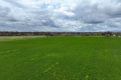
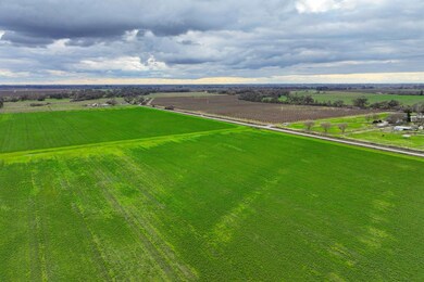
About This Lot
Location
Property is located at 17027 E. Annadale Avenue in Sanger, CA.
Size
+/-72.88 Assessed Acres
Land Use
Property is open land currently being farmed as Alfalfa.
Water
Property is located in the Kings River Water District with a turn out, and is part of Kings River East GSA. There is no well or pump on the property.
Soil
See Soil Map and Soil Description.
Legal
Fresno County APN: 333-090-03
Groundwater Disclosure
Sustainable Groundwater Management Act (SGMA) requires groundwater basins to be sustainable by 2040. SGMA requires a Groundwater Sustainability Plan (GSP) by 2020. Said plans may limit ground water pumping. For more information please visit the SGMA website.
Remarks
Discover the allure of this prime location nestled within the scenic Sanger River Bottom. With access to excellent district water, this picturesque setting offers the perfect canvas to build your dream home. Dont miss this opportunity to create your ideal living space in this idyllic environment.

Property Details
Property Type
- Land
Est. Annual Taxes
- $7,386
Lot Details
- Current uses include agriculture, residential single
- Potential uses include agriculture, residential single
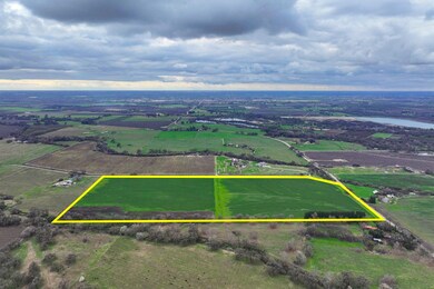
Map
Home Values in the Area
Average Home Value in this Area
Tax History
| Year | Tax Paid | Tax Assessment Tax Assessment Total Assessment is a certain percentage of the fair market value that is determined by local assessors to be the total taxable value of land and additions on the property. | Land | Improvement |
|---|---|---|---|---|
| 2025 | $7,386 | $619,528 | $619,528 | -- |
| 2023 | $7,293 | $595,472 | $595,472 | $0 |
| 2022 | $7,182 | $583,797 | $583,797 | $0 |
| 2021 | $7,124 | $572,350 | $572,350 | $0 |
| 2020 | $6,913 | $566,482 | $566,482 | $0 |
| 2019 | $6,772 | $555,375 | $555,375 | $0 |
| 2018 | $6,487 | $544,486 | $544,486 | $0 |
| 2017 | $6,376 | $533,810 | $533,810 | $0 |
| 2016 | $5,987 | $523,344 | $523,344 | $0 |
| 2015 | $6,038 | $515,483 | $515,483 | $0 |
| 2014 | $5,955 | $505,386 | $505,386 | $0 |
Property History
| Date | Event | Price | Change | Sq Ft Price |
|---|---|---|---|---|
| 01/23/2025 01/23/25 | For Sale | $2,186,400 | -- | -- |
Purchase History
| Date | Type | Sale Price | Title Company |
|---|---|---|---|
| Grant Deed | -- | -- |
- 0 N Piedra Rd Unit 23953832
- 17439 E Kings Canyon Rd
- 0 E Annadale Ave Unit W. of S. Riverbend A
- 50000 California 180
- 1098 S Rainbow Route
- 93 Wood Duck Dr
- 17231 E Trimmer Springs Rd
- 18176 Little Beaver Rd
- 5139 Jim Savage Rd
- 5221 S Reed Ave
- 339 N Frankwood Ave Unit 6
- 339 N Frankwood Ave Unit 24
- 535 Barbara Ave
- 919 Harriett Ave
- 0 0 Unit 633407
- 3670 S Newmark Ave
- 3680 S Newmark Ave
- 1875 5th St Unit 203
- 12835 E Mckinley Ave Unit P
- 2964 Arundel Way Unit 2964-A
- 683 N Haney Ave
- 2962 de Wolf Ave
- 3798 Ashlan Ave
- 3670 Mccall Ave
- 4155 Twain Ave
- 3700 Loma Vista Pkwy
- 12157 S Bethel Ave
- 680 N Elise Ln
- 7435 E Robinson Ave
- 6446 E Meritage Dr
- 2594 N Armstrong Ave
- 6563 E Tobey Ave
- 3543 Significant Way
- 2627-2667 Ashlan Ave
- 450 S Argyle Ave Unit Argyle #115
- 350 S Argyle Ave
- 3173 Scott Ave