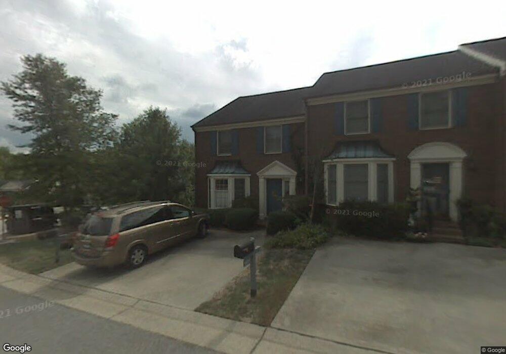
1703 Ternberry Rd High Point, NC 27262
Greater High Point NeighborhoodEstimated Value: $217,000 - $274,000
2
Beds
3
Baths
1,408
Sq Ft
$170/Sq Ft
Est. Value
About This Home
This home is located at 1703 Ternberry Rd, High Point, NC 27262 and is currently estimated at $239,258, approximately $169 per square foot. 1703 Ternberry Rd is a home located in Guilford County with nearby schools including Northwood Elementary School, Ferndale Middle School, and High Point Central High School.
Ownership History
Date
Name
Owned For
Owner Type
Purchase Details
Closed on
Jul 2, 2021
Sold by
Buckner Arnold Graham and Buckner Linda C
Bought by
Hunsucker Thomas Jacob
Current Estimated Value
Home Financials for this Owner
Home Financials are based on the most recent Mortgage that was taken out on this home.
Original Mortgage
$153,000
Outstanding Balance
$138,824
Interest Rate
2.9%
Mortgage Type
New Conventional
Estimated Equity
$100,434
Purchase Details
Closed on
Oct 24, 2003
Sold by
Childress Mary L and Childress Russell
Bought by
Buckner Arnold Graham and Buckner Linda C
Home Financials for this Owner
Home Financials are based on the most recent Mortgage that was taken out on this home.
Original Mortgage
$104,800
Interest Rate
3.87%
Mortgage Type
Purchase Money Mortgage
Create a Home Valuation Report for This Property
The Home Valuation Report is an in-depth analysis detailing your home's value as well as a comparison with similar homes in the area
Home Values in the Area
Average Home Value in this Area
Purchase History
| Date | Buyer | Sale Price | Title Company |
|---|---|---|---|
| Hunsucker Thomas Jacob | $180,000 | None Available | |
| Buckner Arnold Graham | $131,000 | -- |
Source: Public Records
Mortgage History
| Date | Status | Borrower | Loan Amount |
|---|---|---|---|
| Open | Hunsucker Thomas Jacob | $153,000 | |
| Previous Owner | Buckner Arnold Graham | $104,800 |
Source: Public Records
Tax History
| Year | Tax Paid | Tax Assessment Tax Assessment Total Assessment is a certain percentage of the fair market value that is determined by local assessors to be the total taxable value of land and additions on the property. | Land | Improvement |
|---|---|---|---|---|
| 2025 | $2,420 | $175,600 | $34,000 | $141,600 |
| 2024 | $2,420 | $175,600 | $34,000 | $141,600 |
| 2023 | $2,420 | $175,600 | $34,000 | $141,600 |
| 2022 | $2,367 | $175,600 | $34,000 | $141,600 |
| 2021 | $1,594 | $115,700 | $21,000 | $94,700 |
| 2020 | $1,594 | $115,700 | $21,000 | $94,700 |
| 2019 | $1,594 | $115,700 | $0 | $0 |
| 2018 | $1,586 | $115,700 | $0 | $0 |
| 2017 | $1,594 | $115,700 | $0 | $0 |
| 2016 | $1,717 | $122,400 | $0 | $0 |
| 2015 | $1,726 | $122,400 | $0 | $0 |
| 2014 | $1,755 | $122,400 | $0 | $0 |
Source: Public Records
Map
Nearby Homes
- 1001 Nuthatch Ct
- 914 Flicker Ln
- 708 Rockspring Rd
- 416 Greenwood Dr
- 709 Overbrook Dr
- 1616 Heathcliff Rd
- 629 Rockspring Rd
- 506 Greenwood Dr
- 744 Celtic Crossing Dr
- 900 W Lexington Ave
- 619 W Lexington Ave
- 752 Celtic Crossing Dr
- 607 Rockspring Rd
- 101 Oxford Place Unit 19
- 1508 Wendover Dr
- 2215 Shadow Valley Rd Unit H
- 443 W Lexington Ave
- 1101 Robin Hood Rd
- 795 Avalon Springs Ct
- 417 Hillcrest Dr
- 1701 Ternberry Rd
- 1705 Ternberry Rd
- 1707 Ternberry Rd
- 1709 Ternberry Rd
- 1613 Ternberry Rd
- 1611 Ternberry Rd
- 1706 Ternberry Rd
- 1708 Ternberry Rd
- 1712 Ternberry Rd
- 1714 Ternberry Rd
- 1609 Ternberry Rd
- 1704 Ternberry Rd
- 1607 Ternberry Rd
- 1605 Ternberry Rd
- 1713 Ternberry Rd
- 1716 Ternberry Rd
- 1603 Ternberry Rd
- 1601 Ternberry Rd
- 1715 Ternberry Rd
- 1615 Ternberry Rd
Your Personal Tour Guide
Ask me questions while you tour the home.