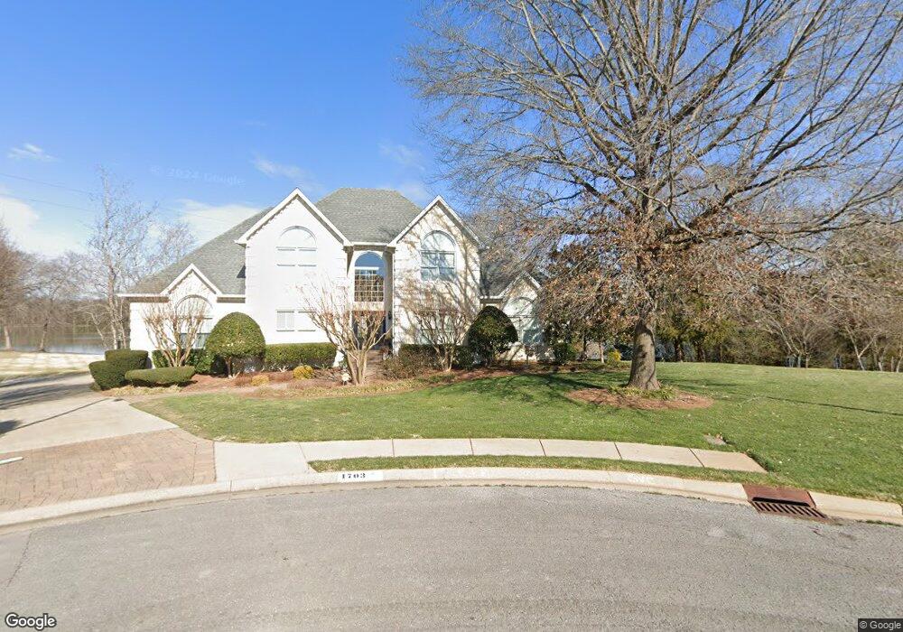
1703 Waters Edge Ct Murfreesboro, TN 37130
Estimated Value: $808,000 - $970,000
--
Bed
4
Baths
4,088
Sq Ft
$214/Sq Ft
Est. Value
About This Home
This home is located at 1703 Waters Edge Ct, Murfreesboro, TN 37130 and is currently estimated at $873,913, approximately $213 per square foot. 1703 Waters Edge Ct is a home located in Rutherford County with nearby schools including Black Fox Elementary School, Whitworth-Buchanan Middle School, and Riverdale High School.
Ownership History
Date
Name
Owned For
Owner Type
Purchase Details
Closed on
Oct 31, 2001
Sold by
Wiser Cyrus W and Wiser Regina G
Bought by
Richard Reeves W and Richard Joan
Current Estimated Value
Purchase Details
Closed on
Oct 27, 1998
Sold by
Matthews Roderick M
Bought by
Richard Reeves W and Richard Joan
Home Financials for this Owner
Home Financials are based on the most recent Mortgage that was taken out on this home.
Original Mortgage
$330,000
Interest Rate
6.65%
Purchase Details
Closed on
Apr 7, 1995
Sold by
Hatcliff William P
Bought by
Matthews Roderick M
Create a Home Valuation Report for This Property
The Home Valuation Report is an in-depth analysis detailing your home's value as well as a comparison with similar homes in the area
Home Values in the Area
Average Home Value in this Area
Purchase History
| Date | Buyer | Sale Price | Title Company |
|---|---|---|---|
| Richard Reeves W | -- | -- | |
| Richard Reeves W | $430,000 | -- | |
| Matthews Roderick M | $365,000 | -- |
Source: Public Records
Mortgage History
| Date | Status | Borrower | Loan Amount |
|---|---|---|---|
| Previous Owner | Matthews Roderick M | $330,000 |
Source: Public Records
Tax History Compared to Growth
Tax History
| Year | Tax Paid | Tax Assessment Tax Assessment Total Assessment is a certain percentage of the fair market value that is determined by local assessors to be the total taxable value of land and additions on the property. | Land | Improvement |
|---|---|---|---|---|
| 2025 | $5,328 | $188,375 | $33,750 | $154,625 |
| 2024 | $5,328 | $188,375 | $33,750 | $154,625 |
| 2023 | $3,561 | $189,825 | $33,750 | $156,075 |
| 2022 | $3,068 | $189,825 | $33,750 | $156,075 |
| 2021 | $2,839 | $127,925 | $28,250 | $99,675 |
| 2020 | $2,839 | $127,925 | $28,250 | $99,675 |
| 2019 | $2,839 | $127,925 | $28,250 | $99,675 |
| 2018 | $3,901 | $127,925 | $0 | $0 |
| 2017 | $4,664 | $120,000 | $0 | $0 |
| 2016 | $4,664 | $120,000 | $0 | $0 |
| 2015 | $4,664 | $120,000 | $0 | $0 |
| 2014 | $2,984 | $120,000 | $0 | $0 |
| 2013 | -- | $113,825 | $0 | $0 |
Source: Public Records
Map
Nearby Homes
- 1518 Cameron Ct
- 1519 Kensington Dr
- 1919 Chartwell Ct
- 1103 S Baird Ln
- 1602 Cypress Dr
- 1315 Bradyville Pike Unit 2
- 1315 Bradyville Pike Unit 1
- 1806 Greerson Dr
- 1834 Greerson Ct
- 1819 Greerson Dr
- 1919 Bradyville Pike
- 1951 Russell Ct
- 2010 Olympia Place
- 2010 Bartway Dr Unit 2012
- 914 Kay St
- 1003 Tyler Ct
- 1811 Meadowgreen Dr
- 710 Saratoga Dr
- 1906 Gardner Dr
- 2209 Seahunter Ct
- 1702 Waters Edge Ct
- 1711 Waters Edge Ct
- 1706 Waters Edge Ct
- 1715 Waters Edge Ct
- 1419 Broadlands Dr
- 1719 Waters Edge Ct
- 1426 Broadlands Dr
- 1426 Broad Lands Dr
- 1402 Lakeshore Dr
- 1635 Glenhaven Dr
- 1422 Broad Lands Dr
- 1326 Lakeshore Dr
- 1415 Broad Lands Dr
- 1631 Glenhaven Dr
- 1720 Waters Edge Ct
- 1634 Glenhaven Dr
- 1322 Lakeshore Dr
- 1414 Broad Lands Dr
- 1410 Lakeshore Dr
- 1406 Lakeshore Dr