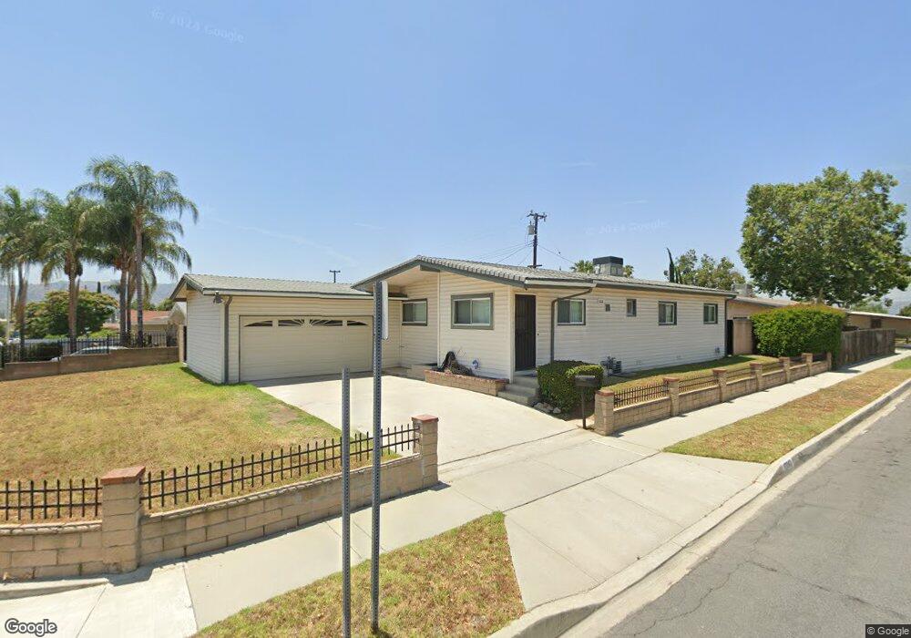
17042 Rorimer St La Puente, CA 91744
Estimated Value: $682,000 - $725,000
4
Beds
2
Baths
1,158
Sq Ft
$608/Sq Ft
Est. Value
About This Home
This home is located at 17042 Rorimer St, La Puente, CA 91744 and is currently estimated at $704,307, approximately $608 per square foot. 17042 Rorimer St is a home located in Los Angeles County with nearby schools including Hurley Elementary School, Giano Intermediate School, and Nogales High School.
Ownership History
Date
Name
Owned For
Owner Type
Purchase Details
Closed on
Nov 28, 2022
Sold by
Chadwick Don and Chadwick Regina
Bought by
Chadwick Family Trust
Current Estimated Value
Purchase Details
Closed on
Dec 3, 1998
Sold by
Alford Carrie B and Montgomery Carrie B
Bought by
The Carrie B Alford Revocable 1998 Trust
Purchase Details
Closed on
Jul 24, 1996
Sold by
Reid Tracy
Bought by
Alford Carrie B
Home Financials for this Owner
Home Financials are based on the most recent Mortgage that was taken out on this home.
Original Mortgage
$65,500
Interest Rate
8.18%
Create a Home Valuation Report for This Property
The Home Valuation Report is an in-depth analysis detailing your home's value as well as a comparison with similar homes in the area
Home Values in the Area
Average Home Value in this Area
Purchase History
| Date | Buyer | Sale Price | Title Company |
|---|---|---|---|
| Chadwick Family Trust | -- | -- | |
| The Carrie B Alford Revocable 1998 Trust | -- | -- | |
| Alford Carrie B | -- | Old Republic Title Company |
Source: Public Records
Mortgage History
| Date | Status | Borrower | Loan Amount |
|---|---|---|---|
| Previous Owner | Alford Carrie B | $65,500 |
Source: Public Records
Tax History
| Year | Tax Paid | Tax Assessment Tax Assessment Total Assessment is a certain percentage of the fair market value that is determined by local assessors to be the total taxable value of land and additions on the property. | Land | Improvement |
|---|---|---|---|---|
| 2025 | $7,356 | $583,114 | $480,223 | $102,891 |
| 2024 | $7,356 | $571,681 | $470,807 | $100,874 |
| 2023 | $7,107 | $560,473 | $461,576 | $98,897 |
| 2022 | $6,780 | $541,110 | $459,000 | $82,110 |
| 2021 | $1,115 | $51,687 | $15,375 | $36,312 |
| 2020 | $1,105 | $51,158 | $15,218 | $35,940 |
| 2019 | $1,088 | $50,156 | $14,920 | $35,236 |
| 2018 | $977 | $49,174 | $14,628 | $34,546 |
| 2016 | $928 | $47,266 | $14,061 | $33,205 |
| 2015 | $914 | $46,557 | $13,850 | $32,707 |
| 2014 | $917 | $45,646 | $13,579 | $32,067 |
Source: Public Records
Map
Nearby Homes
- 17045 Salais St
- 16702 Wegman Dr
- 17437 Northam St
- 17400 Renault St
- 16459 Main St
- 138 Banbridge Ave
- 562 S Backton Ave
- 16203 Bluebonnet St
- 226 Shay Ave
- 401 Dixford Ln
- 16149 Abbey St
- 16142 Abbey St
- 413 Roxdale Ave
- 17750 Boulay St
- 16060 Las Vecinas Dr
- 16906 Millstone Dr
- 11 Alley Way
- 1440 Forest Glen Dr
- 1413 Eagle Park Rd Unit 105
- 1425 Forest Glen Dr
- 609 Radstock Ave
- 17028 Rorimer St
- 608 Wickford Ave
- 615 Radstock Ave
- 17041 Rorimer St
- 17035 Rorimer St
- 17047 Rorimer St
- 614 Wickford Ave
- 602 Radstock Ave
- 610 Radstock Ave
- 17103 Rorimer St
- 17029 Rorimer St
- 621 Radstock Ave
- 616 Radstock Ave
- 17109 Rorimer St
- 17038 Salais St
- 627 Radstock Ave
- 17034 Salais St
- 17044 Salais St
- 622 Radstock Ave
Your Personal Tour Guide
Ask me questions while you tour the home.