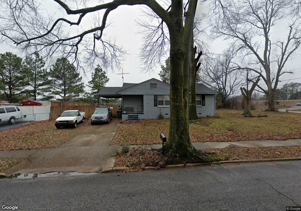
1705 Berwind Rd Memphis, TN 38116
Whitehaven NeighborhoodEstimated Value: $70,000 - $132,000
3
Beds
1
Bath
1,056
Sq Ft
$95/Sq Ft
Est. Value
About This Home
This home is located at 1705 Berwind Rd, Memphis, TN 38116 and is currently estimated at $100,151, approximately $94 per square foot. 1705 Berwind Rd is a home located in Shelby County with nearby schools including Robert R. Church Elementary School, A. Maceo Walker Middle School, and Freedom Preparatory Academy Elementary School.
Ownership History
Date
Name
Owned For
Owner Type
Purchase Details
Closed on
Jan 31, 1997
Sold by
Ferguson Dorothy and Ferguson Dorothy Helen
Bought by
Mason Carl B
Current Estimated Value
Home Financials for this Owner
Home Financials are based on the most recent Mortgage that was taken out on this home.
Original Mortgage
$42,408
Outstanding Balance
$4,307
Interest Rate
7.69%
Mortgage Type
FHA
Estimated Equity
$95,844
Create a Home Valuation Report for This Property
The Home Valuation Report is an in-depth analysis detailing your home's value as well as a comparison with similar homes in the area
Home Values in the Area
Average Home Value in this Area
Purchase History
| Date | Buyer | Sale Price | Title Company |
|---|---|---|---|
| Mason Carl B | $42,000 | -- | |
| Mason Carl B | $42,000 | -- |
Source: Public Records
Mortgage History
| Date | Status | Borrower | Loan Amount |
|---|---|---|---|
| Open | Mason Carl B | $42,408 | |
| Closed | Mason Carl B | $42,408 | |
| Closed | Mason Carl B | $2,271 |
Source: Public Records
Tax History
| Year | Tax Paid | Tax Assessment Tax Assessment Total Assessment is a certain percentage of the fair market value that is determined by local assessors to be the total taxable value of land and additions on the property. | Land | Improvement |
|---|---|---|---|---|
| 2025 | $436 | $20,125 | $4,125 | $16,000 |
| 2024 | $436 | $12,875 | $3,500 | $9,375 |
| 2023 | $784 | $12,875 | $3,500 | $9,375 |
| 2022 | $784 | $12,875 | $3,500 | $9,375 |
| 2021 | $794 | $12,875 | $3,500 | $9,375 |
| 2020 | $835 | $11,525 | $3,500 | $8,025 |
| 2019 | $835 | $11,525 | $3,500 | $8,025 |
| 2018 | $835 | $11,525 | $3,500 | $8,025 |
| 2017 | $474 | $11,525 | $3,500 | $8,025 |
| 2016 | $505 | $11,550 | $0 | $0 |
| 2014 | $505 | $11,550 | $0 | $0 |
Source: Public Records
Map
Nearby Homes
- 3687 Windcrest Rd
- 3816 Cazassa Rd
- 1821 Dale Lavern Rd
- 3643 W Big Bend Dr
- 1435 Blueberry Dr
- 3639 Huckleberry St
- 3595 Huckleberry St
- 3539 Acacia St
- 3970 Patte Ann Dr
- 3613 Acacia St
- 1534 E Raines Rd
- 1341 Carol Dr
- 1304 Carol Dr
- 4232 Ambrose Rd
- 1185 Timothy Dr
- 1971 Francisco St
- 2015 E Brooks Rd
- 1308 E Raines Rd
- 3836 Birchleaf Rd
- 1681 Janis Dr
- 1717 Berwind Rd
- 3702 Millbranch Rd
- 3721 Millbranch Rd
- 1724 Berwind Rd
- 1727 Berwind Rd
- 3694 Millbranch Rd
- 1717 Victoria Rd
- 1727 Victoria Rd
- 1742 Berwind Rd
- 1745 Berwind Rd
- 1735 Victoria Rd
- 1750 Berwind Rd
- 1753 Berwind Rd
- 1743 Victoria Rd
- 3672 Millbranch Rd
- 1756 Berwind Rd
- 1716 Victoria Rd
- 1751 Victoria Rd
- 1751 Victoria Ave
- 1761 Berwind Rd