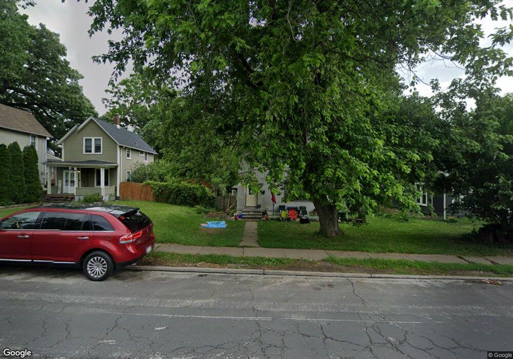
1705 Bridge Ave Davenport, IA 52803
East End NeighborhoodEstimated Value: $100,000 - $151,000
4
Beds
2
Baths
2,148
Sq Ft
$53/Sq Ft
Est. Value
About This Home
This home is located at 1705 Bridge Ave, Davenport, IA 52803 and is currently estimated at $114,163, approximately $53 per square foot. 1705 Bridge Ave is a home located in Scott County with nearby schools including Caverna Elementary School, Casey County Middle School, and Hopkinsville Middle School.
Ownership History
Date
Name
Owned For
Owner Type
Purchase Details
Closed on
Feb 4, 2022
Sold by
B & V Partners Llc 12
Bought by
Woods Rebecca M
Current Estimated Value
Purchase Details
Closed on
Feb 3, 2022
Sold by
Sticher Jr Jerald M
Bought by
Woods Rebecca M
Purchase Details
Closed on
Jan 30, 2008
Sold by
Adair Holdings Llc
Bought by
Ward Helen J
Create a Home Valuation Report for This Property
The Home Valuation Report is an in-depth analysis detailing your home's value as well as a comparison with similar homes in the area
Home Values in the Area
Average Home Value in this Area
Purchase History
| Date | Buyer | Sale Price | Title Company |
|---|---|---|---|
| Woods Rebecca M | $13,000 | None Listed On Document | |
| Woods Rebecca M | -- | None Listed On Document | |
| Ward Helen J | $10,587 | None Available |
Source: Public Records
Tax History Compared to Growth
Tax History
| Year | Tax Paid | Tax Assessment Tax Assessment Total Assessment is a certain percentage of the fair market value that is determined by local assessors to be the total taxable value of land and additions on the property. | Land | Improvement |
|---|---|---|---|---|
| 2025 | $1,484 | $52,240 | $17,500 | $34,740 |
| 2024 | $588 | $44,220 | $17,500 | $26,720 |
| 2023 | $792 | $44,220 | $17,500 | $26,720 |
| 2022 | $796 | $45,960 | $10,500 | $35,460 |
| 2021 | $796 | $46,090 | $10,500 | $35,590 |
| 2020 | $708 | $44,400 | $10,500 | $33,900 |
| 2019 | $522 | $31,790 | $10,500 | $21,290 |
| 2018 | $506 | $31,790 | $10,500 | $21,290 |
| 2017 | $530 | $31,790 | $10,500 | $21,290 |
| 2016 | $573 | $28,600 | $0 | $0 |
| 2015 | $436 | $25,660 | $0 | $0 |
| 2014 | $376 | $22,720 | $0 | $0 |
| 2013 | $496 | $0 | $0 | $0 |
| 2012 | -- | $55,480 | $12,180 | $43,300 |
Source: Public Records
Map
Nearby Homes
- 1626 Esplanade Ave
- 1616 Esplanade Ave
- 1310 Kirkwood Blvd
- 1501 Bridge Ave
- 1920 Carey Ave
- 1020 E 15th St
- 916 Kirkwood Blvd
- 2030 Esplanade Ave
- 1605 Arlington Ave
- 1603 Arlington Ave
- 11 Oak Ln
- 1220 College Ave
- 1325 Mississippi Ave
- 2116 Eastern Ave
- 1224 E 11th St
- 1102 College Ave
- 1202 Adams St
- 2118 Arlington Ave
- 1233 Eastern Ave
- 2125 Eastern Ave
- 1703 Bridge Ave
- 1709 Bridge Ave
- 1711 Bridge Ave
- 1624 College Ave
- 1612 College Ave
- 1710 Bridge Ave
- 1608 College Ave
- 1721 Bridge Ave
- 1148 Kirkwood Blvd
- 1708 College Ave
- 1602 College Ave
- 1718 Bridge Ave
- 1727 Bridge Ave
- 1524 College Ave
- 1142 Kirkwood Blvd
- 1722 Bridge Ave
- 1720 College Ave
- 1728 Bridge Ave
- 1520 College Ave
- 1138 Kirkwood Blvd