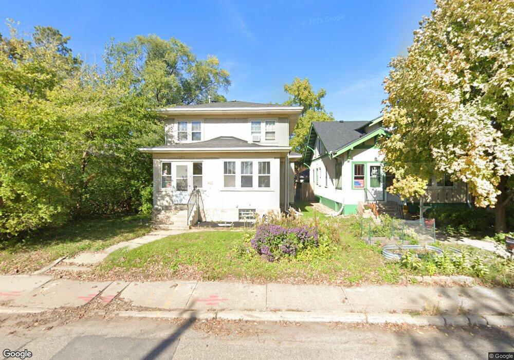
1705 Lowry Ave NE Minneapolis, MN 55418
Audubon Park NeighborhoodEstimated Value: $373,000 - $396,000
3
Beds
1
Bath
1,690
Sq Ft
$226/Sq Ft
Est. Value
About This Home
This home is located at 1705 Lowry Ave NE, Minneapolis, MN 55418 and is currently estimated at $381,983, approximately $226 per square foot. 1705 Lowry Ave NE is a home located in Hennepin County with nearby schools including Pillsbury Elementary School, Northeast Middle School, and Thomas Edison High School.
Ownership History
Date
Name
Owned For
Owner Type
Purchase Details
Closed on
Dec 19, 2003
Sold by
Hardin Seth
Bought by
Birmingham Francis Richard and Birmingham Anita M
Current Estimated Value
Purchase Details
Closed on
Apr 20, 2001
Sold by
Wentland Cheryl L
Bought by
Hardin Seth
Purchase Details
Closed on
Jul 1, 1998
Sold by
Lindman Robert S
Bought by
Wentland Cheryl Lee and Elias Susan Marie
Create a Home Valuation Report for This Property
The Home Valuation Report is an in-depth analysis detailing your home's value as well as a comparison with similar homes in the area
Home Values in the Area
Average Home Value in this Area
Purchase History
| Date | Buyer | Sale Price | Title Company |
|---|---|---|---|
| Birmingham Francis Richard | $211,000 | -- | |
| Hardin Seth | $164,000 | -- | |
| Wentland Cheryl Lee | $5,250 | -- |
Source: Public Records
Mortgage History
| Date | Status | Borrower | Loan Amount |
|---|---|---|---|
| Closed | Wentland Cheryl Lee | -- |
Source: Public Records
Tax History Compared to Growth
Tax History
| Year | Tax Paid | Tax Assessment Tax Assessment Total Assessment is a certain percentage of the fair market value that is determined by local assessors to be the total taxable value of land and additions on the property. | Land | Improvement |
|---|---|---|---|---|
| 2024 | $4,971 | $348,000 | $120,000 | $228,000 |
| 2023 | $4,628 | $359,000 | $110,000 | $249,000 |
| 2022 | $3,924 | $337,000 | $97,000 | $240,000 |
| 2021 | $3,668 | $293,000 | $55,000 | $238,000 |
| 2020 | $3,976 | $284,500 | $48,300 | $236,200 |
| 2019 | $3,881 | $284,500 | $46,900 | $237,600 |
| 2018 | $3,399 | $271,000 | $46,900 | $224,100 |
| 2017 | $3,112 | $217,500 | $42,600 | $174,900 |
| 2016 | $2,891 | $198,500 | $42,600 | $155,900 |
| 2015 | $2,955 | $194,000 | $42,600 | $151,400 |
| 2014 | -- | $176,000 | $42,600 | $133,400 |
Source: Public Records
Map
Nearby Homes
- 2539 Ulysses St NE
- 2422 Garfield St NE
- 2407 Garfield St NE
- 2318 Lincoln St NE
- 2619 Lincoln St NE
- 2309 Buchanan St NE
- 2512 Buchanan St NE
- 1711 22nd Ave NE
- 2509 Pierce St NE
- 2219 Lincoln St NE
- 2706 Hayes St NE
- 2543 Pierce St NE
- 2358 Benjamin St NE
- 1937 Hayes St NE
- 2730 Ulysses St NE
- 1943 Lincoln St NE
- 2307 Fillmore St NE
- 2354 Mckinley St NE
- 1921 Hayes St NE
- 1939 Pierce St NE
- 1701 Lowry Ave NE
- 1709 Lowry Ave NE
- 1715 Lowry Ave NE
- 2515 Ulysses St NE
- 1717 Lowry Ave NE
- 2519 Ulysses St NE
- 2510 Ulysses St NE
- 2514 Hayes St NE
- 1723 Lowry Ave NE
- 2523 Ulysses St NE
- 2518 Hayes St NE
- 1617 Lowry Ave NE
- 2514 Ulysses St NE
- 2527 Ulysses St NE
- 2522 Hayes St NE
- 2518 Ulysses St NE
- 1615 Lowry Ave NE
- 2526 Hayes St NE
- 2522 Ulysses St NE
- 2531 Ulysses St NE