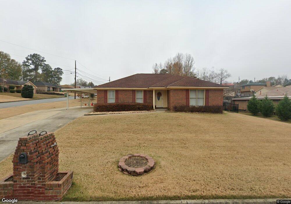
1705 Mazor Dr Columbus, GA 31907
East Columbus NeighborhoodEstimated Value: $197,149 - $210,000
3
Beds
2
Baths
1,617
Sq Ft
$125/Sq Ft
Est. Value
About This Home
This home is located at 1705 Mazor Dr, Columbus, GA 31907 and is currently estimated at $202,787, approximately $125 per square foot. 1705 Mazor Dr is a home located in Muscogee County with nearby schools including Wesley Heights Elementary School, East Columbus Magnet Academy, and Kendrick High School.
Ownership History
Date
Name
Owned For
Owner Type
Purchase Details
Closed on
Aug 29, 2019
Sold by
Allen Vickie D
Bought by
Hailes Wane A and Hailes Valerie
Current Estimated Value
Home Financials for this Owner
Home Financials are based on the most recent Mortgage that was taken out on this home.
Original Mortgage
$126,957
Outstanding Balance
$112,641
Interest Rate
4.25%
Mortgage Type
FHA
Estimated Equity
$90,146
Purchase Details
Closed on
Feb 28, 2007
Sold by
Loney Larry W and Loney Cynthia K
Bought by
Allen Vickie D
Home Financials for this Owner
Home Financials are based on the most recent Mortgage that was taken out on this home.
Original Mortgage
$25,000
Interest Rate
6.19%
Mortgage Type
Credit Line Revolving
Create a Home Valuation Report for This Property
The Home Valuation Report is an in-depth analysis detailing your home's value as well as a comparison with similar homes in the area
Home Values in the Area
Average Home Value in this Area
Purchase History
| Date | Buyer | Sale Price | Title Company |
|---|---|---|---|
| Hailes Wane A | $129,300 | -- | |
| Allen Vickie D | $125,000 | None Available |
Source: Public Records
Mortgage History
| Date | Status | Borrower | Loan Amount |
|---|---|---|---|
| Open | Hailes Wane A | $126,957 | |
| Previous Owner | Allen Vickie D | $25,000 | |
| Previous Owner | Allen Vickie D | $100,000 |
Source: Public Records
Tax History
| Year | Tax Paid | Tax Assessment Tax Assessment Total Assessment is a certain percentage of the fair market value that is determined by local assessors to be the total taxable value of land and additions on the property. | Land | Improvement |
|---|---|---|---|---|
| 2025 | $1,506 | $77,288 | $8,712 | $68,576 |
| 2024 | $1,505 | $77,288 | $8,712 | $68,576 |
| 2023 | $820 | $77,288 | $8,712 | $68,576 |
| 2022 | $1,569 | $59,448 | $8,712 | $50,736 |
| 2021 | $1,562 | $51,656 | $8,712 | $42,944 |
| 2020 | $1,563 | $51,656 | $8,712 | $42,944 |
| 2019 | $1,559 | $46,800 | $8,712 | $38,088 |
| 2018 | $1,559 | $46,800 | $8,712 | $38,088 |
| 2017 | $1,566 | $46,800 | $8,712 | $38,088 |
| 2016 | $1,573 | $51,406 | $6,400 | $45,006 |
| 2015 | $1,576 | $51,406 | $6,400 | $45,006 |
| 2014 | $1,578 | $51,406 | $6,400 | $45,006 |
| 2013 | -- | $51,406 | $6,400 | $45,006 |
Source: Public Records
Map
Nearby Homes
- 1925 Woodhollow Dr
- 6293 Dupree Dr
- 6213 Fitzgerald Dr
- 1524 Mazor Dr
- 2312 Burnside Dr
- 6270 Mill Branch Rd
- 6620 Cove Cir
- 1314 Pagoda Dr
- 6370 Lemongrass Dr
- 6362 Lemongrass Dr
- 6224 Valencia Dr
- 6366 Lemongrass Dr
- 6061 Luna Dr
- 6033 Luna Dr
- 6021 Luna Dr
- 6311 Morning Dew Dr
- 6303 Morning Dew Dr
- 6302 Morning Dew Dr
- 6307 Morning Dew Dr
- 2216 Hunter Ct
- 1711 Mazor Dr
- 6331 Albright Dr
- 1639 Mazor Dr
- 6325 Albright Dr
- 1706 Mazor Dr
- 1717 Mazor Dr
- 6338 Browning Dr
- 1712 Mazor Dr
- 1700 Mazor Dr
- 6332 Albright Dr
- 1718 Mazor Dr
- 6332 Browning Dr
- 1642 Mazor Dr
- 6319 Albright Dr
- 6326 Albright Dr
- 1633 Mazor Dr
- 1724 Mazor Dr
- 6326 Browning Dr
- 1636 Mazor Dr
- 6320 Albright Dr