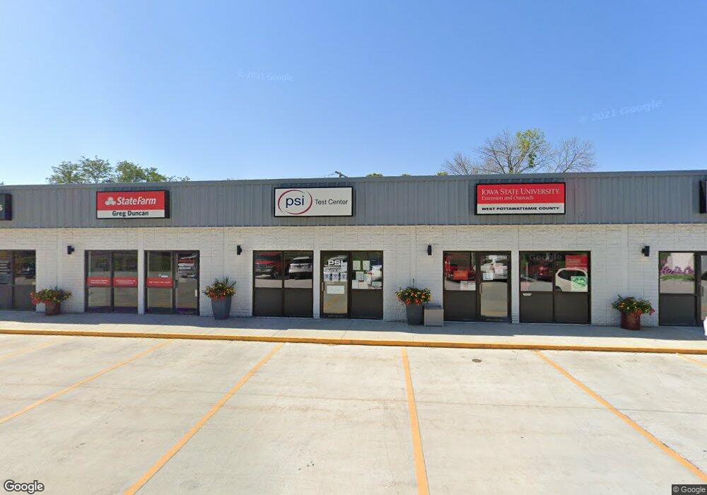
1705 Mcpherson Ave Unit GL 300 Council Bluffs, IA 51503
Valley View NeighborhoodEstimated Value: $1,438,946
--
Bed
--
Bath
1,255
Sq Ft
$1,147/Sq Ft
Est. Value
About This Home
This home is located at 1705 Mcpherson Ave Unit GL 300, Council Bluffs, IA 51503 and is currently estimated at $1,438,946, approximately $1,146 per square foot. 1705 Mcpherson Ave Unit GL 300 is a home located in Pottawattamie County with nearby schools including College View Elementary School, Gerald W. Kirn Middle School, and Abraham Lincoln High School.
Ownership History
Date
Name
Owned For
Owner Type
Purchase Details
Closed on
Sep 1, 2024
Sold by
Chrm Llc
Bought by
Mcpherson Plaza Llc
Current Estimated Value
Home Financials for this Owner
Home Financials are based on the most recent Mortgage that was taken out on this home.
Original Mortgage
$995,000
Outstanding Balance
$969,799
Interest Rate
6.46%
Mortgage Type
New Conventional
Estimated Equity
$469,147
Purchase Details
Closed on
Sep 21, 2009
Sold by
1705 Mcpherson Avenue Llc
Bought by
American National Bank
Create a Home Valuation Report for This Property
The Home Valuation Report is an in-depth analysis detailing your home's value as well as a comparison with similar homes in the area
Home Values in the Area
Average Home Value in this Area
Purchase History
| Date | Buyer | Sale Price | Title Company |
|---|---|---|---|
| Mcpherson Plaza Llc | $1,350,000 | None Listed On Document | |
| American National Bank | -- | None Available |
Source: Public Records
Mortgage History
| Date | Status | Borrower | Loan Amount |
|---|---|---|---|
| Open | Mcpherson Plaza Llc | $995,000 |
Source: Public Records
Tax History Compared to Growth
Tax History
| Year | Tax Paid | Tax Assessment Tax Assessment Total Assessment is a certain percentage of the fair market value that is determined by local assessors to be the total taxable value of land and additions on the property. | Land | Improvement |
|---|---|---|---|---|
| 2025 | $22,672 | $1,118,000 | $120,800 | $997,200 |
| 2024 | $22,672 | $664,200 | $105,000 | $559,200 |
| 2023 | $22,900 | $664,200 | $105,000 | $559,200 |
| 2022 | $17,532 | $534,500 | $105,000 | $429,500 |
| 2021 | $26,382 | $531,900 | $105,000 | $426,900 |
| 2020 | $18,126 | $531,900 | $105,000 | $426,900 |
| 2019 | $17,860 | $531,900 | $105,000 | $426,900 |
| 2018 | $17,942 | $531,900 | $105,000 | $426,900 |
| 2017 | $15,886 | $491,970 | $110,400 | $381,570 |
| 2015 | $15,910 | $491,970 | $110,400 | $381,570 |
| 2014 | $17,014 | $491,970 | $110,400 | $381,570 |
Source: Public Records
Map
Nearby Homes
- 23 Wenwood Cir
- 102 Arbor Ridge Ln Unit 8
- 1109 Arbor Ridge Dr
- 104 Paige Ln
- 103 Paige Ln
- 171 Wendover Dr
- 176 Bennett Ave
- 180 Bennett Ave
- 37 Indian Hills Rd
- 215 Wendy Heights Rd
- 225 Pickardy Ln
- 16090 Crystal Ln
- 216 Morningside Ave
- 206 Parkview Dr
- LOT 8 Hazel St
- 508 Iowa Ave
- 200 Timber Dr
- 704 Hazel St
- 1873 Hemlock St
- 1893 Hemlock St
- 1705 Mcpherson Ave Unit LL200
- 1705 Mcpherson Ave Unit GL300/400
- 1705 Mcpherson Ave Unit 500
- 1705 Mcpherson Ave Unit 400
- 1705 Mcpherson Ave
- 1705 Mcpherson Ave Unit GL 300 B
- 1705 Mcpherson Ave Unit GL 100
- 1705 Mcpherson Ave Unit GL 200
- 9 Arnold Ave
- 3 Bennett Ave
- 3 Bennett Ave
- 3 Bennett Ave
- 3 Bennett Ave
- 7 Arnold Ave
- 13 Arnold Ave
- 6 Graywynn Dr
- 5 Arnold Ave
- 1 Adrian Ave
- 15 Arnold Ave
- 1702 Mcpherson Ave