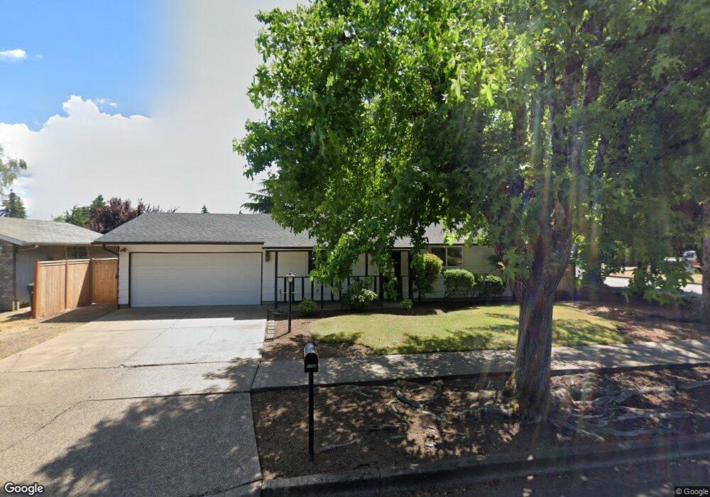
1705 Rainbow Dr Springfield, OR 97477
West Springfield NeighborhoodEstimated Value: $326,000 - $363,000
3
Beds
1
Bath
940
Sq Ft
$372/Sq Ft
Est. Value
About This Home
This home is located at 1705 Rainbow Dr, Springfield, OR 97477 and is currently estimated at $349,861, approximately $372 per square foot. 1705 Rainbow Dr is a home located in Lane County with nearby schools including Centennial Elementary School, Hamlin Middle School, and Springfield High School.
Ownership History
Date
Name
Owned For
Owner Type
Purchase Details
Closed on
Jun 5, 2025
Sold by
Taubenkrau Jay
Bought by
Jay Taubenkrau Trust and Taubenkrau
Current Estimated Value
Purchase Details
Closed on
Oct 12, 2009
Sold by
Hooton Marilyn K
Bought by
Taubenkrau Jay
Home Financials for this Owner
Home Financials are based on the most recent Mortgage that was taken out on this home.
Original Mortgage
$150,228
Interest Rate
5.02%
Mortgage Type
FHA
Create a Home Valuation Report for This Property
The Home Valuation Report is an in-depth analysis detailing your home's value as well as a comparison with similar homes in the area
Home Values in the Area
Average Home Value in this Area
Purchase History
| Date | Buyer | Sale Price | Title Company |
|---|---|---|---|
| Jay Taubenkrau Trust | -- | None Listed On Document | |
| Taubenkrau Jay | $153,000 | Western Title |
Source: Public Records
Mortgage History
| Date | Status | Borrower | Loan Amount |
|---|---|---|---|
| Previous Owner | Taubenkrau Jay | $150,228 |
Source: Public Records
Tax History
| Year | Tax Paid | Tax Assessment Tax Assessment Total Assessment is a certain percentage of the fair market value that is determined by local assessors to be the total taxable value of land and additions on the property. | Land | Improvement |
|---|---|---|---|---|
| 2025 | $2,967 | $161,824 | -- | -- |
| 2024 | $2,919 | $157,111 | -- | -- |
| 2023 | $2,919 | $152,535 | -- | -- |
| 2022 | $2,704 | $148,093 | $0 | $0 |
| 2021 | $2,655 | $143,780 | $0 | $0 |
| 2020 | $2,578 | $139,593 | $0 | $0 |
| 2019 | $2,500 | $135,528 | $0 | $0 |
| 2018 | $2,357 | $127,749 | $0 | $0 |
| 2017 | $2,266 | $127,749 | $0 | $0 |
| 2016 | $2,219 | $124,028 | $0 | $0 |
| 2015 | $2,155 | $120,416 | $0 | $0 |
| 2014 | $2,123 | $116,909 | $0 | $0 |
Source: Public Records
Map
Nearby Homes
- 804 W N St
- 1310 W Quinalt St
- 1450 W Quinalt St
- 898 Lochaven Ave
- 538 Lochaven Ave
- 1566 Laura St
- 451 Lochaven Ave
- 428 W Centennial Blvd
- 364 Scotts Glen Dr
- 992 Sunset Dr
- 2150 Laura St Unit 119
- 2150 Laura St Unit 111
- 2150 Laura St Unit 39
- 2150 Laura St Unit 57
- 2150 Laura St Unit 83
- 2150 Laura St Unit 44
- 2150 Laura (#57) St Unit 57
- 1533 Sequoia Ave
- 1424 Wimbledon Place
- 952 Summit Blvd
- 1711 Rainbow Dr
- 820 W Fairview Dr
- 805 W Fairview Dr
- 1715 Rainbow Dr
- 1730 Rainbow Loop
- 939 W Fairview Dr
- 814 W Fairview Dr
- 976 W Fairview Dr
- 1710 Rainbow Dr
- 957 W Fairview Dr
- 1718 Rainbow Dr
- 817 W Fairview Dr
- 810 W Fairview Dr
- 809 W Fairview Dr
- 1740 Rainbow Loop
- 1738 Rainbow Loop
- 1726 Rainbow Loop
- 975 W Fairview Dr
- 1736 Rainbow Dr
- 1702 Rainbow Loop
Your Personal Tour Guide
Ask me questions while you tour the home.