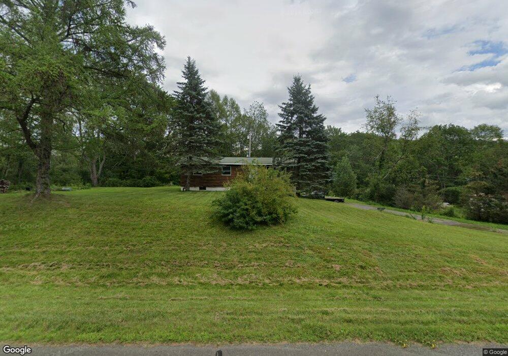
1705 State Route 82 Ancram, NY 12502
Estimated Value: $272,000 - $304,000
3
Beds
1
Bath
968
Sq Ft
$299/Sq Ft
Est. Value
About This Home
This home is located at 1705 State Route 82, Ancram, NY 12502 and is currently estimated at $289,388, approximately $298 per square foot. 1705 State Route 82 is a home located in Columbia County with nearby schools including Germantown Elementary School and Germantown Junior/Senior High School.
Ownership History
Date
Name
Owned For
Owner Type
Purchase Details
Closed on
Aug 12, 2025
Sold by
Behrens Thomas E
Bought by
Clark Riley X and Tavernia Hope
Current Estimated Value
Home Financials for this Owner
Home Financials are based on the most recent Mortgage that was taken out on this home.
Original Mortgage
$228,000
Outstanding Balance
$227,801
Interest Rate
6.67%
Mortgage Type
New Conventional
Estimated Equity
$61,587
Purchase Details
Closed on
Apr 10, 2003
Sold by
Action Real Estate Investments Inc
Bought by
Behrens Thomas E
Purchase Details
Closed on
Apr 29, 2002
Purchase Details
Closed on
Aug 1, 2001
Sold by
Washington Mutual Home
Bought by
Washington Mutual Home
Purchase Details
Closed on
Jan 16, 1998
Sold by
Palmitier Allen W
Bought by
Beck William P and Beck Debra A
Create a Home Valuation Report for This Property
The Home Valuation Report is an in-depth analysis detailing your home's value as well as a comparison with similar homes in the area
Home Values in the Area
Average Home Value in this Area
Purchase History
| Date | Buyer | Sale Price | Title Company |
|---|---|---|---|
| Clark Riley X | $285,000 | Amtrust Title Ins Co | |
| Behrens Thomas E | $120,000 | -- | |
| Behrens Thomas E | $120,000 | -- | |
| -- | $65,230 | -- | |
| -- | $65,230 | -- | |
| Washington Mutual Home | $80,990 | -- | |
| -- | $80,990 | -- | |
| -- | $80,990 | -- | |
| Beck William P | $66,450 | -- | |
| Beck William P | $66,450 | -- |
Source: Public Records
Mortgage History
| Date | Status | Borrower | Loan Amount |
|---|---|---|---|
| Open | Clark Riley X | $228,000 |
Source: Public Records
Tax History Compared to Growth
Tax History
| Year | Tax Paid | Tax Assessment Tax Assessment Total Assessment is a certain percentage of the fair market value that is determined by local assessors to be the total taxable value of land and additions on the property. | Land | Improvement |
|---|---|---|---|---|
| 2024 | $3,232 | $158,000 | $36,400 | $121,600 |
| 2023 | $3,300 | $158,000 | $36,400 | $121,600 |
| 2022 | $3,163 | $158,000 | $36,400 | $121,600 |
| 2021 | $3,224 | $158,000 | $36,400 | $121,600 |
| 2020 | $3,330 | $158,000 | $36,400 | $121,600 |
| 2019 | $1,184 | $158,000 | $36,400 | $121,600 |
| 2018 | $3,257 | $158,000 | $36,400 | $121,600 |
| 2017 | $3,103 | $145,000 | $30,000 | $115,000 |
| 2016 | $3,251 | $145,000 | $30,000 | $115,000 |
| 2015 | -- | $145,000 | $30,000 | $115,000 |
| 2014 | -- | $145,000 | $30,000 | $115,000 |
Source: Public Records
Map
Nearby Homes
- 472 Doodletown Rd
- 59 New Forge Road II Unit 1
- 630 County Route 11
- 42 E Pond Lilly Rd
- 0 County Route 7 Unit KEYH6308186
- 0 County Route 7 Unit 152778
- 91 Decker Rd
- 46 Brothers Rd
- 220 W Pond Lily Rd
- 0 Westfall Rd Unit 154554
- 0 Westfall Rd
- 270 Hull Rd Unit Stop 3
- 803 County Route 27
- 2727 County Route 8
- 0 County Route 10 Unit KEY842732
- 1899 County Route 10
- 65 Tims Rd
- 1301 County Route 7
- 3264 County Route 7
- 2934 County Route 7
- 1530 County Route 11
- 1492 County Route 11
- 1709 New York 82
- 780 County Route 11
- 1155 County Route 11
- 1155 County Route 11
- 1713 State Route 82
- 777 County Route 11
- 1700 New York 82
- 1680 State Route 82
- 1716 State Route 82
- 1740 New York 82
- 5 New Forge Road 1
- 1742 State Route 82
- 1742 State Route 82
- 1742 New York 82
- 495 State Rt 82
- 1760 State Route 82
- 6 County Route 8
- 2 County Route 8