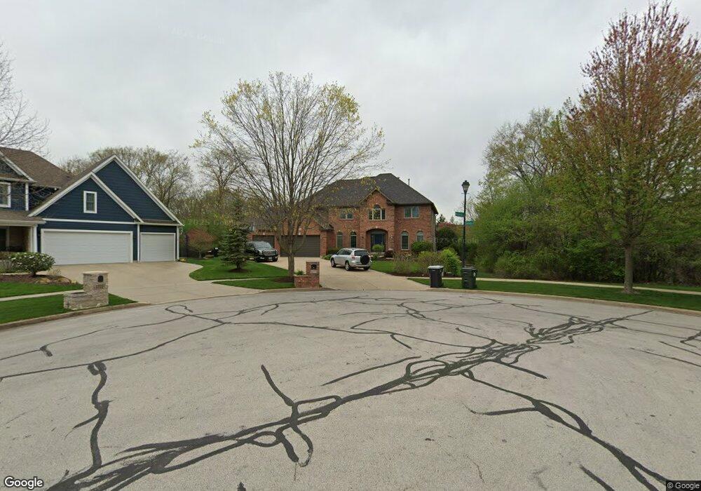
1705 Wiesbrock Ln Batavia, IL 60510
Estimated Value: $733,017 - $896,000
5
Beds
4
Baths
3,838
Sq Ft
$214/Sq Ft
Est. Value
About This Home
This home is located at 1705 Wiesbrock Ln, Batavia, IL 60510 and is currently estimated at $820,254, approximately $213 per square foot. 1705 Wiesbrock Ln is a home located in Kane County with nearby schools including Hoover Wood Elementary School, Sam Rotolo Middle School, and Batavia Sr High School.
Ownership History
Date
Name
Owned For
Owner Type
Purchase Details
Closed on
Aug 21, 2017
Sold by
Podraza Katherine A
Bought by
Kibler Kray and Kibler Thais
Current Estimated Value
Home Financials for this Owner
Home Financials are based on the most recent Mortgage that was taken out on this home.
Original Mortgage
$300,000
Outstanding Balance
$250,798
Interest Rate
4.03%
Mortgage Type
New Conventional
Estimated Equity
$569,456
Purchase Details
Closed on
Apr 3, 2002
Sold by
Frontier Land Group Llc
Bought by
Katherine A Podraza Living Trust
Purchase Details
Closed on
Dec 30, 2001
Sold by
Kielions Ray Dan Corp
Bought by
Frontier Land Group Llc
Create a Home Valuation Report for This Property
The Home Valuation Report is an in-depth analysis detailing your home's value as well as a comparison with similar homes in the area
Home Values in the Area
Average Home Value in this Area
Purchase History
| Date | Buyer | Sale Price | Title Company |
|---|---|---|---|
| Kibler Kray | $580,000 | First American Title | |
| Katherine A Podraza Living Trust | $50,000 | -- | |
| Frontier Land Group Llc | $200,000 | -- |
Source: Public Records
Mortgage History
| Date | Status | Borrower | Loan Amount |
|---|---|---|---|
| Open | Kibler Kray | $300,000 |
Source: Public Records
Tax History Compared to Growth
Tax History
| Year | Tax Paid | Tax Assessment Tax Assessment Total Assessment is a certain percentage of the fair market value that is determined by local assessors to be the total taxable value of land and additions on the property. | Land | Improvement |
|---|---|---|---|---|
| 2024 | $15,395 | $202,708 | $26,716 | $175,992 |
| 2023 | $15,101 | $183,979 | $24,248 | $159,731 |
| 2022 | $14,490 | $171,943 | $22,662 | $149,281 |
| 2021 | $16,139 | $188,056 | $21,493 | $166,563 |
| 2020 | $15,748 | $184,441 | $21,080 | $163,361 |
| 2019 | $16,411 | $187,970 | $20,334 | $167,636 |
| 2018 | $16,379 | $187,528 | $19,559 | $167,969 |
| 2017 | $14,064 | $160,157 | $18,914 | $141,243 |
| 2016 | $13,775 | $155,492 | $18,363 | $137,129 |
| 2015 | -- | $151,952 | $17,945 | $134,007 |
| 2014 | -- | $147,169 | $17,380 | $129,789 |
| 2013 | -- | $152,692 | $25,435 | $127,257 |
Source: Public Records
Map
Nearby Homes
- 1580 Wind Energy Pass
- 1548 Wind Energy Pass
- 1667 S Raddant Rd
- 3S201 S Raddant Rd
- 3058 Preakness Ct
- 733 Wind Energy Pass
- 1335 Chillem Dr
- 610 Norcross Dr
- 2909 Savannah Dr Unit 1
- 2856 Church Rd
- 943 Orchard Ct
- 1017 Willow Ln Unit 2
- 1949 Pinnacle Dr
- 1669 Pinnacle Ct
- 473 Bond Dr
- 1903 Flagstone Ln
- 1136 Pine Ct
- 810 Columbia Cir Unit 3
- 1111 Hart Rd
- 918 S Raddant Rd
- 1303 Kielion Dr
- 1711 Wiesbrock Ln
- 1309 Kielion Dr
- 1723 Wiesbrock Ln
- 34W056 Wagner Rd
- 1314 Kielion Dr
- 2S915 Wagner Rd
- 1320 Kelly Ct Unit 3
- 1729 Wiesbrock Ln
- 1301 Kelly Ct
- 1640 Beels Ct
- 1330 Kelly Ct
- 1630 Beels Ct
- 1641 Beels Ct
- 3S015 Wagner Rd
- 1849 Wagner Rd
- 1311 Kelly Ct
- 1321 Kelly Ct Unit 3
- 1620 Beels Ct
- 1851 Wagner Rd