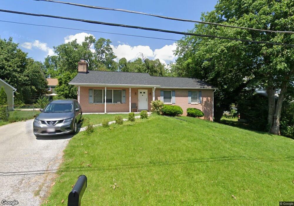
1705 Willis Dr Halethorpe, MD 21227
Estimated Value: $369,000 - $433,000
3
Beds
2
Baths
2,688
Sq Ft
$148/Sq Ft
Est. Value
About This Home
This home is located at 1705 Willis Dr, Halethorpe, MD 21227 and is currently estimated at $398,794, approximately $148 per square foot. 1705 Willis Dr is a home located in Baltimore County with nearby schools including Relay Elementary School, Arbutus Middle School, and Lansdowne High School.
Ownership History
Date
Name
Owned For
Owner Type
Purchase Details
Closed on
Dec 23, 2021
Sold by
Gill Jeffrey D
Bought by
Gill Matthew J and Lester Donovan A
Current Estimated Value
Home Financials for this Owner
Home Financials are based on the most recent Mortgage that was taken out on this home.
Original Mortgage
$309,294
Interest Rate
3.11%
Mortgage Type
FHA
Purchase Details
Closed on
Aug 20, 2020
Sold by
Gill James H and Gill Jeffrey D
Bought by
Gill Jeffrey D
Purchase Details
Closed on
Sep 7, 2010
Sold by
Gill James H
Bought by
Gill Jennie P
Purchase Details
Closed on
Aug 18, 2003
Sold by
Gill James H
Bought by
Gill Jeffrey David
Purchase Details
Closed on
Oct 14, 1997
Sold by
Gill James H
Bought by
Gill James H and Gill Jennie P
Create a Home Valuation Report for This Property
The Home Valuation Report is an in-depth analysis detailing your home's value as well as a comparison with similar homes in the area
Home Values in the Area
Average Home Value in this Area
Purchase History
| Date | Buyer | Sale Price | Title Company |
|---|---|---|---|
| Gill Matthew J | $315,000 | Campus Title | |
| Gill Jeffrey D | -- | None Available | |
| Gill Jennie P | -- | -- | |
| Gill Jeffrey David | -- | -- | |
| Gill James H | -- | -- |
Source: Public Records
Mortgage History
| Date | Status | Borrower | Loan Amount |
|---|---|---|---|
| Previous Owner | Gill Matthew J | $309,294 |
Source: Public Records
Tax History Compared to Growth
Tax History
| Year | Tax Paid | Tax Assessment Tax Assessment Total Assessment is a certain percentage of the fair market value that is determined by local assessors to be the total taxable value of land and additions on the property. | Land | Improvement |
|---|---|---|---|---|
| 2025 | $4,754 | $348,333 | -- | -- |
| 2024 | $4,754 | $333,600 | $121,100 | $212,500 |
| 2023 | $2,202 | $302,767 | $0 | $0 |
| 2022 | $3,948 | $271,933 | $0 | $0 |
| 2021 | $3,746 | $241,100 | $64,100 | $177,000 |
| 2020 | $2,843 | $234,567 | $0 | $0 |
| 2019 | $2,764 | $228,033 | $0 | $0 |
| 2018 | $4,347 | $221,500 | $64,100 | $157,400 |
| 2017 | $3,785 | $219,633 | $0 | $0 |
| 2016 | $2,634 | $217,767 | $0 | $0 |
| 2015 | $2,634 | $215,900 | $0 | $0 |
| 2014 | $2,634 | $215,900 | $0 | $0 |
Source: Public Records
Map
Nearby Homes
- 1807 Sutton Ave
- 1817 Centre St
- 5729 Richardson Mews Square
- 5816 Richardson Mews Square
- 19 Piedmont Ct
- 16 W End Ct
- 12 Piedmont Ct
- 20 Deer Run Ct Unit F
- 1110 Francis Ave
- 901 Grovehill Rd
- 927 Grovehill Rd
- 1132 Ingate Rd
- 1027 Downton Rd
- 5640 Braxfield Rd
- 1078 Downton Rd
- 4606 Ridge Ave
- 5536 Gayland Rd
- 1911 Halethorpe Ave
- 6025 Hosta Ct
- 5879 Bonnie View Ln
- 1701 Willis Dr
- 5117 S Rolling Rd
- 5113 S Rolling Rd
- 1707 Willis Dr
- 5119 S Rolling Rd
- 5121 S Rolling Rd
- 1709 Willis Dr
- 1713 S Rolling Rd
- 1711 Willis Dr
- 5102 Chestnut Ave
- 1708 S Rolling Rd
- 5100 Chestnut Ave
- 1717 S Rolling Rd
- 1716 Arlington Ave
- 1712 S Rolling Rd
- 1710 Arlington Ave
- 5109 S Rolling Rd
- 5123 S Rolling Rd
- 1714 S Rolling Rd
- 5116 S Rolling Rd