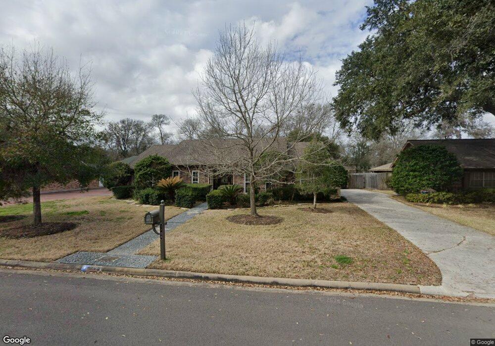
1706 Cedar Dr Richmond, TX 77469
Estimated Value: $275,000 - $299,000
4
Beds
2
Baths
2,010
Sq Ft
$142/Sq Ft
Est. Value
About This Home
This home is located at 1706 Cedar Dr, Richmond, TX 77469 and is currently estimated at $284,887, approximately $141 per square foot. 1706 Cedar Dr is a home located in Fort Bend County with nearby schools including Smith Elementary School, Lamar Junior High School, and Lamar Consolidated High School.
Ownership History
Date
Name
Owned For
Owner Type
Purchase Details
Closed on
Oct 21, 2022
Sold by
Donnell Raymond Lee
Bought by
Donnell June Marie
Current Estimated Value
Home Financials for this Owner
Home Financials are based on the most recent Mortgage that was taken out on this home.
Original Mortgage
$75,000
Interest Rate
6.33%
Mortgage Type
Seller Take Back
Purchase Details
Closed on
Jun 18, 2014
Sold by
Donnell Ray and Donnell June
Bought by
Donnell Ray and Donnell June
Home Financials for this Owner
Home Financials are based on the most recent Mortgage that was taken out on this home.
Original Mortgage
$128,000
Interest Rate
4.18%
Mortgage Type
New Conventional
Purchase Details
Closed on
Aug 21, 2000
Sold by
Vecera Anthony A
Bought by
Donnell Ray
Home Financials for this Owner
Home Financials are based on the most recent Mortgage that was taken out on this home.
Original Mortgage
$102,150
Interest Rate
8.15%
Mortgage Type
Purchase Money Mortgage
Purchase Details
Closed on
Apr 15, 1992
Sold by
Mayo Donald R
Bought by
Donnell Ray and Donnell June
Create a Home Valuation Report for This Property
The Home Valuation Report is an in-depth analysis detailing your home's value as well as a comparison with similar homes in the area
Home Values in the Area
Average Home Value in this Area
Purchase History
| Date | Buyer | Sale Price | Title Company |
|---|---|---|---|
| Donnell June Marie | -- | None Listed On Document | |
| Donnell June Marie | -- | None Listed On Document | |
| Donnell Ray | -- | None Available | |
| Donnell Ray | -- | Houston Title | |
| Donnell Ray | -- | -- |
Source: Public Records
Mortgage History
| Date | Status | Borrower | Loan Amount |
|---|---|---|---|
| Previous Owner | Donnell June Marie | $75,000 | |
| Previous Owner | Donnell Ray | $128,000 | |
| Previous Owner | Donnell Ray | $102,150 |
Source: Public Records
Tax History
| Year | Tax Paid | Tax Assessment Tax Assessment Total Assessment is a certain percentage of the fair market value that is determined by local assessors to be the total taxable value of land and additions on the property. | Land | Improvement |
|---|---|---|---|---|
| 2025 | $2,573 | $282,268 | $28,600 | $253,668 |
| 2024 | $2,573 | $269,552 | $12,370 | $257,182 |
| 2023 | $2,573 | $303,557 | $22,000 | $281,557 |
| 2022 | $3,718 | $222,770 | $0 | $235,680 |
| 2021 | $4,809 | $202,520 | $22,000 | $180,520 |
| 2020 | $4,656 | $193,190 | $22,000 | $171,190 |
| 2019 | $4,943 | $193,540 | $22,000 | $171,540 |
| 2018 | $4,927 | $191,790 | $22,000 | $169,790 |
| 2017 | $4,866 | $187,240 | $18,500 | $168,740 |
| 2016 | $4,589 | $176,570 | $18,500 | $158,070 |
| 2015 | $3,845 | $165,460 | $18,500 | $146,960 |
| 2014 | $4,048 | $166,540 | $18,500 | $148,040 |
Source: Public Records
Map
Nearby Homes
- 1704 Mulberry Dr
- 2005 Lamar Dr
- 2100 Crestwood Dr
- 1905 Dowling Dr
- 4602 Avenue H
- 4618 Compass Ave
- 4534 Castor Dr
- 000 Fm 2218 Rd
- 0 Fm 2218 Unit 25550047
- 900 Chateau Place
- 5121 Alderney Ct
- 512 and 514 Travis St
- 1215 Main St
- 24339 Norwood Groves Dr
- 1511 Ruby Ford Ln
- 4426 Misty Woods Trail
- 5130 Riverwood Dr
- 4707 E Parma Dr
- 6219 Deep Gulch Dr
- 506 Bayou Dr
- 1704 Cedar Dr
- 1708 Cedar Dr
- 1702 Cedar Dr
- 1808 Hawthorn Dr
- 1802 Cedar Dr
- 1700 Cedar Dr
- 1809 Mulberry Dr
- 1304 Sally Anne Dr
- 1806 Hawthorn Dr
- 1807 Mulberry Dr
- 1804 Cedar Dr
- 1807 Hawthorn Dr
- 1804 Hawthorn Dr
- 1808 Willow Dr
- 1220 Sally Anne Dr
- 1619 Cedar Dr
- 1612 Cedar Dr
- 4621 Jane Long Dr
- 1806 Willow Dr
- 1802 Hawthorn Dr
Your Personal Tour Guide
Ask me questions while you tour the home.