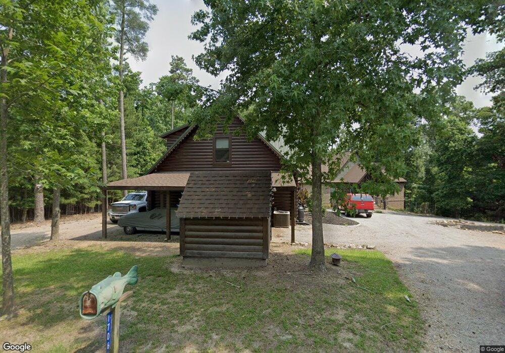
1706 Harmon St Gilbert, SC 29054
Estimated Value: $667,000 - $773,000
Studio
--
Bath
1,337
Sq Ft
$536/Sq Ft
Est. Value
About This Home
This home is located at 1706 Harmon St, Gilbert, SC 29054 and is currently estimated at $716,508, approximately $535 per square foot. 1706 Harmon St is a home with nearby schools including Centerville Elementary School, Gilbert Middle School, and Gilbert High School.
Ownership History
Date
Name
Owned For
Owner Type
Purchase Details
Closed on
Jan 15, 2021
Sold by
Pauley Kathryn Mary
Bought by
Pauley Kathryn Mary and Pauley Dwight D
Current Estimated Value
Purchase Details
Closed on
Apr 8, 2016
Sold by
Tavenner James Francis
Bought by
Tavenner Kathryn Mary
Purchase Details
Closed on
Mar 27, 2013
Sold by
Pauley Kathryn M and Pauley Dwight D
Bought by
Tavenner Clement
Purchase Details
Closed on
May 16, 2007
Sold by
Hoover J Ray
Bought by
Hoover J Ray and Hoover Ruth K
Purchase Details
Closed on
May 15, 2007
Sold by
Hoover J Ray
Bought by
Hoover J Ray and Hoover Ruth K
Create a Home Valuation Report for This Property
The Home Valuation Report is an in-depth analysis detailing your home's value as well as a comparison with similar homes in the area
Home Values in the Area
Average Home Value in this Area
Purchase History
| Date | Buyer | Sale Price | Title Company |
|---|---|---|---|
| Pauley Kathryn Mary | -- | None Available | |
| Tavenner Kathryn Mary | -- | None Available | |
| Tavenner Clement | -- | -- | |
| Hoover J Ray | -- | None Available | |
| Hoover J Ray | -- | None Available |
Source: Public Records
Tax History
| Year | Tax Paid | Tax Assessment Tax Assessment Total Assessment is a certain percentage of the fair market value that is determined by local assessors to be the total taxable value of land and additions on the property. | Land | Improvement |
|---|---|---|---|---|
| 2024 | $3,455 | $21,190 | $7,800 | $13,390 |
| 2023 | $3,164 | $21,061 | $7,800 | $13,261 |
| 2022 | $3,136 | $21,061 | $7,800 | $13,261 |
| 2020 | $3,313 | $21,061 | $7,800 | $13,261 |
| 2019 | $9,005 | $17,627 | $10,920 | $6,707 |
| 2018 | $8,681 | $17,627 | $10,920 | $6,707 |
| 2017 | $8,535 | $17,627 | $10,920 | $6,707 |
| 2016 | $1,331 | $11,751 | $7,280 | $4,471 |
| 2014 | $1,503 | $13,419 | $8,840 | $4,579 |
| 2013 | -- | $20,130 | $13,260 | $6,870 |
Source: Public Records
Map
Nearby Homes
- 180 Lillian St
- 1633 Barracks Dr
- 1459 Bombing Range Rd
- 1233 Shull Island Rd
- 1148 Shull Island Rd
- 1305 Rock Island Rd
- 417 Dot Ct
- 157 Collins Cove Dr
- 102 Royal Ct
- 604 Wisteria Key Place
- 115 Pointe Overlook Dr
- 249 Pointe Overlook Dr
- 120 Magnolia Key Dr
- 0 Misty Cir Unit 566318
- 404 Jasmine Key Ln
- 870 Shore Rd
- 0 Counts Ferry Rd Unit LOT 5
- 0 Counts Ferry Rd Unit LOT 6
- 0 Counts Ferry Rd Unit LOT 4
- 0 Counts Ferry Rd Unit LOT 2
Your Personal Tour Guide
Ask me questions while you tour the home.