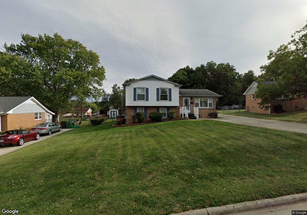
1706 Oberlin Dr High Point, NC 27260
Greater High Point NeighborhoodEstimated Value: $205,000 - $235,000
3
Beds
2
Baths
1,606
Sq Ft
$135/Sq Ft
Est. Value
About This Home
This home is located at 1706 Oberlin Dr, High Point, NC 27260 and is currently estimated at $217,078, approximately $135 per square foot. 1706 Oberlin Dr is a home located in Guilford County with nearby schools including Jamestown Elementary School, Southwest Guilford Middle School, and Southwest Guilford High School.
Ownership History
Date
Name
Owned For
Owner Type
Purchase Details
Closed on
Dec 29, 1999
Sold by
Parsons James E
Bought by
Parsons James E and Parsons Sharon S
Current Estimated Value
Home Financials for this Owner
Home Financials are based on the most recent Mortgage that was taken out on this home.
Original Mortgage
$114,300
Interest Rate
7.8%
Create a Home Valuation Report for This Property
The Home Valuation Report is an in-depth analysis detailing your home's value as well as a comparison with similar homes in the area
Home Values in the Area
Average Home Value in this Area
Purchase History
| Date | Buyer | Sale Price | Title Company |
|---|---|---|---|
| Parsons James E | -- | -- |
Source: Public Records
Mortgage History
| Date | Status | Borrower | Loan Amount |
|---|---|---|---|
| Closed | Parsons James E | $114,300 |
Source: Public Records
Tax History Compared to Growth
Tax History
| Year | Tax Paid | Tax Assessment Tax Assessment Total Assessment is a certain percentage of the fair market value that is determined by local assessors to be the total taxable value of land and additions on the property. | Land | Improvement |
|---|---|---|---|---|
| 2025 | $2,049 | $148,700 | $25,000 | $123,700 |
| 2024 | $2,049 | $148,700 | $25,000 | $123,700 |
| 2023 | $2,049 | $148,700 | $25,000 | $123,700 |
| 2022 | $2,004 | $148,700 | $25,000 | $123,700 |
| 2021 | $1,306 | $94,800 | $13,000 | $81,800 |
| 2020 | $1,306 | $94,800 | $13,000 | $81,800 |
| 2019 | $1,306 | $94,800 | $0 | $0 |
| 2018 | $1,300 | $94,800 | $0 | $0 |
| 2017 | $1,306 | $94,800 | $0 | $0 |
| 2016 | $1,310 | $93,400 | $0 | $0 |
| 2015 | $1,317 | $93,400 | $0 | $0 |
| 2014 | $1,339 | $93,400 | $0 | $0 |
Source: Public Records
Map
Nearby Homes
- 1514 Kingsway Dr
- 615 Hendrix St
- 723 Hendrix St
- 303 Northridge Rd
- 735 Hendrix St
- 116 Orville Dr
- 737 Hendrix St
- 2305 Delaware Place
- 600 Greensboro Rd
- 404 Hickory Chapel Rd
- 106 Crestwood Cir
- 627 Spring Garden Cir
- 3110 Wayne Ave
- 1005 Gordon St
- 1007 Gordon St
- 3309 Colony Dr
- 701 Locust Place
- 3546 Gardner Parson Point
- 3408 Dillon Rd
- 911 New Hampshire Dr
- 1704 Oberlin Dr
- 1708 Oberlin Dr
- 1702 Oberlin Dr
- 1707 Cedrow Dr
- 1709 Cedrow Dr
- 1710 Oberlin Dr
- 1705 Cedrow Dr
- 1711 Cedrow Dr
- 1705 Oberlin Dr
- 1707 Oberlin Dr
- 1703 Cedrow Dr
- 1713 Cedrow Dr
- 1703 Oberlin Dr
- 1712 Oberlin Dr
- 1709 Oberlin Dr
- 404 Runyon Dr
- 402 Runyon Dr
- 1715 Cedrow Dr
- 500 Runyon Dr
- 400 Runyon Dr