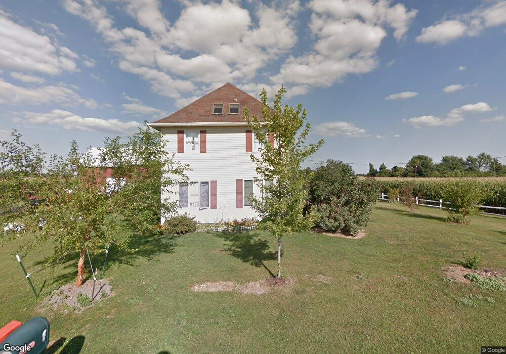
17060 Armbruster Rd Grand Rapids, OH 43522
Estimated Value: $213,000 - $277,000
3
Beds
2
Baths
2,032
Sq Ft
$122/Sq Ft
Est. Value
About This Home
This home is located at 17060 Armbruster Rd, Grand Rapids, OH 43522 and is currently estimated at $246,970, approximately $121 per square foot. 17060 Armbruster Rd is a home located in Wood County with nearby schools including Otsego Elementary School, Otsego Junior High School, and Otsego High School.
Ownership History
Date
Name
Owned For
Owner Type
Purchase Details
Closed on
Apr 29, 2015
Sold by
Berry Michael L and Berry Ninda M
Bought by
Frankforther Jedd R and Armentrout Pam
Current Estimated Value
Home Financials for this Owner
Home Financials are based on the most recent Mortgage that was taken out on this home.
Original Mortgage
$136,800
Outstanding Balance
$105,386
Interest Rate
3.68%
Mortgage Type
New Conventional
Estimated Equity
$141,584
Purchase Details
Closed on
Dec 16, 1996
Sold by
Rosonowski Richard
Bought by
Berry Michael L
Home Financials for this Owner
Home Financials are based on the most recent Mortgage that was taken out on this home.
Original Mortgage
$117,300
Interest Rate
7.85%
Mortgage Type
VA
Purchase Details
Closed on
May 4, 1983
Bought by
Rosonowski Richard L
Create a Home Valuation Report for This Property
The Home Valuation Report is an in-depth analysis detailing your home's value as well as a comparison with similar homes in the area
Home Values in the Area
Average Home Value in this Area
Purchase History
| Date | Buyer | Sale Price | Title Company |
|---|---|---|---|
| Frankforther Jedd R | $144,000 | None Available | |
| Berry Michael L | $115,000 | -- | |
| Rosonowski Richard L | -- | -- |
Source: Public Records
Mortgage History
| Date | Status | Borrower | Loan Amount |
|---|---|---|---|
| Open | Frankforther Jedd R | $136,800 | |
| Previous Owner | Berry Michael L | $117,300 |
Source: Public Records
Tax History Compared to Growth
Tax History
| Year | Tax Paid | Tax Assessment Tax Assessment Total Assessment is a certain percentage of the fair market value that is determined by local assessors to be the total taxable value of land and additions on the property. | Land | Improvement |
|---|---|---|---|---|
| 2024 | $2,840 | $64,820 | $9,555 | $55,265 |
| 2023 | $2,840 | $64,830 | $9,560 | $55,270 |
| 2021 | $2,639 | $54,500 | $9,560 | $44,940 |
| 2020 | $2,645 | $54,500 | $9,560 | $44,940 |
| 2019 | $2,277 | $45,510 | $9,560 | $35,950 |
| 2018 | $2,270 | $45,510 | $9,560 | $35,950 |
| 2017 | $2,221 | $45,510 | $9,560 | $35,950 |
| 2016 | $1,997 | $41,970 | $8,930 | $33,040 |
| 2015 | $1,997 | $41,970 | $8,930 | $33,040 |
| 2014 | $1,968 | $41,970 | $8,930 | $33,040 |
| 2013 | $2,143 | $41,970 | $8,930 | $33,040 |
Source: Public Records
Map
Nearby Homes
- 22888 Wintergreen Rd
- 15255 Van Tassel Rd
- 0 Manore Lot A Rd Unit 6130402
- 0 Manore Lot B Rd Unit 6130403
- 17630 Woodburn Ave
- 19330 Tuller Rd
- 22327 U S 6
- 23763 Front St
- 0 Otsego Pike Unit 6136991
- 0 Kellogg Rd Unit 6125521
- 23912 E 2nd St
- 15722 Range Line Rd
- 24432 W 3rd St
- 19393 U S 6
- 0 Scott Rd
- 20553 Euler Rd
- 0 W River Rd Unit 10000155
- 16710 Potter Rd
- 20391 Brown Ln
- 20410 Oak St
- 21415 Long Judson Rd
- 21305 Long Judson Rd
- 21100 Long Judson Rd
- 21050 Long Judson Rd
- 0 Armbruster Rd
- 21010 Long Judson Rd
- 17265 Weston Rd
- 20985 Long Judson Rd
- 17355 Weston Rd
- 21500 Wintergreen Rd
- 21845 Long Judson Rd
- 21232 Wintergreen Rd
- 17372 Weston Rd
- 16720 Milton Rd
- 16719 Milton Rd
- 21695 Wintergreen Rd
- 21910 Wintergreen Rd
- 16601 Weston Rd
- 22180 Long Judson Rd
- 21922 Wintergreen Rd