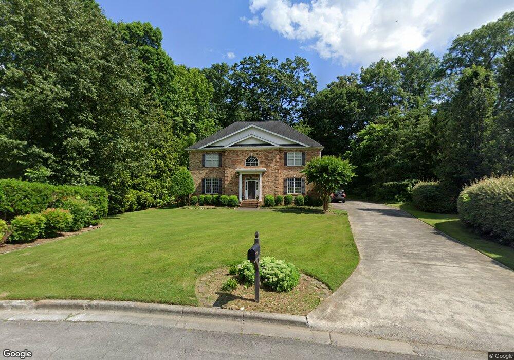
1707 Brandywine Way Dalton, GA 30720
Estimated Value: $495,116 - $650,000
4
Beds
3
Baths
3,558
Sq Ft
$168/Sq Ft
Est. Value
About This Home
This home is located at 1707 Brandywine Way, Dalton, GA 30720 and is currently estimated at $598,279, approximately $168 per square foot. 1707 Brandywine Way is a home located in Whitfield County with nearby schools including Brookwood Elementary School, Dalton Middle School, and Dalton High School.
Ownership History
Date
Name
Owned For
Owner Type
Purchase Details
Closed on
May 1, 2007
Sold by
Cole Amy Kinard
Bought by
Cooper Christopher T
Current Estimated Value
Home Financials for this Owner
Home Financials are based on the most recent Mortgage that was taken out on this home.
Original Mortgage
$140,000
Outstanding Balance
$84,925
Interest Rate
6.12%
Mortgage Type
New Conventional
Estimated Equity
$513,354
Purchase Details
Closed on
Jul 10, 2003
Sold by
Cole Stephen C
Bought by
Cole Amy Kinard
Purchase Details
Closed on
Jun 29, 2000
Sold by
Kinard Development Inc
Bought by
Cole Amy Kinard
Create a Home Valuation Report for This Property
The Home Valuation Report is an in-depth analysis detailing your home's value as well as a comparison with similar homes in the area
Home Values in the Area
Average Home Value in this Area
Purchase History
| Date | Buyer | Sale Price | Title Company |
|---|---|---|---|
| Cooper Christopher T | $295,000 | -- | |
| Cole Amy Kinard | -- | -- | |
| Cole Stephen C | -- | -- | |
| Cole Amy Kinard | -- | -- |
Source: Public Records
Mortgage History
| Date | Status | Borrower | Loan Amount |
|---|---|---|---|
| Open | Cooper Christopher T | $140,000 |
Source: Public Records
Tax History Compared to Growth
Tax History
| Year | Tax Paid | Tax Assessment Tax Assessment Total Assessment is a certain percentage of the fair market value that is determined by local assessors to be the total taxable value of land and additions on the property. | Land | Improvement |
|---|---|---|---|---|
| 2024 | $4,621 | $187,820 | $25,200 | $162,620 |
| 2023 | $4,621 | $130,755 | $21,600 | $109,155 |
| 2022 | $3,466 | $108,036 | $17,600 | $90,436 |
| 2021 | $3,610 | $112,034 | $17,600 | $94,434 |
| 2020 | $3,738 | $112,034 | $17,600 | $94,434 |
| 2019 | $3,850 | $112,034 | $17,600 | $94,434 |
| 2018 | $3,902 | $112,034 | $17,600 | $94,434 |
| 2017 | $3,909 | $112,034 | $17,600 | $94,434 |
| 2016 | $3,432 | $102,689 | $16,800 | $85,889 |
| 2014 | $3,160 | $102,689 | $16,800 | $85,889 |
| 2013 | -- | $102,688 | $16,800 | $85,888 |
Source: Public Records
Map
Nearby Homes
- 1709 Dug Gap Rd
- 1913 Tara Place
- 1506 Summer Gate Way
- 1506 Summer Gate Way Unit 8
- 1922 Fairfield Dr
- 1498 Mineral Springs Rd
- 1482 Mineral Springs Rd
- 1704 Southmont Dr
- 1934 Spring Chase Way
- 1608 Ryman Ridge Rd
- 0 Horizon Ct Unit 130497
- 0 Horizon Ct Unit 130499
- 0 Horizon Ct Unit 130479
- 0 Horizon Ct Unit 130477
- 0 Horizon Ct Unit 130478
- 0 Horizon Ct Unit 130496
- 0 Horizon Ct Unit 130498
- 1908 Valley Brook Dr
- 00 Rio Vista Dr
- Lot 12 Bald Eagle Ln
- 1705 Brandywine Way
- 1709 Brandywine Way
- 2010 Sheffield Place
- 2012 Sheffield Place
- 2008 Sheffield Place
- 2014 Sheffield Place
- 1704 Habersham Way
- 1702 Brandywine Way
- 1703 Brandywine Way
- 1711 Brandywine Way
- 2006 Sheffield Place
- 2016 Sheffield Place
- 1706 Habersham Way
- 1702 Habersham Way
- 2003 Sheffield Place
- 1923 Fairington Dr
- 2018 Sheffield Place
- 1702 Westchester Dr
- 2004 Sheffield Place
- 1704 Brandywine Way