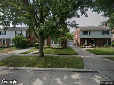
1707 Newcastle Rd Grosse Pointe Woods, MI 48236
Estimated Value: $340,302 - $373,000
3
Beds
2
Baths
1,989
Sq Ft
$179/Sq Ft
Est. Value
About This Home
This home is located at 1707 Newcastle Rd, Grosse Pointe Woods, MI 48236 and is currently estimated at $356,826, approximately $179 per square foot. 1707 Newcastle Rd is a home located in Wayne County with nearby schools including John Monteith Elementary School, Brownell Middle School, and Grosse Pointe North High School.
Ownership History
Date
Name
Owned For
Owner Type
Purchase Details
Closed on
Jun 16, 2004
Sold by
Hesselson Aaron B and Hesselson Heather H
Bought by
Lai Tito
Current Estimated Value
Home Financials for this Owner
Home Financials are based on the most recent Mortgage that was taken out on this home.
Original Mortgage
$88,100
Interest Rate
6.37%
Mortgage Type
Credit Line Revolving
Create a Home Valuation Report for This Property
The Home Valuation Report is an in-depth analysis detailing your home's value as well as a comparison with similar homes in the area
Home Values in the Area
Average Home Value in this Area
Purchase History
| Date | Buyer | Sale Price | Title Company |
|---|---|---|---|
| Lai Tito | $269,000 | Greco |
Source: Public Records
Mortgage History
| Date | Status | Borrower | Loan Amount |
|---|---|---|---|
| Open | Lai Tito | $124,000 | |
| Closed | Lai Tito | $153,700 | |
| Closed | Lai Tito | $88,100 | |
| Closed | Lai Tito | $154,000 |
Source: Public Records
Tax History Compared to Growth
Tax History
| Year | Tax Paid | Tax Assessment Tax Assessment Total Assessment is a certain percentage of the fair market value that is determined by local assessors to be the total taxable value of land and additions on the property. | Land | Improvement |
|---|---|---|---|---|
| 2024 | $2,796 | $167,400 | $0 | $0 |
| 2023 | $2,689 | $145,600 | $0 | $0 |
| 2022 | $4,211 | $132,200 | $0 | $0 |
| 2021 | $4,014 | $135,400 | $0 | $0 |
| 2020 | $4,133 | $130,700 | $0 | $0 |
| 2019 | $2,447 | $121,200 | $0 | $0 |
| 2018 | $2,405 | $97,900 | $0 | $0 |
| 2017 | $2,795 | $96,500 | $0 | $0 |
| 2016 | $3,810 | $93,200 | $0 | $0 |
| 2015 | $6,604 | $84,700 | $0 | $0 |
| 2013 | $6,400 | $65,300 | $0 | $0 |
| 2012 | -- | $73,400 | $16,700 | $56,700 |
Source: Public Records
Map
Nearby Homes
- 19299 Raymond St
- 1855 Prestwick Rd
- 1878 Prestwick Rd
- 19218 Eastborne St
- 484 Bournemouth Cir
- 19280 Berden St
- 21719 Moross Rd
- 21519 Sloan Dr
- 21746 Moross Rd
- 5228 Hillcrest St
- 5921 Hillcrest St
- 21421 Bournemouth St
- 441 Roland Rd
- 21327 Prestwick Ave
- 19131 Chester St
- 21306 Brierstone St
- 21225 Bournemouth St
- 1873 Manchester Blvd
- 5522 Ashley St
- 19266 Tyrone St
- 1707 Newcastle Rd
- 1699 Newcastle Rd
- 1715 Newcastle Rd
- 1725 Newcastle Rd
- 1731 Newcastle Rd
- 1722 Bournemouth Rd
- 1691 Newcastle Rd
- 1730 Bournemouth Rd
- 1738 Bournemouth Rd
- 1714 Bournemouth Rd
- 1739 Newcastle Rd
- 1746 Bournemouth Rd
- 1683 Newcastle Rd
- 1706 Bournemouth Rd
- 1698 Bournemouth Rd
- 1710 Newcastle Rd
- 1718 Newcastle Rd
- 1702 Newcastle Rd
- 1726 Newcastle Rd
- 1747 Newcastle Rd