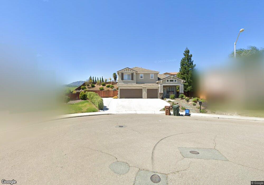
1707 Observation Way Antioch, CA 94531
Lone Tree Valley NeighborhoodEstimated Value: $830,000 - $961,000
5
Beds
4
Baths
3,413
Sq Ft
$257/Sq Ft
Est. Value
About This Home
This home is located at 1707 Observation Way, Antioch, CA 94531 and is currently estimated at $878,765, approximately $257 per square foot. 1707 Observation Way is a home located in Contra Costa County with nearby schools including Lone Tree Elementary School, Dallas Ranch Middle School, and Deer Valley High School.
Ownership History
Date
Name
Owned For
Owner Type
Purchase Details
Closed on
May 31, 2019
Sold by
Frederickson Richard Allan and Frederickson Kathleen Ann
Bought by
Girish Scott Michael and Blizzard Katherine Lea
Current Estimated Value
Home Financials for this Owner
Home Financials are based on the most recent Mortgage that was taken out on this home.
Original Mortgage
$627,000
Outstanding Balance
$552,393
Interest Rate
4.2%
Mortgage Type
New Conventional
Estimated Equity
$326,372
Purchase Details
Closed on
Nov 22, 2002
Sold by
Richmond American Homes Of Ca Inc
Bought by
Frederickson Richard Allan and Frederickson Kathleen Ann
Home Financials for this Owner
Home Financials are based on the most recent Mortgage that was taken out on this home.
Original Mortgage
$392,000
Interest Rate
6.28%
Mortgage Type
Purchase Money Mortgage
Create a Home Valuation Report for This Property
The Home Valuation Report is an in-depth analysis detailing your home's value as well as a comparison with similar homes in the area
Home Values in the Area
Average Home Value in this Area
Purchase History
| Date | Buyer | Sale Price | Title Company |
|---|---|---|---|
| Girish Scott Michael | $660,000 | Old Republic Title Company | |
| Frederickson Richard Allan | $497,500 | First American Title |
Source: Public Records
Mortgage History
| Date | Status | Borrower | Loan Amount |
|---|---|---|---|
| Open | Girish Scott Michael | $627,000 | |
| Previous Owner | Frederickson Richard Allan | $392,000 | |
| Closed | Frederickson Richard Allan | $30,000 |
Source: Public Records
Tax History
| Year | Tax Paid | Tax Assessment Tax Assessment Total Assessment is a certain percentage of the fair market value that is determined by local assessors to be the total taxable value of land and additions on the property. | Land | Improvement |
|---|---|---|---|---|
| 2025 | $8,465 | $736,238 | $167,325 | $568,913 |
| 2024 | $7,991 | $721,803 | $164,045 | $557,758 |
| 2023 | $7,991 | $707,651 | $160,829 | $546,822 |
| 2022 | $7,864 | $693,776 | $157,676 | $536,100 |
| 2021 | $7,634 | $680,174 | $154,585 | $525,589 |
| 2019 | $6,505 | $566,000 | $153,349 | $412,651 |
| 2018 | $6,175 | $548,000 | $148,472 | $399,528 |
| 2017 | $5,719 | $504,500 | $136,687 | $367,813 |
| 2016 | $5,559 | $491,500 | $133,165 | $358,335 |
| 2015 | $5,686 | $468,500 | $126,934 | $341,566 |
| 2014 | $6,512 | $468,000 | $126,799 | $341,201 |
Source: Public Records
Map
Nearby Homes
- 1653 Observation Ct
- 1803 Sanger Peak Way
- 5488 Southwood Ct
- 2096 Mokelumne Dr
- 5448 Southwood Way
- 1821 Kern Mountain Way
- 1246 Oak Haven Way
- 2500 Vallecito Way
- 2487 Stanford Way
- 1879 Mount Conness Way
- 2469 Sparrow Ct
- 1256 Mokelumne Ct
- 5388 Southwood Way
- 2512 Forty Niner Way
- 2625 Orange Way
- 5081 Mesa Ridge Dr
- 5204 Chinook Ct
- 2117 Mark Twain Dr
- 5224 Kestrel St
- 5408 Kestrel Ct
- 1711 Sanger Peak Way
- 1992 Mount Wilson Ct
- 1994 Mount Wilson Ct
- 1699 Observation Way
- 1996 Mount Wilson Ct
- 1715 Sanger Peak Way
- 1990 Mount Wilson Ct
- 1716 Sanger Peak Way
- 1998 Mount Wilson Ct
- 1719 Sanger Peak Way
- 1949 Colosseum Way
- 1945 Colosseum Way
- 1720 Sanger Peak Way
- 2000 Mount Wilson Ct
- 1941 Colosseum Way
- 1988 Mount Wilson Ct
- 1723 Sanger Peak Way
- 1986 Mount Wilson Ct
- 1984 Mount Wilson Ct
- 1724 Sanger Peak Way
Your Personal Tour Guide
Ask me questions while you tour the home.