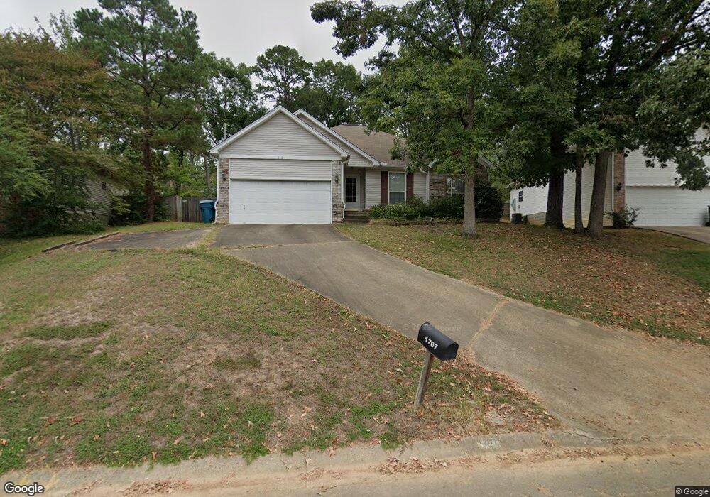
1707 Point West Dr Little Rock, AR 72211
Western Little Rock NeighborhoodEstimated Value: $234,000 - $245,749
--
Bed
2
Baths
1,491
Sq Ft
$160/Sq Ft
Est. Value
About This Home
This home is located at 1707 Point West Dr, Little Rock, AR 72211 and is currently estimated at $238,187, approximately $159 per square foot. 1707 Point West Dr is a home located in Pulaski County with nearby schools including Terry Elementary School, Pinnacle View Middle School, and LISA Academy West Elementary School.
Ownership History
Date
Name
Owned For
Owner Type
Purchase Details
Closed on
Jul 9, 2014
Sold by
Dyer Julie A
Bought by
Vanprooyen Timothy
Current Estimated Value
Purchase Details
Closed on
Jan 16, 2006
Sold by
Renick Michael A and Renick Kerri A
Bought by
Dyer Julie A
Home Financials for this Owner
Home Financials are based on the most recent Mortgage that was taken out on this home.
Original Mortgage
$112,000
Interest Rate
6.25%
Mortgage Type
Fannie Mae Freddie Mac
Purchase Details
Closed on
Dec 29, 2000
Sold by
Rosenthal Michael Scott
Bought by
Renick Michael A and Renick Kerri A
Home Financials for this Owner
Home Financials are based on the most recent Mortgage that was taken out on this home.
Original Mortgage
$123,878
Interest Rate
7.78%
Mortgage Type
FHA
Create a Home Valuation Report for This Property
The Home Valuation Report is an in-depth analysis detailing your home's value as well as a comparison with similar homes in the area
Home Values in the Area
Average Home Value in this Area
Purchase History
| Date | Buyer | Sale Price | Title Company |
|---|---|---|---|
| Vanprooyen Timothy | $156,625 | First National Title Company | |
| Dyer Julie A | $152,000 | Stewart Title Of Ar Inc | |
| Renick Michael A | $125,000 | -- |
Source: Public Records
Mortgage History
| Date | Status | Borrower | Loan Amount |
|---|---|---|---|
| Previous Owner | Dyer Julie A | $112,000 | |
| Previous Owner | Renick Michael A | $123,878 |
Source: Public Records
Tax History Compared to Growth
Tax History
| Year | Tax Paid | Tax Assessment Tax Assessment Total Assessment is a certain percentage of the fair market value that is determined by local assessors to be the total taxable value of land and additions on the property. | Land | Improvement |
|---|---|---|---|---|
| 2025 | $2,692 | $38,460 | $5,800 | $32,660 |
| 2024 | $2,519 | $38,460 | $5,800 | $32,660 |
| 2023 | $2,519 | $38,460 | $5,800 | $32,660 |
| 2022 | $2,405 | $38,460 | $5,800 | $32,660 |
| 2021 | $2,306 | $32,710 | $7,200 | $25,510 |
| 2020 | $1,915 | $32,710 | $7,200 | $25,510 |
| 2019 | $1,915 | $32,710 | $7,200 | $25,510 |
| 2018 | $1,940 | $32,710 | $7,200 | $25,510 |
| 2017 | $1,940 | $32,710 | $7,200 | $25,510 |
| 2016 | $2,220 | $31,710 | $5,000 | $26,710 |
| 2015 | $2,223 | $31,710 | $5,000 | $26,710 |
| 2014 | $2,223 | $31,710 | $5,000 | $26,710 |
Source: Public Records
Map
Nearby Homes
- 1707 Point Dr W
- 12400 Cherry Laurel Dr
- 28 Elkrun Cove
- 2001 Brookford Dr
- 12601 Misty Creek Dr
- 1408 S Bowman Rd
- 23 Wagon Wheel Ct
- 1610 Calgary Trail
- 2623 Bowman Rd
- 1509 Gamble Rd
- 12825 Westglen Dr
- 12901 Westglen Dr
- 11701 Shady Creek Dr
- 1409 Mesquite Dr
- 11612 Shady Creek Dr
- 814 Atkins Rd
- 13408 Teton Dr
- 2101 Hickorynut Ct
- 13100 Kanis Rd
- 2806 Woodsgate Dr
- 1705 Point Dr W
- 1711 Point West Dr
- 1705 Point West Dr
- 12409 Woodbourne Dr
- 1715 Point Dr W
- 12401 Woodbourne Dr
- 1715 Point West Dr
- 12419 Woodbourne Dr
- 1708 Point West Dr
- 1708 Point Dr W
- 1712 Point West Dr
- 8 Stonebrook Ct
- 1704 Point West Dr
- 1704 Point Dr W
- 1717 Point West Dr
- 1717 Point Dr W
- 12319 Woodbourne Dr
- 1700 Point Dr W
- 1700 Point West Dr
- 1716 Point West Dr