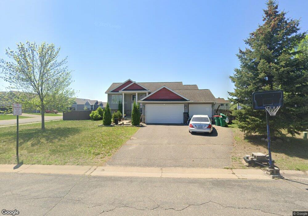
17077 Larkspur Ln Big Lake, MN 55309
Estimated Value: $345,000 - $362,000
4
Beds
3
Baths
1,265
Sq Ft
$279/Sq Ft
Est. Value
About This Home
This home is located at 17077 Larkspur Ln, Big Lake, MN 55309 and is currently estimated at $353,558, approximately $279 per square foot. 17077 Larkspur Ln is a home located in Sherburne County with nearby schools including Liberty Elementary School, Independence Elementary School, and Big Lake Middle School.
Ownership History
Date
Name
Owned For
Owner Type
Purchase Details
Closed on
May 22, 2015
Sold by
Kochsiek Amy
Bought by
Anderson Tyler
Current Estimated Value
Home Financials for this Owner
Home Financials are based on the most recent Mortgage that was taken out on this home.
Original Mortgage
$167,226
Outstanding Balance
$128,544
Interest Rate
3.62%
Mortgage Type
FHA
Estimated Equity
$225,014
Purchase Details
Closed on
Jun 1, 2013
Sold by
Downing Chase Riley
Bought by
Kochsiek Amy Marie
Purchase Details
Closed on
Apr 23, 2010
Sold by
Bank Of America
Bought by
Kochsiek Amy
Home Financials for this Owner
Home Financials are based on the most recent Mortgage that was taken out on this home.
Original Mortgage
$108,000
Interest Rate
5.02%
Mortgage Type
New Conventional
Purchase Details
Closed on
Apr 18, 2005
Sold by
Bruggeman Properties Llc
Bought by
T J Land Trust Iv Llc
Create a Home Valuation Report for This Property
The Home Valuation Report is an in-depth analysis detailing your home's value as well as a comparison with similar homes in the area
Home Values in the Area
Average Home Value in this Area
Purchase History
| Date | Buyer | Sale Price | Title Company |
|---|---|---|---|
| Anderson Tyler | $173,000 | Alliance Title Llc | |
| Kochsiek Amy Marie | -- | None Available | |
| Kochsiek Amy | $142,000 | -- | |
| T J Land Trust Iv Llc | $516,600 | -- |
Source: Public Records
Mortgage History
| Date | Status | Borrower | Loan Amount |
|---|---|---|---|
| Open | Anderson Tyler | $167,226 | |
| Previous Owner | Kochsiek Amy | $108,000 |
Source: Public Records
Tax History Compared to Growth
Tax History
| Year | Tax Paid | Tax Assessment Tax Assessment Total Assessment is a certain percentage of the fair market value that is determined by local assessors to be the total taxable value of land and additions on the property. | Land | Improvement |
|---|---|---|---|---|
| 2025 | $3,962 | $332,300 | $86,400 | $245,900 |
| 2024 | $3,980 | $331,300 | $86,400 | $244,900 |
| 2023 | $3,958 | $332,800 | $86,400 | $246,400 |
| 2022 | $4,958 | $319,600 | $73,200 | $246,400 |
| 2020 | $3,378 | $244,500 | $43,500 | $201,000 |
| 2019 | $3,168 | $227,700 | $38,500 | $189,200 |
| 2018 | $2,992 | $212,400 | $35,400 | $177,000 |
| 2017 | $2,842 | $194,800 | $32,200 | $162,600 |
| 2016 | $2,802 | $180,600 | $30,100 | $150,500 |
| 2015 | $2,560 | $158,300 | $29,100 | $129,200 |
| 2014 | -- | $152,500 | $28,900 | $123,600 |
| 2013 | -- | $133,000 | $27,900 | $105,100 |
Source: Public Records
Map
Nearby Homes
- 20201 Prairie Dr
- 20209 Prairie Dr
- 20138 170th St NW
- 18001 Walnut Cir
- 16760 203rd Ave NW
- XXX 176th St NW
- 20386 181st Cir NW
- 23xxx 182nd St NW
- 15910 201st Ave NW
- 393 Phyllis St
- 591 Glenwood Ave
- 199 Henry Rd
- 585 Glenwood Ave
- 19400 Karen Ln
- 541 William St
- 18585 Arctic Ave
- 21635 173rd St NW
- 18050 Walnut Cir
- 18052 Walnut Cir
- 18041 Walnut Cir
- 17081 Larkspur Ln
- 20213 Prairie Dr
- 17195 Trillium Ln
- 17181 Trillium Ln
- 20205 Prairie Dr
- 17085 Larkspur Ln
- 17074 Larkspur Ln
- 17177 Trillium Ln
- 17080 Larkspur Ln
- 20197 Prairie Dr
- 20217 Prairie Dr
- 17086 Larkspur Ln
- 20193 Prairie Dr
- xxx Prairie Dr
- XXX Prairi Unassigned Address Dr
- XXX Prairie Unassigned Address Dr
- 20221 Prairie Dr
- 20189 Prairie Dr
- 20225 Prairie Dr
- 17125 Trillium Ln