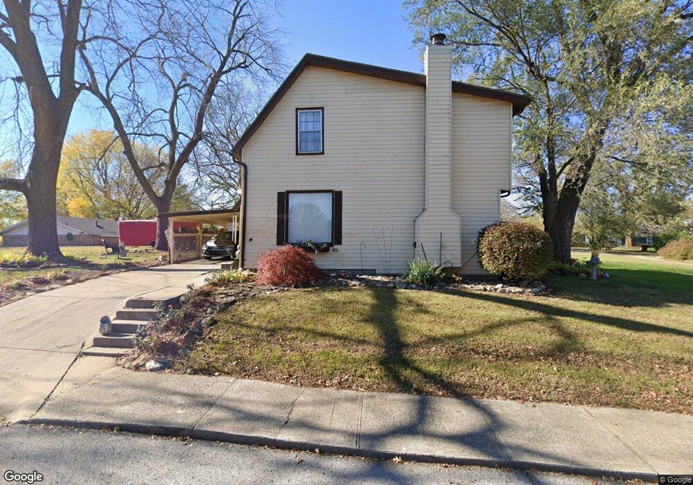
1708 Garland Ave Leavenworth, KS 66048
Estimated Value: $177,000 - $211,000
3
Beds
2
Baths
2,030
Sq Ft
$99/Sq Ft
Est. Value
About This Home
This home is located at 1708 Garland Ave, Leavenworth, KS 66048 and is currently estimated at $200,386, approximately $98 per square foot. 1708 Garland Ave is a home located in Leavenworth County with nearby schools including Anthony Elementary School, Richard Warren Middle School, and Leavenworth Senior High School.
Ownership History
Date
Name
Owned For
Owner Type
Purchase Details
Closed on
Feb 22, 2025
Sold by
Smith Betty L
Bought by
Vanvelzer Melinda J
Current Estimated Value
Home Financials for this Owner
Home Financials are based on the most recent Mortgage that was taken out on this home.
Original Mortgage
$100,000
Outstanding Balance
$98,639
Interest Rate
7.04%
Mortgage Type
New Conventional
Estimated Equity
$101,747
Purchase Details
Closed on
Jan 5, 2023
Sold by
Smith Betty Lou
Bought by
Smith Betty Lou and Smith Lance Michele
Create a Home Valuation Report for This Property
The Home Valuation Report is an in-depth analysis detailing your home's value as well as a comparison with similar homes in the area
Home Values in the Area
Average Home Value in this Area
Purchase History
| Date | Buyer | Sale Price | Title Company |
|---|---|---|---|
| Vanvelzer Melinda J | -- | Lawyers Title Of Kansas | |
| Smith Betty Lou | -- | None Listed On Document |
Source: Public Records
Mortgage History
| Date | Status | Borrower | Loan Amount |
|---|---|---|---|
| Open | Vanvelzer Melinda J | $100,000 |
Source: Public Records
Tax History Compared to Growth
Tax History
| Year | Tax Paid | Tax Assessment Tax Assessment Total Assessment is a certain percentage of the fair market value that is determined by local assessors to be the total taxable value of land and additions on the property. | Land | Improvement |
|---|---|---|---|---|
| 2025 | $2,648 | $23,857 | $1,149 | $22,708 |
| 2024 | $2,619 | $22,721 | $1,149 | $21,572 |
| 2023 | $2,619 | $21,847 | $1,149 | $20,698 |
| 2022 | $2,262 | $18,746 | $1,205 | $17,541 |
| 2021 | $1,800 | $13,910 | $1,205 | $12,705 |
| 2020 | $1,587 | $12,142 | $1,205 | $10,937 |
| 2019 | $1,560 | $11,829 | $1,205 | $10,624 |
| 2018 | $1,572 | $11,829 | $1,205 | $10,624 |
| 2017 | $1,534 | $11,829 | $1,205 | $10,624 |
| 2016 | $1,536 | $11,829 | $1,205 | $10,624 |
| 2015 | $1,634 | $12,635 | $1,619 | $11,016 |
| 2014 | $1,518 | $11,811 | $1,619 | $10,192 |
Source: Public Records
Map
Nearby Homes
- 1708 S Broadway St
- 1610 S Broadway St
- 1700 Lawrence Ave
- 1932 S Broadway St
- 1913 Cleveland Terrace
- 1509 10th Ave
- 1420 10th Ave
- 708 Thornton St
- 1715 Klemp St
- 1417 5th Ave
- 1305 Lawrence Ave
- 1203 5th Ave
- 2307 Maple Ave
- 559 Prospect St
- 522 Buttinger Place
- 1011 9th Ave
- 1116 Quincy St
- 1004 Randolph St
- 927 Columbia Ave
- 1036 Vilas St
- 1704 Garland Ave
- 791 Pennsylvania Ave
- 1707 9th Ave
- 760 Grace St
- 795 Pennsylvania Ave
- 787 Pennsylvania Ave
- 799 Pennsylvania Ave
- 1800 Garland Ave
- 1619 9th Ave
- 801 Pennsylvania Ave
- 788 Pennsylvania Ave
- 1706 9th Ave
- 761 Grace St
- 1710 9th Ave
- 1804 Garland Ave
- 796 Pennsylvania Ave
- 807 Pennsylvania Ave
- 1615 9th Ave
- 1712 9th Ave
- 784 Pennsylvania Ave