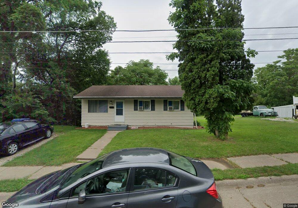
1708 Mound St Davenport, IA 52803
East End NeighborhoodEstimated Value: $103,000 - $128,000
3
Beds
1
Bath
816
Sq Ft
$138/Sq Ft
Est. Value
About This Home
This home is located at 1708 Mound St, Davenport, IA 52803 and is currently estimated at $112,746, approximately $138 per square foot. 1708 Mound St is a home located in Scott County with nearby schools including McKinley Elementary School, Casey County Middle School, and Hopkinsville Middle School.
Ownership History
Date
Name
Owned For
Owner Type
Purchase Details
Closed on
May 27, 2011
Sold by
Corton Inc
Bought by
Hodges Ruth A
Current Estimated Value
Home Financials for this Owner
Home Financials are based on the most recent Mortgage that was taken out on this home.
Original Mortgage
$67,737
Outstanding Balance
$46,922
Interest Rate
4.81%
Mortgage Type
FHA
Estimated Equity
$65,824
Create a Home Valuation Report for This Property
The Home Valuation Report is an in-depth analysis detailing your home's value as well as a comparison with similar homes in the area
Home Values in the Area
Average Home Value in this Area
Purchase History
| Date | Buyer | Sale Price | Title Company |
|---|---|---|---|
| Hodges Ruth A | $69,500 | None Available |
Source: Public Records
Mortgage History
| Date | Status | Borrower | Loan Amount |
|---|---|---|---|
| Open | Hodges Ruth A | $67,737 |
Source: Public Records
Tax History Compared to Growth
Tax History
| Year | Tax Paid | Tax Assessment Tax Assessment Total Assessment is a certain percentage of the fair market value that is determined by local assessors to be the total taxable value of land and additions on the property. | Land | Improvement |
|---|---|---|---|---|
| 2025 | $1,340 | $104,730 | $23,360 | $81,370 |
| 2024 | $1,420 | $98,910 | $23,360 | $75,550 |
| 2023 | $1,580 | $98,910 | $23,360 | $75,550 |
| 2022 | $1,586 | $82,870 | $14,020 | $68,850 |
| 2021 | $1,586 | $82,870 | $14,020 | $68,850 |
| 2020 | $1,538 | $79,590 | $14,020 | $65,570 |
| 2019 | $1,476 | $74,340 | $14,020 | $60,320 |
| 2018 | $1,340 | $74,340 | $14,020 | $60,320 |
| 2017 | $388 | $69,750 | $14,020 | $55,730 |
| 2016 | $1,480 | $76,310 | $0 | $0 |
| 2015 | $1,480 | $68,990 | $0 | $0 |
| 2014 | $1,338 | $68,990 | $0 | $0 |
| 2013 | $1,312 | $0 | $0 | $0 |
| 2012 | -- | $59,670 | $11,910 | $47,760 |
Source: Public Records
Map
Nearby Homes
- 1504 Christie St
- 1803 Belle Ave
- 1815 Belle Ave
- 2316 East St
- 2316 E Pleasant St
- 1704 Jersey Ridge Rd
- 1515 Jersey Ridge Rd
- 2103 E Lombard St
- 2125 Eastern Ave
- 1734 Ridgewood Ave
- 1233 Eastern Ave
- 1325 Mississippi Ave
- 1626 Esplanade Ave
- 1616 Esplanade Ave
- 1202 Adams St
- 1310 Kirkwood Blvd
- 2618 Elm St
- 2429 E Central Park Ave
- 2704 E High St
- 10 Kenwood Ave
- 1720 Mound St
- 1724 Mound St
- 1610 Mound St
- 1711 Mound St
- 1619 Mound St
- 2021 E Locust St
- 2021 E Locust St Unit 1
- 1717 Mound St
- 1615 Mound St
- 1601 Mound St
- 2109 E Locust St
- 1528 Mound St
- 2115 E Locust St
- 1535 Mound St
- 1524 Mound St
- 1710 Christie St
- 1708 Christie St
- 1716 Christie St
- 1618 Christie St
- 1531 Mound St