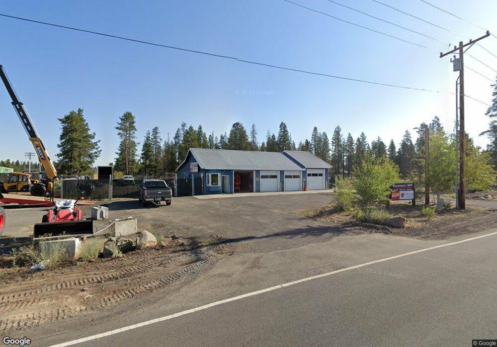
17080 Tracy Rd La Pine, OR 97739
Estimated Value: $630,472
--
Bed
--
Bath
2,136
Sq Ft
$295/Sq Ft
Est. Value
About This Home
This home is located at 17080 Tracy Rd, La Pine, OR 97739 and is currently estimated at $630,472, approximately $295 per square foot. 17080 Tracy Rd is a home located in Deschutes County with nearby schools including Rosland Elementary School, La Pine Middle School, and La Pine Senior High School.
Ownership History
Date
Name
Owned For
Owner Type
Purchase Details
Closed on
Jan 13, 2020
Sold by
Sannes Frederick O and Aday Rita R
Bought by
Pnr Llc
Current Estimated Value
Purchase Details
Closed on
Apr 20, 2016
Sold by
Sannes Frederick O and Aday Rita R
Bought by
Aday Sannes Family Trust
Purchase Details
Closed on
Aug 15, 2005
Sold by
Tracy Gerald R and Tracy Ellouise M
Bought by
Sannes Fred D and Aday Rita R
Home Financials for this Owner
Home Financials are based on the most recent Mortgage that was taken out on this home.
Original Mortgage
$100,000
Interest Rate
5.56%
Mortgage Type
Seller Take Back
Create a Home Valuation Report for This Property
The Home Valuation Report is an in-depth analysis detailing your home's value as well as a comparison with similar homes in the area
Home Values in the Area
Average Home Value in this Area
Purchase History
| Date | Buyer | Sale Price | Title Company |
|---|---|---|---|
| Pnr Llc | $450,000 | First American Title | |
| Aday Sannes Family Trust | -- | None Available | |
| Sannes Fred D | $225,000 | Western Title & Escrow Co |
Source: Public Records
Mortgage History
| Date | Status | Borrower | Loan Amount |
|---|---|---|---|
| Previous Owner | Sannes Fred D | $100,000 |
Source: Public Records
Tax History Compared to Growth
Tax History
| Year | Tax Paid | Tax Assessment Tax Assessment Total Assessment is a certain percentage of the fair market value that is determined by local assessors to be the total taxable value of land and additions on the property. | Land | Improvement |
|---|---|---|---|---|
| 2024 | $2,826 | $154,200 | -- | -- |
| 2023 | $2,761 | $149,710 | $0 | $0 |
| 2022 | $2,470 | $141,120 | $0 | $0 |
| 2021 | $2,484 | $137,010 | $0 | $0 |
| 2020 | $2,361 | $137,010 | $0 | $0 |
| 2019 | $2,296 | $133,020 | $0 | $0 |
| 2018 | $2,231 | $129,150 | $0 | $0 |
| 2017 | $2,147 | $125,390 | $0 | $0 |
| 2016 | $2,061 | $121,740 | $0 | $0 |
| 2015 | $1,988 | $118,200 | $0 | $0 |
| 2014 | $1,899 | $114,605 | $0 | $0 |
Source: Public Records
Map
Nearby Homes
- 52530 Railroad St
- 52611 Pam Ln
- 52630 Railroad St
- 0 Skidgel Rd Unit 220152152
- 52644 Skidgel Rd
- 52606 Doe Ln
- 52505 Pine Dr
- 52555 Pine Dr
- 52433 Pine Dr
- 16760 Pine Place
- 16781 Cagle Rd
- 52575 Ammon Rd
- 16650 Willow Ln
- 52628 Ammon Rd
- 17545 Holgate Ct
- 17575 Sutter St
- 52356 Allen Dr
- 52812 Timber Lane Loop
- 52844 Timber Lane Loop
- 52748 Golden Astor Rd
- 52504 Hwy 97
- 52502 Highway 97
- 17070 Rosland Rd
- 0 La Pine Commercial Unit 201307460
- 52504 U S 97
- 52510 Highway 97
- 52520 Highway 97
- 52530 Highway 97
- 17071 Tracy Rd
- 17125 Rosland Rd Unit 1
- 17125 Rosland Rd
- 0 Rosland Rd Unit 2613299
- 0 Rosland Rd Unit 9904801
- 0 Rosland Rd Unit Lot 2 2900977
- 52556 Drafter Rd
- 52509 Railroad St
- 52519 Railroad St
- 52505 Railroad St
- 52533 Railroad St
- 52568 Drafter Rd