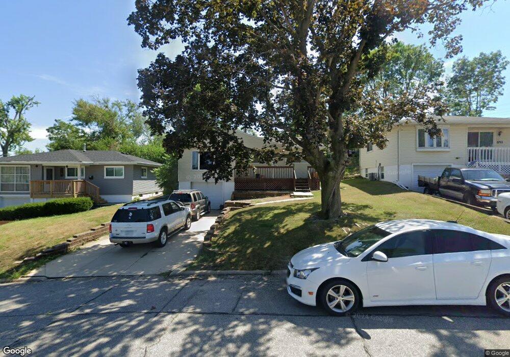
1709 12th Ave SW Cedar Rapids, IA 52404
Cleveland Area NeighborhoodEstimated Value: $146,870 - $164,000
3
Beds
1
Bath
920
Sq Ft
$170/Sq Ft
Est. Value
About This Home
This home is located at 1709 12th Ave SW, Cedar Rapids, IA 52404 and is currently estimated at $156,468, approximately $170 per square foot. 1709 12th Ave SW is a home located in Linn County with nearby schools including Cleveland Elementary School, Roosevelt Creative Corridor Business Academy, and Thomas Jefferson High School.
Ownership History
Date
Name
Owned For
Owner Type
Purchase Details
Closed on
Jan 12, 2010
Sold by
Graham Catherine H
Bought by
Maine Michelle J
Current Estimated Value
Home Financials for this Owner
Home Financials are based on the most recent Mortgage that was taken out on this home.
Original Mortgage
$106,534
Outstanding Balance
$69,661
Interest Rate
4.87%
Mortgage Type
FHA
Estimated Equity
$86,807
Create a Home Valuation Report for This Property
The Home Valuation Report is an in-depth analysis detailing your home's value as well as a comparison with similar homes in the area
Home Values in the Area
Average Home Value in this Area
Purchase History
| Date | Buyer | Sale Price | Title Company |
|---|---|---|---|
| Maine Michelle J | $108,000 | None Available |
Source: Public Records
Mortgage History
| Date | Status | Borrower | Loan Amount |
|---|---|---|---|
| Open | Maine Michelle J | $106,534 |
Source: Public Records
Tax History Compared to Growth
Tax History
| Year | Tax Paid | Tax Assessment Tax Assessment Total Assessment is a certain percentage of the fair market value that is determined by local assessors to be the total taxable value of land and additions on the property. | Land | Improvement |
|---|---|---|---|---|
| 2025 | $2,194 | $152,100 | $24,700 | $127,400 |
| 2024 | $2,388 | $142,500 | $22,500 | $120,000 |
| 2023 | $2,388 | $134,500 | $22,500 | $112,000 |
| 2022 | $2,220 | $122,100 | $19,100 | $103,000 |
| 2021 | $2,264 | $116,100 | $19,100 | $97,000 |
| 2020 | $2,264 | $111,200 | $18,000 | $93,200 |
| 2019 | $2,006 | $101,600 | $18,000 | $83,600 |
| 2018 | $1,946 | $101,600 | $18,000 | $83,600 |
| 2017 | $1,974 | $99,200 | $18,000 | $81,200 |
| 2016 | $2,053 | $96,600 | $18,000 | $78,600 |
| 2015 | $2,017 | $94,837 | $17,980 | $76,857 |
| 2014 | $1,832 | $98,073 | $17,980 | $80,093 |
| 2013 | $1,856 | $98,073 | $17,980 | $80,093 |
Source: Public Records
Map
Nearby Homes
- 1506 14th Ave SW
- 1807 9th Ave SW
- 1818 Holly Meadow Ave SW
- 1824 Holly Meadow Ave SW
- 1907 Holly Meadow Ave SW
- 1913 Holly Meadow Ave SW
- 1801 Shady Grove Rd SW
- 1602 1st Ave NW
- 1400 7th Ave SW
- Bakersfield - Cedar Rapids Plan at Whispering Pines
- Becker II - Cedar Rapids Plan at Whispering Pines
- Becker - Cedar Rapids Plan at Whispering Pines
- Remington - Cedar Rapids Plan at Whispering Pines
- Concord - Cedar Rapids Plan at Whispering Pines
- Meadowbrook - Cedar Rapids Plan at Whispering Pines
- Yuma Expanded Plan at Whispering Pines
- Copeland Plan at Whispering Pines
- Becker - Cedar Rapids Plan at Stags Leap Estates
- Becker II - Cedar Rapids Plan at Stags Leap Estates
- Prescott - Cedar Rapids Plan at Stags Leap Estates
- 1709 12th Ave SW
- 1707 12th Ave SW
- 1711 12th Ave SW
- 1706 13th Ave SW
- 1705 12th Ave SW
- 1704 13th Ave SW
- 1715 12th Ave SW
- 1708 13th Ave SW
- 1710 13th Ave SW
- 1703 12th Ave SW
- 1717 12th Ave SW
- 1706 12th Ave SW
- 1704 12th Ave SW
- 1708 12th Ave SW
- 1700 13th Ave SW
- 1712 13th Ave SW
- 1702 12th Ave SW
- 1701 12th Ave SW
- 1719 12th Ave SW
- 1710 12th Ave SW