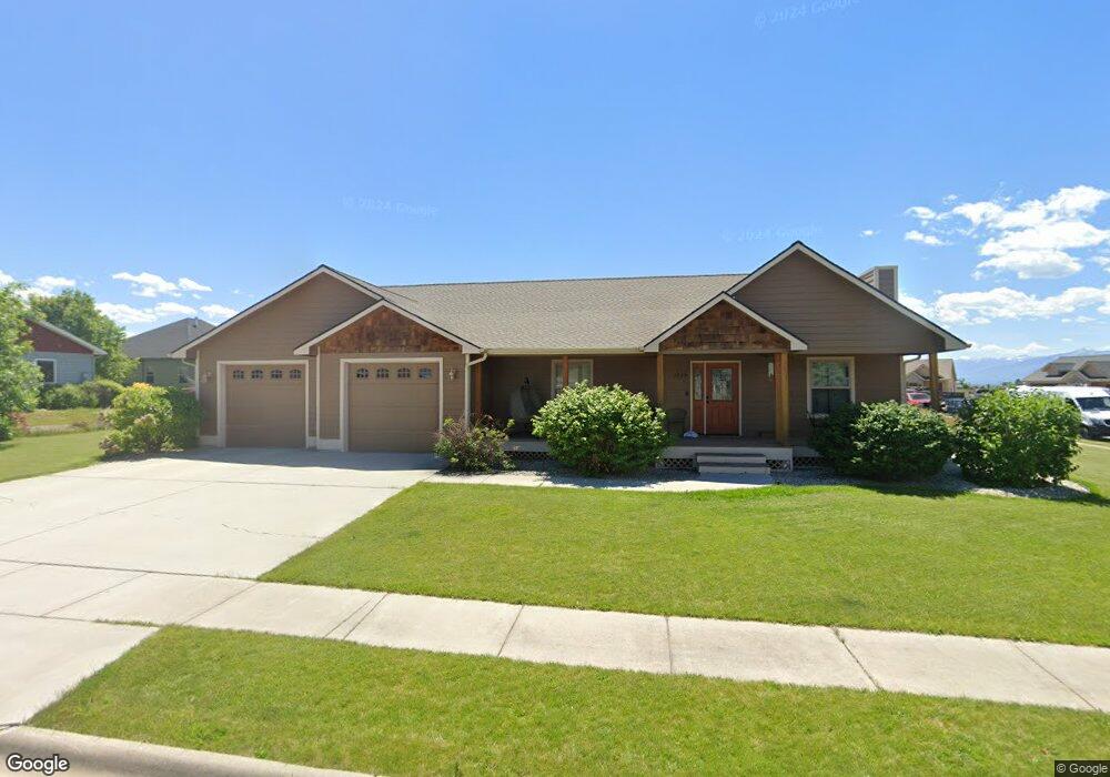
1709 Creekside Dr Stevensville, MT 59870
Stevensville NeighborhoodEstimated Value: $601,851 - $670,000
4
Beds
2
Baths
2,038
Sq Ft
$308/Sq Ft
Est. Value
About This Home
This home is located at 1709 Creekside Dr, Stevensville, MT 59870 and is currently estimated at $628,463, approximately $308 per square foot. 1709 Creekside Dr is a home located in Ravalli County with nearby schools including Stevensville Elementary School, Stevensville Junior High School, and Stevensville High School.
Ownership History
Date
Name
Owned For
Owner Type
Purchase Details
Closed on
Jun 20, 2016
Sold by
Kultgen Merrl K and Kultgen Lyla R
Bought by
Charbonneau Gabriel D
Current Estimated Value
Home Financials for this Owner
Home Financials are based on the most recent Mortgage that was taken out on this home.
Original Mortgage
$251,750
Outstanding Balance
$194,842
Interest Rate
2.75%
Mortgage Type
New Conventional
Estimated Equity
$433,621
Purchase Details
Closed on
Dec 23, 2009
Bought by
Kultgen Merrl K and Kultgen Lyla R
Create a Home Valuation Report for This Property
The Home Valuation Report is an in-depth analysis detailing your home's value as well as a comparison with similar homes in the area
Home Values in the Area
Average Home Value in this Area
Purchase History
| Date | Buyer | Sale Price | Title Company |
|---|---|---|---|
| Charbonneau Gabriel D | $314,687 | First American Title | |
| Kultgen Merrl K | -- | -- |
Source: Public Records
Mortgage History
| Date | Status | Borrower | Loan Amount |
|---|---|---|---|
| Open | Charbonneau Gabriel D | $251,750 |
Source: Public Records
Tax History Compared to Growth
Tax History
| Year | Tax Paid | Tax Assessment Tax Assessment Total Assessment is a certain percentage of the fair market value that is determined by local assessors to be the total taxable value of land and additions on the property. | Land | Improvement |
|---|---|---|---|---|
| 2025 | $2,322 | $587,600 | $0 | $0 |
| 2024 | $3,020 | $496,400 | $0 | $0 |
| 2023 | $3,121 | $496,400 | $0 | $0 |
| 2022 | $2,545 | $331,300 | $0 | $0 |
| 2021 | $2,764 | $331,300 | $0 | $0 |
| 2020 | $2,639 | $296,900 | $0 | $0 |
| 2019 | $2,578 | $296,900 | $0 | $0 |
| 2018 | $2,164 | $258,200 | $0 | $0 |
| 2017 | $2,126 | $258,200 | $0 | $0 |
| 2016 | $1,938 | $234,700 | $0 | $0 |
| 2015 | $1,946 | $234,700 | $0 | $0 |
| 2014 | $2,130 | $149,364 | $0 | $0 |
Source: Public Records
Map
Nearby Homes
- 302 Syringa St
- 3602 Blacksmith Ln
- 211 Middle Burnt Fork Rd
- 301 Park Ave
- 413 5th St
- 623 Park St Unit 3
- 404 Pine St
- 194 Kadex Place
- Lot 5 Bessie Ln
- 586 Cash Nichols Rd
- 308 8th St
- 1100 College St
- 3808 Eastside Hwy
- 3806 Eastside Hwy
- 211 Buck St
- NHN Mystic River Rd
- 650 Hollibaugh Rd
- 101 Binks Way Unit 6
- 252 Barbara St
- 262 Barbara St
- 304 Sassafras Ct
- 301 Syringa St
- 1700 Creekside Dr
- Lot 36 Clover Ln
- Lot 33 Clover Ln
- 1617 Creekside Dr
- 1708 Creekside Dr
- 1618 Creekside Dr
- 303 Sassafras Ct
- 303 Syringa St
- 1718 Creekside Dr
- 307 Sassafras Ct
- 1610 Creekside Dr
- Lot 35 Clover Ln
- 311 Sassafras Ct
- 1609 Creekside Dr
- 300 Syringa St
- 1802 Creekside Dr
- Lot 31 Clover Ln
- Lot 32 Clover Ln