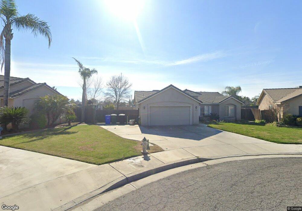
1709 W Pamela Ct Unit 12 Porterville, CA 93257
Porterville Northwest NeighborhoodEstimated Value: $358,162 - $379,000
3
Beds
2
Baths
1,580
Sq Ft
$233/Sq Ft
Est. Value
About This Home
This home is located at 1709 W Pamela Ct Unit 12, Porterville, CA 93257 and is currently estimated at $368,041, approximately $232 per square foot. 1709 W Pamela Ct Unit 12 is a home located in Tulare County with nearby schools including Oak Grove Elementary School, Burton Middle School, and Monache High School.
Ownership History
Date
Name
Owned For
Owner Type
Purchase Details
Closed on
Feb 7, 2005
Sold by
Smee Builders Inc
Bought by
Sandoval Lisandro D
Current Estimated Value
Home Financials for this Owner
Home Financials are based on the most recent Mortgage that was taken out on this home.
Original Mortgage
$159,353
Outstanding Balance
$81,210
Interest Rate
5.79%
Mortgage Type
Purchase Money Mortgage
Estimated Equity
$286,831
Create a Home Valuation Report for This Property
The Home Valuation Report is an in-depth analysis detailing your home's value as well as a comparison with similar homes in the area
Home Values in the Area
Average Home Value in this Area
Purchase History
| Date | Buyer | Sale Price | Title Company |
|---|---|---|---|
| Sandoval Lisandro D | $168,000 | Stewart Title Of California | |
| Smee Builders Inc | -- | Stewart Title Of California |
Source: Public Records
Mortgage History
| Date | Status | Borrower | Loan Amount |
|---|---|---|---|
| Open | Sandoval Lisandro D | $159,353 |
Source: Public Records
Tax History Compared to Growth
Tax History
| Year | Tax Paid | Tax Assessment Tax Assessment Total Assessment is a certain percentage of the fair market value that is determined by local assessors to be the total taxable value of land and additions on the property. | Land | Improvement |
|---|---|---|---|---|
| 2025 | $2,502 | $233,481 | $62,725 | $170,756 |
| 2024 | $2,502 | $228,904 | $61,496 | $167,408 |
| 2023 | $2,500 | $224,417 | $60,291 | $164,126 |
| 2022 | $2,424 | $220,017 | $59,109 | $160,908 |
| 2021 | $2,395 | $215,703 | $57,950 | $157,753 |
| 2020 | $2,310 | $208,000 | $52,000 | $156,000 |
| 2019 | $2,028 | $183,000 | $46,000 | $137,000 |
| 2018 | $2,009 | $181,000 | $45,000 | $136,000 |
| 2017 | $1,823 | $165,000 | $41,000 | $124,000 |
| 2016 | $1,728 | $159,000 | $40,000 | $119,000 |
| 2015 | $1,357 | $141,000 | $35,000 | $106,000 |
| 2014 | $1,357 | $125,000 | $31,000 | $94,000 |
Source: Public Records
Map
Nearby Homes
- 0 Pioneer Ave Unit 233651
- 1842 Santa Maria Ave
- 1320 N Greenfield St
- 1555 Verdugo Place
- 1926 W Nancy Ave
- 1450 W Brian Ln
- 1857 W Westfield Ave
- 1681 W Wall Ln
- 1370 Lindale Place
- 1121 N Lindale Way
- 1245 Atkins St
- 1041 Greenfield Dr
- 1692 N Beverly St
- 1761 N Wilson Place
- 1750 W Terry Cir
- 1362 W North Grand Ave
- 1076 N Beverly St
- Lot 30 2184 W Pioneer Ave
- 1370 Camelot St
- 2206 W Glenn Ct
- 1709 W Pamela Ct
- 1704 W Pamela Ct Unit 13
- 1704 W Pamela Ct
- 1719 W Pamela Ct Unit 11
- 1719 W Pamela Ct
- 1729 W Pamela Ct Unit 10
- 1714 W Pamela Ct Unit 14
- 1714 W Pamela Ct
- 1724 W Pamela Ct Unit 15
- 1724 W Pamela Ct
- 0 Pioneer Ave Unit 56973
- 0 Pioneer Ave Unit 123858
- 0 Pioneer Ave Unit 128075
- 0 Pioneer Ave Unit 219730
- 1739 W Pamela Ct Unit 9
- 1739 W Pamela Ct
- 1734 W Pamela Ct Unit 16
- 1734 W Pamela Ct
- 1744 W Pamela Ct
- 1718 Pioneer Ave