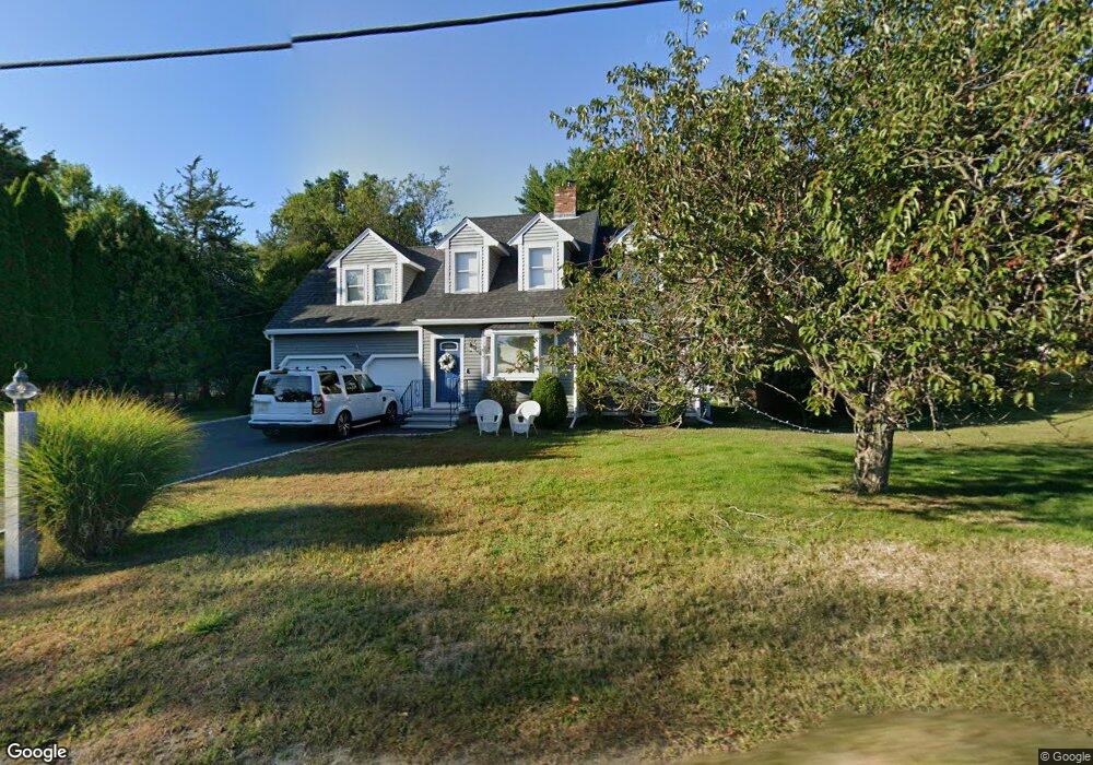
170R Atlantic St Gloucester, MA 01930
West Gloucester NeighborhoodEstimated Value: $986,000 - $1,479,000
3
Beds
3
Baths
2,900
Sq Ft
$435/Sq Ft
Est. Value
About This Home
This home is located at 170R Atlantic St, Gloucester, MA 01930 and is currently estimated at $1,261,944, approximately $435 per square foot. 170R Atlantic St is a home located in Essex County with nearby schools including West Parish, Ralph B O'maley Middle School, and Gloucester High School.
Ownership History
Date
Name
Owned For
Owner Type
Purchase Details
Closed on
Jul 26, 2019
Sold by
Alessio Bruce A and Alessio Phyllis A
Bought by
Alessio Bruce A and Alessio Phyllis A
Current Estimated Value
Purchase Details
Closed on
Oct 22, 2015
Sold by
Cole Donald P and Cole Mary
Bought by
Allesio Bruce A and Fermon Phyllis A
Purchase Details
Closed on
May 4, 2006
Sold by
Rossi Louise and Rossi William A
Bought by
Cole Donald P and Cole Mary
Home Financials for this Owner
Home Financials are based on the most recent Mortgage that was taken out on this home.
Original Mortgage
$150,100
Interest Rate
6.34%
Mortgage Type
Purchase Money Mortgage
Create a Home Valuation Report for This Property
The Home Valuation Report is an in-depth analysis detailing your home's value as well as a comparison with similar homes in the area
Home Values in the Area
Average Home Value in this Area
Purchase History
| Date | Buyer | Sale Price | Title Company |
|---|---|---|---|
| Alessio Bruce A | -- | -- | |
| Allesio Bruce A | $605,000 | -- | |
| Cole Donald P | $720,000 | -- |
Source: Public Records
Mortgage History
| Date | Status | Borrower | Loan Amount |
|---|---|---|---|
| Previous Owner | Cole Donald P | $200,000 | |
| Previous Owner | Cole Donald P | $100,000 | |
| Previous Owner | Cole Donald P | $150,100 |
Source: Public Records
Tax History
| Year | Tax Paid | Tax Assessment Tax Assessment Total Assessment is a certain percentage of the fair market value that is determined by local assessors to be the total taxable value of land and additions on the property. | Land | Improvement |
|---|---|---|---|---|
| 2025 | $9,711 | $999,100 | $267,300 | $731,800 |
| 2024 | $8,972 | $922,100 | $254,500 | $667,600 |
| 2023 | $8,407 | $793,900 | $227,300 | $566,600 |
| 2022 | $8,069 | $687,900 | $193,200 | $494,700 |
| 2021 | $7,792 | $626,400 | $175,700 | $450,700 |
| 2020 | $7,846 | $636,300 | $175,700 | $460,600 |
| 2019 | $8,212 | $647,100 | $175,700 | $471,400 |
| 2018 | $7,727 | $597,600 | $175,700 | $421,900 |
| 2017 | $7,772 | $589,200 | $167,300 | $421,900 |
| 2016 | $8,065 | $592,600 | $167,700 | $424,900 |
| 2015 | $7,083 | $518,900 | $167,700 | $351,200 |
Source: Public Records
Map
Nearby Homes
- 178 Atlantic St
- 167 Atlantic St
- 226 Atlantic St
- 2 Breezy Point Rd
- 13 Honeysuckle Rd
- 672 Washington St
- 3 Deacon Farm Ln
- 31 Echo Ave
- 5 Samoset Rd Unit B
- 7 Leaman Dr
- 7 Colburn St
- 145 Essex Ave Unit 402
- 24 Cobblestone Ln Unit 603
- 13 Mystic Ave
- 5 Lepage Ln
- 6 Monroe Ct
- 8 Mystic Ave
- 368 Essex Ave
- 98 Maplewood Ave
- 15 Harvard St
- 170 Atlantic St
- 170 Atlantic St Unit R
- 172 Atlantic St
- 168 Atlantic St
- 7 Atlantic Ave
- 9 Atlantic Ave
- 9 Atlantic Ave Unit 2
- 166 Atlantic St
- 172R Atlantic St
- 176 Atlantic St
- 11 Atlantic Ave
- 13 Atlantic Ave
- 164 Atlantic St
- 180 Atlantic St
- 182 Atlantic St
- 1 Brookfield Dr
- 184 Atlantic St
- 186 Atlantic St
- 3 Brookfield Dr
- 0 Castleview Road Lot 8 Unit 70742669
Your Personal Tour Guide
Ask me questions while you tour the home.