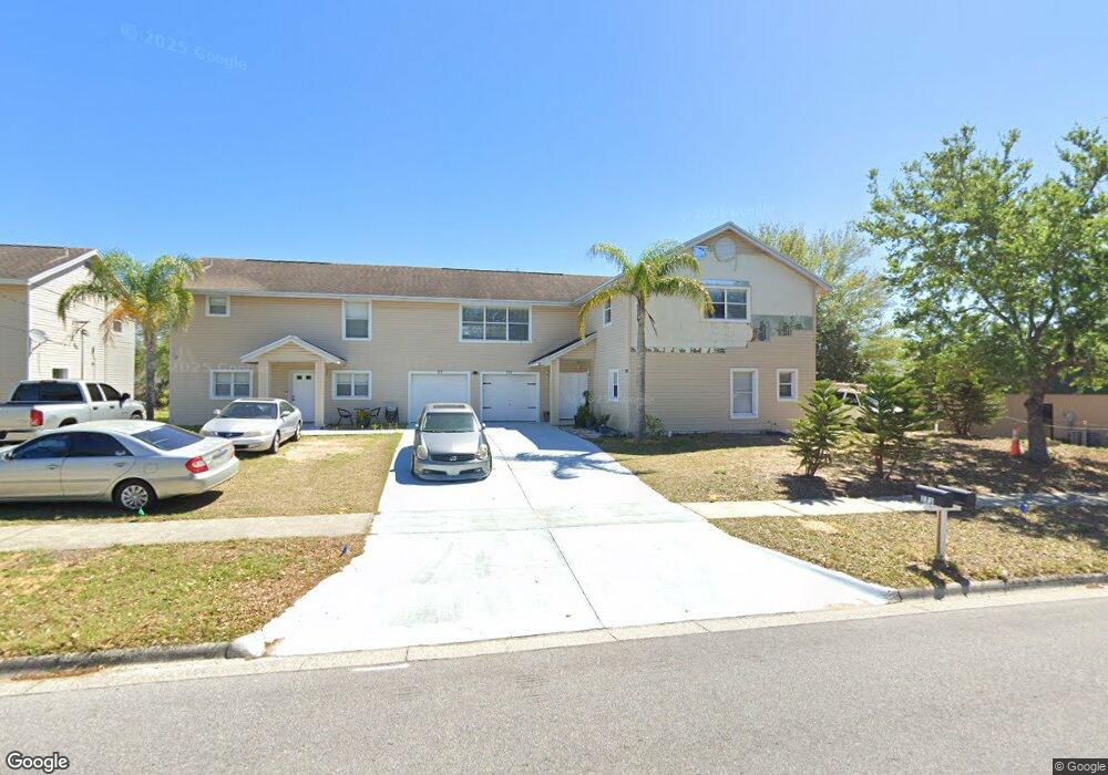
171 Bloxam Ave Clermont, FL 34711
Estimated Value: $218,000 - $588,000
2
Beds
3
Baths
4,782
Sq Ft
$83/Sq Ft
Est. Value
About This Home
This home is located at 171 Bloxam Ave, Clermont, FL 34711 and is currently estimated at $396,125, approximately $82 per square foot. 171 Bloxam Ave is a home located in Lake County with nearby schools including Aurelia Cole Academy, South Lake High School, and Better Life K4c Christian Academy.
Ownership History
Date
Name
Owned For
Owner Type
Purchase Details
Closed on
Mar 23, 2023
Sold by
Paul Suruj and Paul Umwattie
Bought by
Suruj Paul And Umwattie Lackpaul Inter Vivos
Current Estimated Value
Purchase Details
Closed on
Oct 28, 2022
Sold by
Ramsarup Hamechand and Ramsarup Ruby
Bought by
Paul Suruj and Lackpaul Umwattie
Home Financials for this Owner
Home Financials are based on the most recent Mortgage that was taken out on this home.
Original Mortgage
$375,000
Interest Rate
6.02%
Mortgage Type
Seller Take Back
Create a Home Valuation Report for This Property
The Home Valuation Report is an in-depth analysis detailing your home's value as well as a comparison with similar homes in the area
Purchase History
| Date | Buyer | Sale Price | Title Company |
|---|---|---|---|
| Suruj Paul And Umwattie Lackpaul Inter Vivos | $100 | -- | |
| Paul Suruj | $445,000 | -- |
Source: Public Records
Mortgage History
| Date | Status | Borrower | Loan Amount |
|---|---|---|---|
| Previous Owner | Paul Suruj | $375,000 |
Source: Public Records
Tax History
| Year | Tax Paid | Tax Assessment Tax Assessment Total Assessment is a certain percentage of the fair market value that is determined by local assessors to be the total taxable value of land and additions on the property. | Land | Improvement |
|---|---|---|---|---|
| 2026 | $3,476 | $244,690 | $33,075 | $211,615 |
| 2025 | $4,118 | $244,690 | $33,075 | $211,615 |
| 2024 | $4,118 | $244,690 | $33,075 | $211,615 |
| 2023 | $4,118 | $237,617 | $33,075 | $204,542 |
| 2022 | $4,017 | $237,617 | $33,075 | $204,542 |
| 2021 | $3,498 | $206,390 | $0 | $0 |
| 2020 | $3,524 | $206,390 | $0 | $0 |
| 2019 | $3,699 | $206,390 | $0 | $0 |
| 2018 | $3,646 | $206,390 | $0 | $0 |
| 2017 | $3,610 | $203,289 | $0 | $0 |
| 2016 | $3,678 | $203,289 | $0 | $0 |
| 2015 | $3,596 | $192,795 | $0 | $0 |
| 2014 | $3,469 | $189,390 | $0 | $0 |
Source: Public Records
Map
Nearby Homes
- 654 Harbor Villa Ct
- 682 Lexington Dr
- 629 Harbor Villa Ct
- 0 Roys Rd Unit MFRO6235691
- 697 Winding Lake Dr
- 333 Nautica Mile Dr
- 152 Riggings Way
- 747/749 Pitt St
- 408 Raymond St
- 107 Summerhill Ct
- 241 Nautica Mile Dr
- 240 Division St
- 211 Willow Bend Dr
- 747 Roane Rd
- 161 Nautica Mile Dr
- 550 Disston Ave
- 0 E Minneola Ave
- 508 S Bloxam Ave
- 660 Shady Nook Dr
- 809 Disston Ave
Your Personal Tour Guide
Ask me questions while you tour the home.