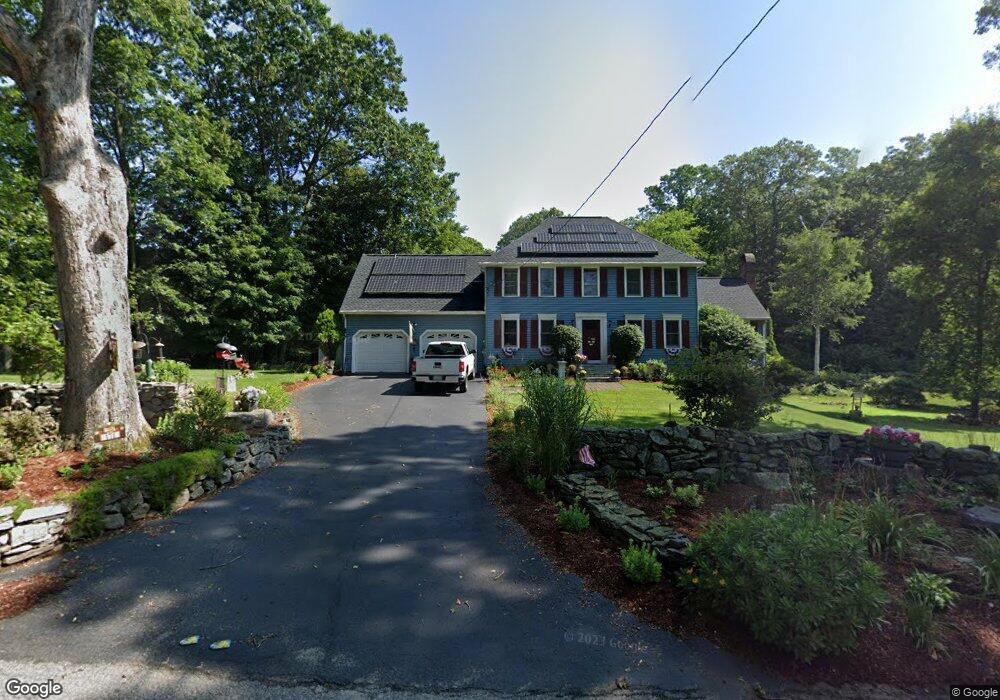
171 Hartness Rd Sutton, MA 01590
Estimated Value: $651,623 - $803,000
3
Beds
3
Baths
2,230
Sq Ft
$333/Sq Ft
Est. Value
About This Home
This home is located at 171 Hartness Rd, Sutton, MA 01590 and is currently estimated at $742,656, approximately $333 per square foot. 171 Hartness Rd is a home located in Worcester County with nearby schools including Sutton Elementary School, Sutton Middle School, and Sutton High School.
Ownership History
Date
Name
Owned For
Owner Type
Purchase Details
Closed on
Nov 28, 1994
Sold by
Bldg Joe Kelleys
Bought by
Tronerud Jason and Tronerud Teresa
Current Estimated Value
Home Financials for this Owner
Home Financials are based on the most recent Mortgage that was taken out on this home.
Original Mortgage
$153,000
Interest Rate
8.91%
Mortgage Type
Purchase Money Mortgage
Purchase Details
Closed on
Sep 9, 1994
Sold by
Omara Marie J
Bought by
Joe Kelleys Bldg & Pai
Home Financials for this Owner
Home Financials are based on the most recent Mortgage that was taken out on this home.
Original Mortgage
$127,500
Interest Rate
8.54%
Mortgage Type
Purchase Money Mortgage
Create a Home Valuation Report for This Property
The Home Valuation Report is an in-depth analysis detailing your home's value as well as a comparison with similar homes in the area
Home Values in the Area
Average Home Value in this Area
Purchase History
| Date | Buyer | Sale Price | Title Company |
|---|---|---|---|
| Tronerud Jason | $170,000 | -- | |
| Joe Kelleys Bldg & Pai | $45,000 | -- |
Source: Public Records
Mortgage History
| Date | Status | Borrower | Loan Amount |
|---|---|---|---|
| Open | Joe Kelleys Bldg & Pai | $293,470 | |
| Closed | Joe Kelleys Bldg & Pai | $189,000 | |
| Closed | Joe Kelleys Bldg & Pai | $153,000 | |
| Previous Owner | Joe Kelleys Bldg & Pai | $127,500 |
Source: Public Records
Tax History
| Year | Tax Paid | Tax Assessment Tax Assessment Total Assessment is a certain percentage of the fair market value that is determined by local assessors to be the total taxable value of land and additions on the property. | Land | Improvement |
|---|---|---|---|---|
| 2025 | $7,718 | $619,400 | $180,600 | $438,800 |
| 2024 | $7,391 | $573,400 | $155,800 | $417,600 |
| 2023 | $6,877 | $488,400 | $136,700 | $351,700 |
| 2022 | $7,100 | $457,500 | $138,100 | $319,400 |
| 2021 | $6,950 | $425,600 | $138,100 | $287,500 |
| 2020 | $6,750 | $425,600 | $138,100 | $287,500 |
| 2019 | $6,583 | $398,500 | $138,100 | $260,400 |
| 2018 | $6,332 | $382,600 | $138,100 | $244,500 |
| 2017 | $6,143 | $372,300 | $121,400 | $250,900 |
| 2016 | $6,052 | $362,800 | $121,400 | $241,400 |
| 2015 | $5,840 | $350,100 | $121,400 | $228,700 |
| 2014 | $5,687 | $336,900 | $127,600 | $209,300 |
Source: Public Records
Map
Nearby Homes
- 191 Hartness Rd
- 90 Leland Hill Rd
- 5 Wildflower Dr
- 53 Fisherville Terrace
- 55 Fisherville Terrace
- 44 Fisherville Terrace
- 58 Fisherville Terrace
- 64 Fisherville Terrace
- 62 Fisherville Terrace
- 7 Central Turnpike
- 82 Central Turnpike
- 20 Millers Way Unit C
- 220 Alana Dr
- 175 Armsby Rd
- 51 Lincoln Rd
- 86 Mikes Way Unit 86
- 56 Luka Dr Unit 56
- 229 Worcester-Providence Turnpike
- 150 Ariel Cir
- 20 Wunschel Dr
- 165 Hartness Rd
- 164 Hartness Rd
- 170 Hartness Rd
- 161 Hartness Rd
- 180 Hartness Rd
- 20 Brookside Dr
- 157 Hartness Rd
- 158 Hartness Rd
- 181 Hartness Rd
- 18 Brookside Dr
- 17 Hunters Ct
- 19 Hunters Ct
- 184 Hartness Rd
- 59 Partridge Hill Rd Unit 59
- 59 Partridge Hill Rd
- 15 Hunters Ct Unit Lot 24
- 16 Brookside Dr
- 61 Partridge Hill Rd
- 19 Brookside Dr
- 154 Hartness Rd
Your Personal Tour Guide
Ask me questions while you tour the home.