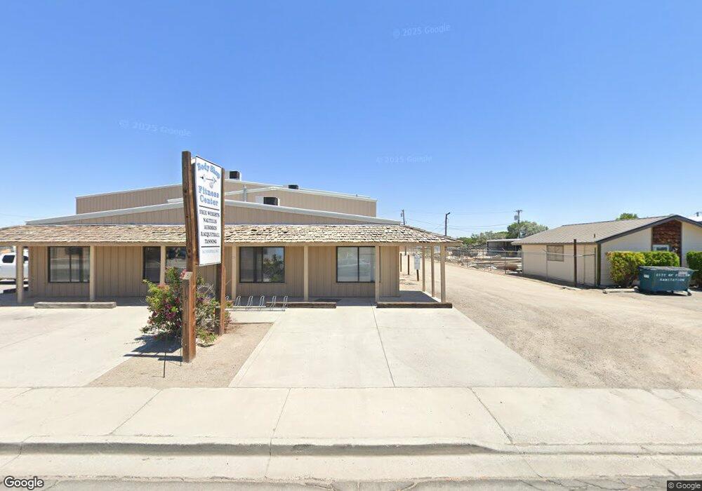
171 Industrial Way Fallon, NV 89406
Studio
--
Bath
7,290
Sq Ft
37,462
Sq Ft
About This Home
This home is located at 171 Industrial Way, Fallon, NV 89406. 171 Industrial Way is a home located in Churchill County with nearby schools including Lahontan Elementary School, E.C. Best Elementary School, and Numa Elementary School.
Ownership History
Date
Name
Owned For
Owner Type
Purchase Details
Closed on
Sep 1, 2010
Sold by
Fowler Virginia Marie and Fowler Guy Allen
Bought by
Steven E Louie Llc
Home Financials for this Owner
Home Financials are based on the most recent Mortgage that was taken out on this home.
Original Mortgage
$202,281
Outstanding Balance
$134,046
Interest Rate
4.51%
Mortgage Type
Commercial
Create a Home Valuation Report for This Property
The Home Valuation Report is an in-depth analysis detailing your home's value as well as a comparison with similar homes in the area
Home Values in the Area
Average Home Value in this Area
Purchase History
| Date | Buyer | Sale Price | Title Company |
|---|---|---|---|
| Steven E Louie Llc | $325,000 | Western Nevada Title Co |
Source: Public Records
Mortgage History
| Date | Status | Borrower | Loan Amount |
|---|---|---|---|
| Open | Steven E Louie Llc | $202,281 |
Source: Public Records
Tax History
| Year | Tax Paid | Tax Assessment Tax Assessment Total Assessment is a certain percentage of the fair market value that is determined by local assessors to be the total taxable value of land and additions on the property. | Land | Improvement |
|---|---|---|---|---|
| 2025 | $5,584 | $143,187 | $13,750 | $129,437 |
| 2024 | $5,584 | $152,883 | $13,750 | $139,133 |
| 2023 | $5,584 | $142,678 | $13,750 | $128,928 |
| 2022 | $4,786 | $118,486 | $10,588 | $107,898 |
| 2021 | $4,920 | $119,841 | $10,588 | $109,253 |
| 2020 | $4,759 | $139,741 | $10,588 | $112,483 |
| 2019 | $4,595 | $139,958 | $10,588 | $129,370 |
| 2018 | $4,387 | $117,307 | $10,588 | $106,719 |
| 2017 | $4,207 | $119,106 | $10,588 | $108,518 |
| 2016 | $4,099 | $106,729 | $10,588 | $96,141 |
| 2015 | $3,911 | $105,705 | $10,588 | $95,117 |
| 2014 | $3,874 | $115,869 | $10,588 | $105,281 |
Source: Public Records
Map
Nearby Homes
- 1044 Allen Rd
- 981 Mckay Ct
- 1410 Cedar Dr
- 2320 Smart Ln
- 475 S Bailey St
- APN 007-091-73 Casey Rd
- APN 007-091-70 Casey Rd
- APN 007-091-75 Casey Rd
- APN 007-091-74 Casey Rd
- APN 007-091-72 Casey Rd
- APN 007-091-71 Casey Rd
- 5011 Reno Hwy
- 250 S Taylor St
- 1009 Deena Way
- 1755 Coleman Rd
- 360 & 360 1/2 W Virginia St
- 2217 Verona Dr
- 1141 Alder Dr
- 126 S Laverne St
- 530 Michael Dr
- 161 Industrial Way
- 161 Industrial Way
- 141 Industrial Way
- 141 Industrial Way Unit 7
- 170 Industrial Way
- 160 Industrial Way
- 150 Industrial Way
- 130 $ 140 Industrial Way
- 180 Industrial Way
- 1659 Kaiser St
- 301 Burntwood St
- 190 Industrial Way
- 1803 Grimes St Unit 3
- 1655 Kaiser St
- 1661 Kaiser St Unit 1
- 1661 Kaiser St
- 1661 Kaiser St Unit St.
- 1857 Grimes St
- 1653 Kaiser St Unit 1
- 1653 Kaiser St
Your Personal Tour Guide
Ask me questions while you tour the home.