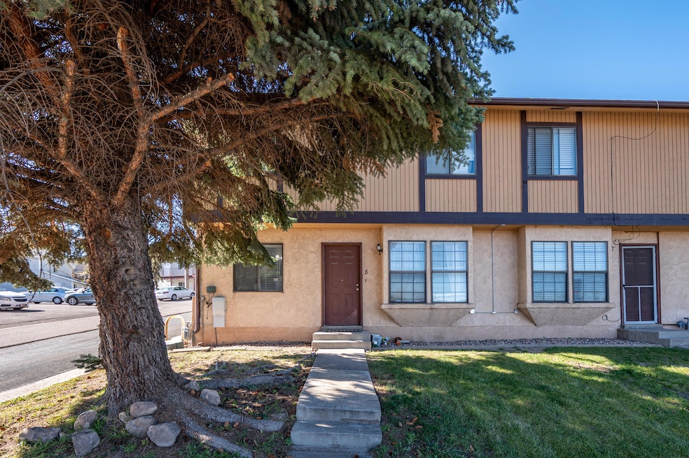
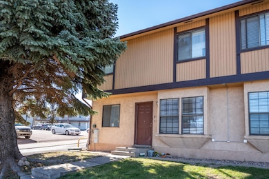
171 N College Way Unit 8 Cedar City, UT 84720
Estimated payment $1,332/month
Highlights
- 1 Car Attached Garage
- Patio
- Forced Air Heating System
- Evaporated cooling system
- Landscaped
About This Home
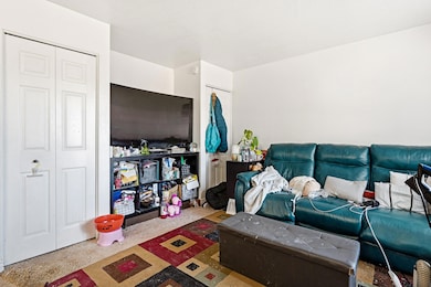
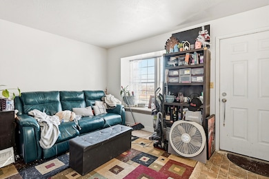
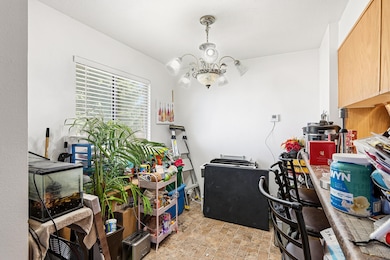
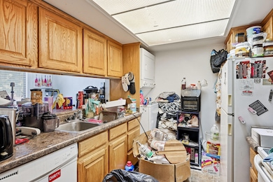
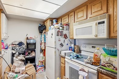
Wonderful 2 bedroom, 1 1/2 bathroom townhome. This unit features front door entrance into the main level where you will find the living room, dining room and kitchen, there is also a stackable washer/dryer in the kitchen. A short flight of stairs leads you to a room that could be used as an office or other, this room also has a door to the 1 car garage and a back door to a patio area. Also, on this level is a half bathroom. Another short flight of stairs leads you to the 2 bedrooms & full bathroom. Fantastic location near SUU. Great property with with a very attractive price. Includes all appliances, unit features a swamp cooler. Tenant occupied, 24 hour notice required. Tenant is on month to month tenancy.
Listing Agent
Century 21 1st Choice Realty License #5487663-PB00 Listed on: 11/03/2025

Townhouse Details
Home Type
- Townhome
Est. Annual Taxes
- $733
Year Built
- Built in 1984
Lot Details
- 1,307 Sq Ft Lot
- Landscaped
- Sprinkler System
HOA Fees
- $190 Monthly HOA Fees
Parking
- 1 Car Attached Garage
Home Design
- Frame Construction
- Asphalt Shingled Roof
- Stucco
Interior Spaces
- 1,038 Sq Ft Home
- 3-Story Property
Kitchen
- Range
- Microwave
- Dishwasher
- Disposal
Bedrooms and Bathrooms
- 2 Bedrooms
Laundry
- Dryer
- Washer
Outdoor Features
- Patio
Utilities
- Evaporated cooling system
- Forced Air Heating System
- Heating System Uses Gas
Community Details
- Association fees include insurance, garbage, lawn care, sewer, snow removal, water
- College Way Townhomes Subdivision
Listing and Financial Details
- Assessor Parcel Number B-1326-0008-0000
Map
Home Values in the Area
Average Home Value in this Area
Tax History
| Year | Tax Paid | Tax Assessment Tax Assessment Total Assessment is a certain percentage of the fair market value that is determined by local assessors to be the total taxable value of land and additions on the property. | Land | Improvement |
|---|---|---|---|---|
| 2025 | $886 | $113,909 | $5,500 | $108,409 |
| 2023 | $716 | $91,990 | $5,500 | $86,490 |
| 2022 | $846 | $91,990 | $5,500 | $86,490 |
| 2021 | $581 | $63,160 | $5,500 | $57,660 |
| 2020 | $614 | $59,265 | $5,500 | $53,765 |
| 2019 | $642 | $59,265 | $5,500 | $53,765 |
| 2018 | $585 | $52,250 | $5,500 | $46,750 |
| 2017 | $520 | $45,650 | $5,500 | $40,150 |
| 2016 | $450 | $36,850 | $5,500 | $31,350 |
| 2015 | $461 | $35,750 | $0 | $0 |
| 2014 | $493 | $35,750 | $0 | $0 |
Property History
| Date | Event | Price | List to Sale | Price per Sq Ft |
|---|---|---|---|---|
| 11/03/2025 11/03/25 | For Sale | $205,000 | -- | $197 / Sq Ft |
Purchase History
| Date | Type | Sale Price | Title Company |
|---|---|---|---|
| Interfamily Deed Transfer | -- | None Available | |
| Interfamily Deed Transfer | -- | None Available | |
| Interfamily Deed Transfer | -- | None Available | |
| Warranty Deed | -- | -- |
Mortgage History
| Date | Status | Loan Amount | Loan Type |
|---|---|---|---|
| Open | $63,200 | New Conventional |
Source: Iron County Board of REALTORS®
MLS Number: 113729
APN: B-1326-0008-0000
- 171 N College Way Unit 7
- 1.75 Acres 200 North Corner Lot Unit Zoned Commercial
- 0.69 Acre Lot W Skyview Dr
- 101 N 1850 W Unit 35
- 53 N Aime Ave
- 1770 W Harding Ave
- 1652 W Harding Ave
- 6333 N 1600 W
- 325 N 1500 W
- 272 N 1500 W
- 2235 W Sunnyside Dr
- 0 1 Af Water (Wr # 73-999) Unit 25-265506
- 147.9141 Acre Ft Water Right 73-1201
- 1931 W 90 S
- 495 N 2150 W
- 2216 W Cedar Hills Dr
- 2377 W Beacon Cir
- 171 N Beacon Hill Dr
- 1225 W Harding Ave Unit 8
- 214 S Columbia Way
- 111 S 1400 W Unit Cinnamon Tree
- 1055 W 400 N
- 209 S 1400 W
- 230 N 700 W
- 589 W 200 N
- 265 S 900 W
- 421 S 1275 W
- 333 N 400 W
- 333 N 400 W
- 2155 W 700 S Unit 4
- 939 Ironwood Dr
- 802 S Interstate Dr
- 780 W 1125 N
- 576 W 1045 N Unit B12
- 703 W 1225 N
- 986 Cedar Knolls W
- 168 E 70 S Unit A
- 1148 Northfield Rd
- 1177 Northfield Rd
- 840 S Main St