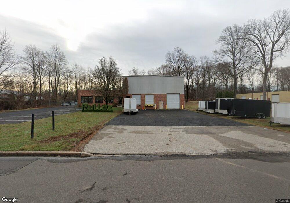
171 Railroad Dr Warminster, PA 18974
Estimated Value: $2,782,847
--
Bed
--
Bath
14,440
Sq Ft
$193/Sq Ft
Est. Value
About This Home
This home is located at 171 Railroad Dr, Warminster, PA 18974 and is currently estimated at $2,782,847, approximately $192 per square foot. 171 Railroad Dr is a home located in Bucks County with nearby schools including Maureen M. Welch Elementary School, Richboro Middle School, and Council Rock High School - South.
Ownership History
Date
Name
Owned For
Owner Type
Purchase Details
Closed on
Jun 1, 2022
Sold by
171 Railroad Drive Llc
Bought by
Rullex Co Llc
Current Estimated Value
Home Financials for this Owner
Home Financials are based on the most recent Mortgage that was taken out on this home.
Original Mortgage
$1,800,000
Outstanding Balance
$1,710,149
Interest Rate
5.1%
Mortgage Type
New Conventional
Estimated Equity
$1,072,698
Purchase Details
Closed on
Oct 2, 2017
Sold by
H F Manufacturing Corp
Bought by
171 Railroad Dr Llc
Home Financials for this Owner
Home Financials are based on the most recent Mortgage that was taken out on this home.
Original Mortgage
$880,000
Interest Rate
3.82%
Mortgage Type
Commercial
Purchase Details
Closed on
Dec 23, 1987
Sold by
Schenk William and Schenk Schenk
Bought by
H & F Mfg Corp
Create a Home Valuation Report for This Property
The Home Valuation Report is an in-depth analysis detailing your home's value as well as a comparison with similar homes in the area
Home Values in the Area
Average Home Value in this Area
Purchase History
| Date | Buyer | Sale Price | Title Company |
|---|---|---|---|
| Rullex Co Llc | $2,400,000 | Camelot Abstract | |
| 171 Railroad Dr Llc | $1,100,000 | None Available | |
| H & F Mfg Corp | $65,000 | -- |
Source: Public Records
Mortgage History
| Date | Status | Borrower | Loan Amount |
|---|---|---|---|
| Open | Rullex Co Llc | $1,800,000 | |
| Previous Owner | 171 Railroad Dr Llc | $880,000 |
Source: Public Records
Tax History Compared to Growth
Tax History
| Year | Tax Paid | Tax Assessment Tax Assessment Total Assessment is a certain percentage of the fair market value that is determined by local assessors to be the total taxable value of land and additions on the property. | Land | Improvement |
|---|---|---|---|---|
| 2025 | $18,621 | $96,680 | $24,000 | $72,680 |
| 2024 | $18,621 | $96,680 | $24,000 | $72,680 |
| 2023 | $17,550 | $96,680 | $24,000 | $72,680 |
| 2022 | $17,390 | $96,680 | $24,000 | $72,680 |
| 2021 | $16,839 | $96,680 | $24,000 | $72,680 |
| 2020 | $16,461 | $96,680 | $24,000 | $72,680 |
| 2019 | $15,756 | $96,680 | $24,000 | $72,680 |
| 2018 | $15,476 | $96,680 | $24,000 | $72,680 |
| 2017 | $14,879 | $96,680 | $24,000 | $72,680 |
| 2016 | $14,879 | $96,680 | $24,000 | $72,680 |
| 2015 | -- | $96,680 | $24,000 | $72,680 |
| 2014 | -- | $96,680 | $24,000 | $72,680 |
Source: Public Records
Map
Nearby Homes
- 9 Spring Mill Dr
- 11 Spring Mill Dr
- 902 Hamilton Way
- 10 Spring Mill Dr
- 8 Lacey Ln
- 21 Spring Mill Dr Unit 12
- 115 Grandview Dr
- 18 Lacey Ln
- 921 Nathaniel Trail
- The Addis Plan at The Reserve at Spring Mill
- The Beckett Plan at The Reserve at Spring Mill
- 55 Parry Way
- 59 Parry Way
- 56 Parry Way
- 934 Nathaniel Trail
- 1000 Old Jacksonville Rd
- 950 Nathaniel Trail
- 451 Twin Streams Dr
- 1306 Gabriel Ln
- 1008 Julian Dr W Unit W