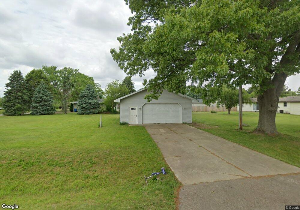
171 Single Tree Ln Battle Creek, MI 49014
Estimated Value: $85,000 - $189,000
2
Beds
1
Bath
--
Sq Ft
0.32
Acres
About This Home
This home is located at 171 Single Tree Ln, Battle Creek, MI 49014 and is currently estimated at $127,967. 171 Single Tree Ln is a home located in Calhoun County with nearby schools including Harper Creek Middle School, Harper Creek High School, and Family Altar Christian School.
Ownership History
Date
Name
Owned For
Owner Type
Purchase Details
Closed on
Jan 8, 2018
Sold by
Brandt Troy W
Bought by
Parker Thoams E and Parker Linda L
Current Estimated Value
Purchase Details
Closed on
May 31, 2016
Sold by
Maichele Kyle D and Maichele Patience
Bought by
Brandt Troy W
Home Financials for this Owner
Home Financials are based on the most recent Mortgage that was taken out on this home.
Original Mortgage
$22,400
Interest Rate
3.66%
Mortgage Type
New Conventional
Purchase Details
Closed on
Jul 18, 2006
Sold by
Martin Kim M and Martin Pamela K
Bought by
Maichele Kyle D
Purchase Details
Closed on
Jun 6, 2001
Sold by
Wolf Michael D
Bought by
Martin Kim M and Martin Pamela K
Purchase Details
Closed on
Apr 2, 1998
Sold by
Walker Gary and Walker Paulette
Bought by
Wolf Michael D
Create a Home Valuation Report for This Property
The Home Valuation Report is an in-depth analysis detailing your home's value as well as a comparison with similar homes in the area
Home Values in the Area
Average Home Value in this Area
Purchase History
| Date | Buyer | Sale Price | Title Company |
|---|---|---|---|
| Parker Thoams E | $32,000 | Chicago Title Of Michigan In | |
| Brandt Troy W | $32,000 | Chicago Title | |
| Maichele Kyle D | $36,500 | Otc | |
| Martin Kim M | $33,000 | -- | |
| Wolf Michael D | $31,000 | -- |
Source: Public Records
Mortgage History
| Date | Status | Borrower | Loan Amount |
|---|---|---|---|
| Previous Owner | Brandt Troy W | $22,400 |
Source: Public Records
Tax History Compared to Growth
Tax History
| Year | Tax Paid | Tax Assessment Tax Assessment Total Assessment is a certain percentage of the fair market value that is determined by local assessors to be the total taxable value of land and additions on the property. | Land | Improvement |
|---|---|---|---|---|
| 2025 | $1,014 | $23,040 | $0 | $0 |
| 2024 | $729 | $21,510 | $0 | $0 |
| 2023 | $910 | $22,150 | $0 | $0 |
| 2022 | $661 | $15,820 | $0 | $0 |
| 2021 | $928 | $16,850 | $0 | $0 |
| 2020 | $940 | $16,500 | $0 | $0 |
| 2019 | $1,310 | $15,650 | $0 | $0 |
| 2018 | $788 | $14,200 | $5,950 | $8,250 |
| 2017 | $788 | $14,100 | $0 | $0 |
| 2016 | $788 | $14,400 | $0 | $0 |
| 2015 | $654 | $13,650 | $5,240 | $8,410 |
| 2014 | $654 | $15,350 | $5,240 | $10,110 |
Source: Public Records
Map
Nearby Homes
- 8270 Robins Ln Unit 3
- 8069 Allison Ln
- 13815 9 Mile Rd
- 8005 Division Dr
- 12460 Beadle Lake Rd
- 1055 Woodland Beach
- 1375 Woodland Beach
- 1355 Middle Ln
- 13028 Harper Crossing
- 2851 Kistler Rd
- VL Beadle Lake Rd
- V/L Beadle Lake Rd
- 167 Kistler Rd
- 159 Beadle Lake Dr
- 6660 B Dr N
- 323 Wattles Rd S
- 12236 6 1 2 Mile Rd
- 13233 6 1 2 Mile Rd
- 8729 D Dr S
- 207 Embury Dr
- 171 Singletree Ln
- 143 Singletree Ln
- 175 Singletree Ln
- 191 Singletree Ln
- 166 Singletree Ln
- 148 Singletree Ln
- 135 Singletree Ln
- 172 Singletree Ln
- 154 Singletree Ln
- 160 Singletree Ln
- 184 Singletree Ln
- 207 Singletree Ln
- 178 Singletree Ln
- 136 Singletree Ln
- 129 Singletree Ln
- 196 Singletree Ln
- 202 Singletree Ln
- 126 Singletree Ln
- 0 Singletree Ln
- 121 Singletree Ln