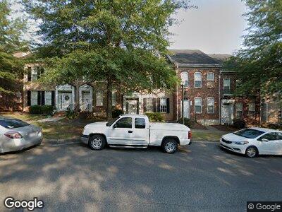
171 Singleton Rd Mooresville, NC 28117
Lake Norman NeighborhoodEstimated Value: $369,000 - $373,971
3
Beds
3
Baths
1,386
Sq Ft
$268/Sq Ft
Est. Value
About This Home
This home is located at 171 Singleton Rd, Mooresville, NC 28117 and is currently estimated at $371,993, approximately $268 per square foot. 171 Singleton Rd is a home located in Iredell County with nearby schools including Lake Norman Elementary School, Lake Norman High School, and Langtree Charter Academy.
Ownership History
Date
Name
Owned For
Owner Type
Purchase Details
Closed on
May 5, 2008
Sold by
Green Darryl O
Bought by
Simons Timothy and Simons Jane M
Current Estimated Value
Home Financials for this Owner
Home Financials are based on the most recent Mortgage that was taken out on this home.
Original Mortgage
$154,036
Interest Rate
5.84%
Mortgage Type
Purchase Money Mortgage
Create a Home Valuation Report for This Property
The Home Valuation Report is an in-depth analysis detailing your home's value as well as a comparison with similar homes in the area
Home Values in the Area
Average Home Value in this Area
Purchase History
| Date | Buyer | Sale Price | Title Company |
|---|---|---|---|
| Simons Timothy | $193,000 | None Available |
Source: Public Records
Mortgage History
| Date | Status | Borrower | Loan Amount |
|---|---|---|---|
| Open | Simons Timothy | $130,000 | |
| Closed | Simons Timothy R | $150,000 | |
| Closed | Simons Timothy | $154,036 |
Source: Public Records
Tax History Compared to Growth
Tax History
| Year | Tax Paid | Tax Assessment Tax Assessment Total Assessment is a certain percentage of the fair market value that is determined by local assessors to be the total taxable value of land and additions on the property. | Land | Improvement |
|---|---|---|---|---|
| 2024 | $3,345 | $319,320 | $50,000 | $269,320 |
| 2023 | $3,345 | $319,320 | $50,000 | $269,320 |
| 2022 | $2,296 | $189,360 | $33,000 | $156,360 |
| 2021 | $2,292 | $189,360 | $33,000 | $156,360 |
| 2020 | $2,292 | $189,360 | $33,000 | $156,360 |
| 2019 | $2,273 | $189,360 | $33,000 | $156,360 |
| 2018 | $1,984 | $163,590 | $35,000 | $128,590 |
| 2017 | $1,924 | $163,590 | $35,000 | $128,590 |
| 2016 | $1,924 | $163,590 | $35,000 | $128,590 |
| 2015 | $1,924 | $163,590 | $35,000 | $128,590 |
| 2014 | $1,916 | $169,350 | $35,000 | $134,350 |
Source: Public Records
Map
Nearby Homes
- 181 Singleton Rd
- 164 Singleton Rd
- 156 Singleton Rd
- 135 Singleton Rd
- 123 Singleton Rd
- 110 Dime Ln
- 114 Mint Ave Unit A
- 133 Capital Ave Unit B
- 248 Singleton Rd Unit 25
- 117 Middleton Place
- 129 N Audubon Ave
- 125 N Wendover Trace
- 105 Runningdeer Dr
- 138 Montibello Dr
- 157 Montibello Dr
- 353 Montibello Dr
- 263 Fernbrook Dr
- 255 Fernbrook Dr
- 160 Fernbrook Dr
- 113 Burlingame Ct Unit C
- 171 Singleton Rd
- 173 Singleton Rd
- 173 Singleton Rd Unit 184
- 169 Singleton Rd Unit 186
- 169 Singleton Rd
- 175 Singleton Rd
- 167 Singleton Rd
- 167 Singleton Rd Unit 187
- 177 Singleton Rd
- 163 Singleton Rd
- 183 Singleton Rd
- 183 Singleton Rd Unit 180
- 161 Singleton Rd
- 185 Singleton Rd
- 159 Singleton Rd
- 187 Singleton Rd
- 157 Singleton Rd
- 189 Singleton Rd
- 189 Singleton Rd Unit 177
- 174 Singleton Rd