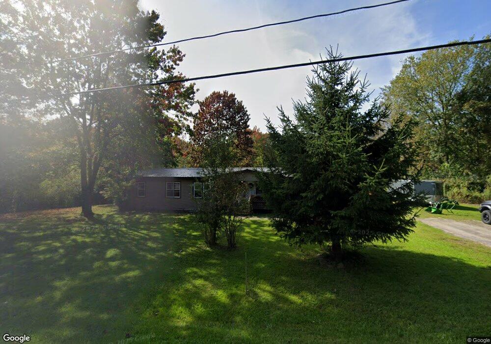
171 Springbrook Rd Pulaski, NY 13142
Estimated Value: $173,000 - $423,000
3
Beds
2
Baths
1,980
Sq Ft
$135/Sq Ft
Est. Value
About This Home
This home is located at 171 Springbrook Rd, Pulaski, NY 13142 and is currently estimated at $267,158, approximately $134 per square foot. 171 Springbrook Rd is a home located in Oswego County with nearby schools including Pulaski Elementary School, Pulaski Middle School, and Pulaski High School.
Ownership History
Date
Name
Owned For
Owner Type
Purchase Details
Closed on
Jul 23, 2019
Sold by
Redden Scott
Bought by
Redden Jenna
Current Estimated Value
Home Financials for this Owner
Home Financials are based on the most recent Mortgage that was taken out on this home.
Original Mortgage
$27,300
Interest Rate
3.7%
Mortgage Type
New Conventional
Purchase Details
Closed on
Sep 20, 2005
Sold by
Redden Scott and Redden Barbie L
Bought by
Redden Scott
Purchase Details
Closed on
Apr 25, 2002
Sold by
Russell Barbara A
Bought by
Redden Scott
Purchase Details
Closed on
Apr 6, 1996
Purchase Details
Closed on
Apr 5, 1996
Sold by
Drake Kenneth
Bought by
Lisero Barbara
Create a Home Valuation Report for This Property
The Home Valuation Report is an in-depth analysis detailing your home's value as well as a comparison with similar homes in the area
Home Values in the Area
Average Home Value in this Area
Purchase History
| Date | Buyer | Sale Price | Title Company |
|---|---|---|---|
| Redden Jenna | $25,000 | None Available | |
| Redden Scott | -- | None Available | |
| Redden Scott | $50,000 | -- | |
| -- | -- | -- | |
| Lisero Barbara | $45,500 | -- |
Source: Public Records
Mortgage History
| Date | Status | Borrower | Loan Amount |
|---|---|---|---|
| Previous Owner | Redden Jenna | $27,300 |
Source: Public Records
Tax History
| Year | Tax Paid | Tax Assessment Tax Assessment Total Assessment is a certain percentage of the fair market value that is determined by local assessors to be the total taxable value of land and additions on the property. | Land | Improvement |
|---|---|---|---|---|
| 2024 | $3,367 | $70,805 | $23,375 | $47,430 |
| 2023 | $3,519 | $70,805 | $23,375 | $47,430 |
| 2022 | $3,450 | $70,805 | $23,375 | $47,430 |
| 2021 | $3,436 | $70,805 | $23,375 | $47,430 |
| 2020 | $3,532 | $70,805 | $23,375 | $47,430 |
| 2019 | $2,627 | $70,805 | $23,375 | $47,430 |
| 2018 | $2,627 | $66,521 | $25,025 | $41,496 |
| 2017 | $2,587 | $66,521 | $25,025 | $41,496 |
| 2016 | $2,540 | $66,521 | $25,025 | $41,496 |
| 2015 | -- | $66,521 | $25,025 | $41,496 |
| 2014 | -- | $66,521 | $25,025 | $41,496 |
Source: Public Records
Map
Nearby Homes
- 179 Cummings Rd
- 91 North St
- 247 County Route 62
- 3796 State Route 13
- 3796 Route 13
- 0 Canning Factory Rd Unit S1659374
- 0 Rome Rd
- 25 Park St
- 7 View Rd
- 19 Lake St
- 00 New York 13
- 516 Wart Rd
- 3699 New York 13
- 20 S Jefferson St
- 4750 Salina St
- 12 James St
- 12 Church St
- 3622 State Route 13
- 0 Cobb Dr Unit S1576907
- 4737 Salina St
- 177 Springbrook Rd
- 163 Springbrook Rd
- 159 Springbrook Rd
- 183 Springbrook Rd
- 443 Canning Factory Rd
- 153 Springbrook Rd
- 447 Canning Factory Rd
- 448 Canning Factory Rd
- 147 Springbrook Rd
- 453 Canning Factory Rd
- 143 Springbrook Rd
- 137 Springbrook Rd
- 467 Canning Factory Rd
- 428 Canning Factory Rd
- 131 Springbrook Rd
- 125 Springbrook Rd
- 479 Canning Factory Rd
- 121 Springbrook Rd
- 120 Springbrook Rd
- 487 Canning Factory Rd
Your Personal Tour Guide
Ask me questions while you tour the home.