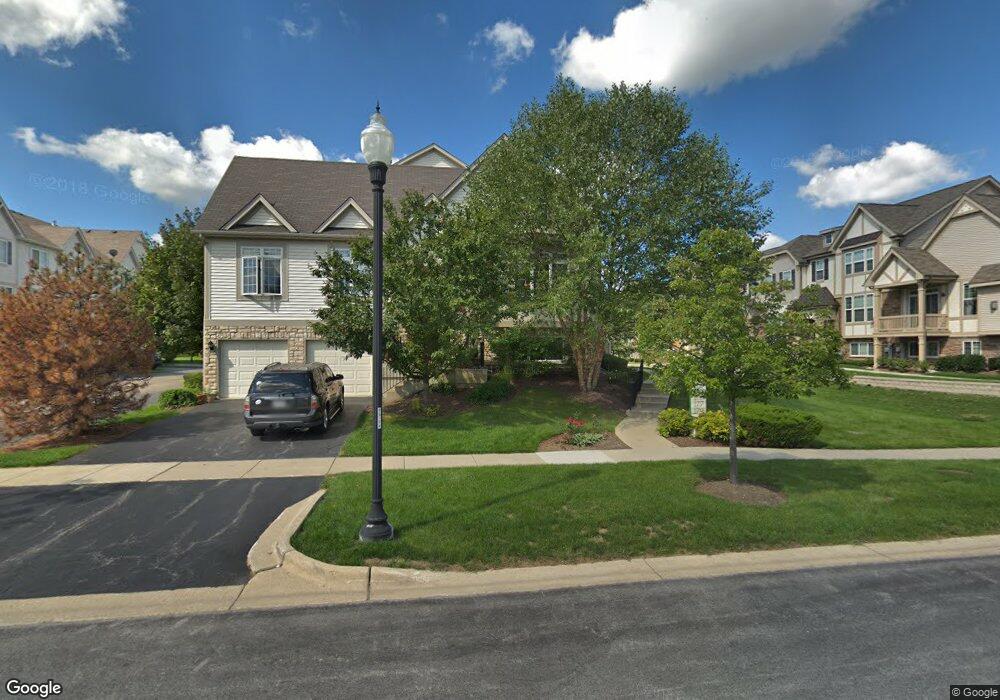
171 Sype Dr Unit 42-1 Carol Stream, IL 60188
Estimated Value: $385,844 - $397,000
2
Beds
3
Baths
1,960
Sq Ft
$200/Sq Ft
Est. Value
About This Home
This home is located at 171 Sype Dr Unit 42-1, Carol Stream, IL 60188 and is currently estimated at $392,961, approximately $200 per square foot. 171 Sype Dr Unit 42-1 is a home located in DuPage County with nearby schools including Field Kindergarten Center, Carol Stream Elementary School, and Jay Stream Middle School.
Ownership History
Date
Name
Owned For
Owner Type
Purchase Details
Closed on
Jul 10, 2020
Sold by
Peters Larry R and Peters Julie A
Bought by
Demma Dominic R and Demma Maryann
Current Estimated Value
Home Financials for this Owner
Home Financials are based on the most recent Mortgage that was taken out on this home.
Original Mortgage
$154,000
Outstanding Balance
$135,965
Interest Rate
2.87%
Mortgage Type
New Conventional
Estimated Equity
$256,996
Purchase Details
Closed on
Mar 26, 2009
Sold by
Carol Stream Holdings Llc
Bought by
Peters Larry R and Peters Julie A
Home Financials for this Owner
Home Financials are based on the most recent Mortgage that was taken out on this home.
Original Mortgage
$273,864
Interest Rate
5.11%
Mortgage Type
FHA
Create a Home Valuation Report for This Property
The Home Valuation Report is an in-depth analysis detailing your home's value as well as a comparison with similar homes in the area
Home Values in the Area
Average Home Value in this Area
Purchase History
| Date | Buyer | Sale Price | Title Company |
|---|---|---|---|
| Demma Dominic R | $308,000 | Chicago Title Company | |
| Peters Larry R | $299,500 | None Available |
Source: Public Records
Mortgage History
| Date | Status | Borrower | Loan Amount |
|---|---|---|---|
| Open | Demma Dominic R | $154,000 | |
| Previous Owner | Peters Larry R | $273,864 |
Source: Public Records
Tax History Compared to Growth
Tax History
| Year | Tax Paid | Tax Assessment Tax Assessment Total Assessment is a certain percentage of the fair market value that is determined by local assessors to be the total taxable value of land and additions on the property. | Land | Improvement |
|---|---|---|---|---|
| 2024 | $8,555 | $115,725 | $26,025 | $89,700 |
| 2023 | $7,684 | $102,000 | $23,800 | $78,200 |
| 2022 | $8,395 | $102,000 | $23,650 | $78,350 |
| 2021 | $8,453 | $102,000 | $22,470 | $79,530 |
| 2020 | $9,811 | $112,970 | $21,920 | $91,050 |
| 2019 | $9,657 | $108,560 | $21,060 | $87,500 |
| 2018 | $8,955 | $102,390 | $20,510 | $81,880 |
| 2017 | $8,472 | $94,900 | $19,010 | $75,890 |
| 2016 | $9,218 | $99,950 | $17,590 | $82,360 |
| 2015 | $9,019 | $93,270 | $16,410 | $76,860 |
| 2014 | $7,736 | $79,500 | $16,410 | $63,090 |
| 2013 | $7,777 | $82,220 | $16,970 | $65,250 |
Source: Public Records
Map
Nearby Homes
- 299 Bennett Dr
- 229 Shawnee Dr
- 269 Thunderbird Trail
- 206 Yuma Ln
- 342 Seminole Ln
- 352 Sioux Ln
- 426 Thunderbird Trail
- 27W130 W Street Charles Rd
- Lot 2 W Street Charles Rd
- 403 Arrowhead Trail
- 437 Eagle View Dr
- 1430 Preserve Dr Unit 29
- 1N060 LOT 1 Morse St
- 1N060 LOT 2 Morse St
- 1N060 LOT 4 Morse St
- 1043 Quarry Ct Unit 11
- 1048 Quarry Ct Unit 13
- 1421 Preserve Dr Unit 18
- 1N060 LOT 3 Morse St
- 1027 Quarry Ct Unit 7
- 171 Sype Dr
- 173 Sype Dr
- 175 Sype Dr
- 177 Sype Dr
- 181 Sype Dr Unit 43-5
- 183 Sype Dr
- 185 Sype Dr
- 307 Richard Cir
- 307 Richard Lot # 41 04 Cir
- 309 Richard Cir
- 187 Sype Dr
- 187 Sype Dr Unit 43-2
- 305 Richard Cir
- 303 Richard Lot # 41 02 Cir
- 303 Richard Cir
- 189 Sype Dr
- 301 Richard Lot # 41 01 Cir
- 301 Richard Cir
- 172 Sype Dr