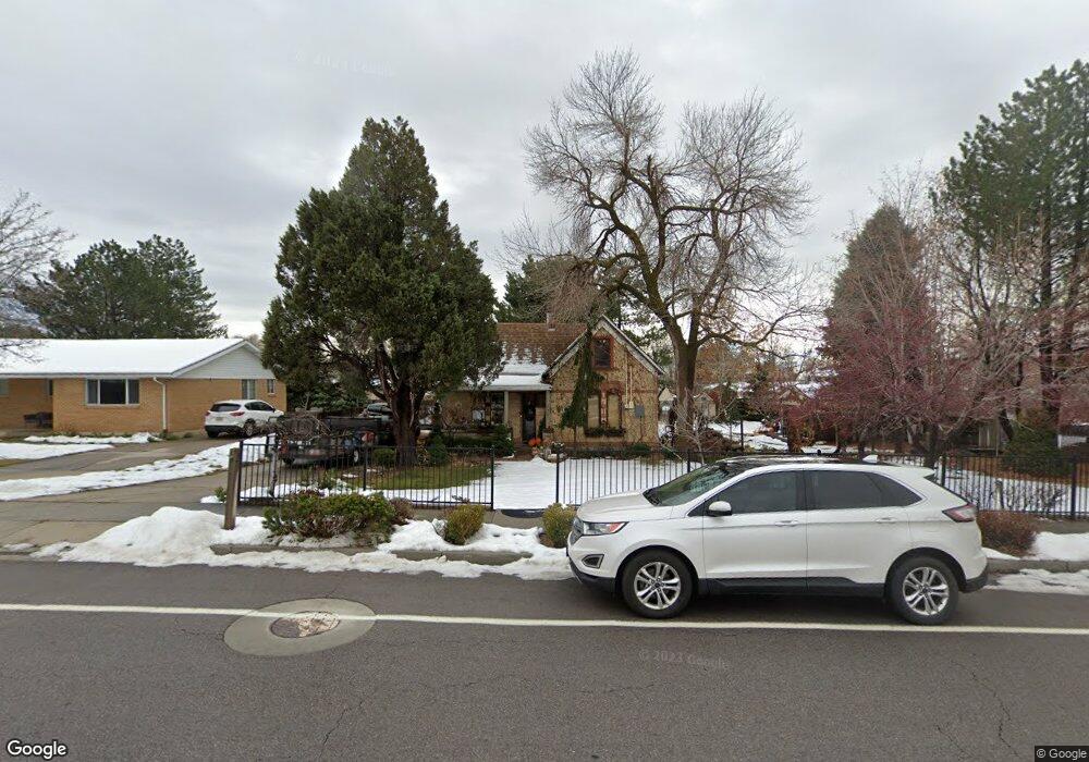
171 W 200 N Alpine, UT 84004
Estimated Value: $405,000 - $577,000
3
Beds
1
Bath
1,040
Sq Ft
$498/Sq Ft
Est. Value
About This Home
This home is located at 171 W 200 N, Alpine, UT 84004 and is currently estimated at $517,991, approximately $498 per square foot. 171 W 200 N is a home located in Utah County with nearby schools including Westfield School, Timberline Middle School, and Lone Peak High School.
Ownership History
Date
Name
Owned For
Owner Type
Purchase Details
Closed on
Dec 31, 2008
Sold by
Buckeye Properties Llc
Bought by
Patterson Construction
Current Estimated Value
Purchase Details
Closed on
Aug 24, 2007
Sold by
Magnusson James L and Magnusson Sharon
Bought by
Buckeye Properties Llc
Purchase Details
Closed on
Jan 25, 2002
Sold by
Smith Christopher and Smith Kirsten
Bought by
Smith Christopher and Smith Kirsten
Home Financials for this Owner
Home Financials are based on the most recent Mortgage that was taken out on this home.
Original Mortgage
$160,500
Interest Rate
7.17%
Purchase Details
Closed on
Jul 30, 1999
Sold by
Smith Christopher and Smith Kirsten
Bought by
Smith Christopher and Smith Kirsten
Purchase Details
Closed on
Jun 16, 1999
Sold by
Snake River Investments Lp
Bought by
Smith Christopher and Smith Kirsten
Home Financials for this Owner
Home Financials are based on the most recent Mortgage that was taken out on this home.
Original Mortgage
$116,700
Interest Rate
6.92%
Purchase Details
Closed on
May 21, 1999
Sold by
Clegg Jack and Clegg Thorma M
Bought by
Magnusson James L and Magnusson Sharon
Home Financials for this Owner
Home Financials are based on the most recent Mortgage that was taken out on this home.
Original Mortgage
$116,700
Interest Rate
6.92%
Purchase Details
Closed on
Mar 24, 1998
Sold by
Donaldson Linda L
Bought by
Snake River Investments L P
Purchase Details
Closed on
Mar 2, 1998
Sold by
David J & Linda L Donaldson Family Trust
Bought by
Donaldson Linda L
Purchase Details
Closed on
Aug 19, 1996
Sold by
Couch Camille and Ahmed Camille
Bought by
David J And Linda L Donaldson Family Tru
Home Financials for this Owner
Home Financials are based on the most recent Mortgage that was taken out on this home.
Original Mortgage
$110,900
Interest Rate
8.42%
Mortgage Type
Seller Take Back
Create a Home Valuation Report for This Property
The Home Valuation Report is an in-depth analysis detailing your home's value as well as a comparison with similar homes in the area
Home Values in the Area
Average Home Value in this Area
Purchase History
| Date | Buyer | Sale Price | Title Company |
|---|---|---|---|
| Patterson Construction | -- | Accommodation | |
| Buckeye Properties Llc | -- | Select Title Insurance Agen | |
| Smith Christopher | -- | Provo Land Title Company | |
| Smith Christopher | -- | Backman Stewart Title | |
| Smith Christopher | -- | -- | |
| Magnusson James L | -- | Equity Title Agency Inc | |
| Snake River Investments L P | -- | -- | |
| Donaldson Linda L | -- | -- | |
| David J And Linda L Donaldson Family Tru | -- | -- |
Source: Public Records
Mortgage History
| Date | Status | Borrower | Loan Amount |
|---|---|---|---|
| Previous Owner | Smith Christopher | $160,500 | |
| Previous Owner | Magnusson James L | $116,700 | |
| Previous Owner | David J And Linda L Donaldson Family Tru | $110,900 |
Source: Public Records
Tax History
| Year | Tax Paid | Tax Assessment Tax Assessment Total Assessment is a certain percentage of the fair market value that is determined by local assessors to be the total taxable value of land and additions on the property. | Land | Improvement |
|---|---|---|---|---|
| 2025 | $2,214 | $275,495 | -- | -- |
| 2024 | $2,214 | $258,060 | $0 | $0 |
| 2023 | $1,933 | $241,835 | $0 | $0 |
| 2022 | $2,045 | $248,545 | $0 | $0 |
| 2021 | $1,529 | $288,600 | $206,200 | $82,400 |
| 2020 | $1,396 | $257,800 | $179,300 | $78,500 |
| 2019 | $1,297 | $250,100 | $179,300 | $70,800 |
| 2018 | $1,275 | $242,900 | $172,100 | $70,800 |
| 2017 | $1,229 | $124,575 | $0 | $0 |
| 2016 | $1,149 | $108,625 | $0 | $0 |
| 2015 | $1,104 | $98,725 | $0 | $0 |
| 2014 | $982 | $86,900 | $0 | $0 |
Source: Public Records
Map
Nearby Homes
- 248 Deerfield Dr
- 151 Glacier Lily Dr
- 30 S Main St
- 48 N 100 E
- 501 W Devey Dr
- 259 Twin River Loop
- 250 S Main St Unit 25
- 250 S Main St Unit 9
- 250 S Main St Unit 7
- 475 Grove Dr
- 366 River Rd
- 353 International Way
- 684 N Summit Way
- 499 E 300 N
- 820 Eagleview Dr
- 596 S Cascade Ct
- 512 Eastridge Cir
- 184 S Pfeifferhorn Dr
- 522 N Pfeifferhorn Dr
- 19 E Elk Ct
Your Personal Tour Guide
Ask me questions while you tour the home.