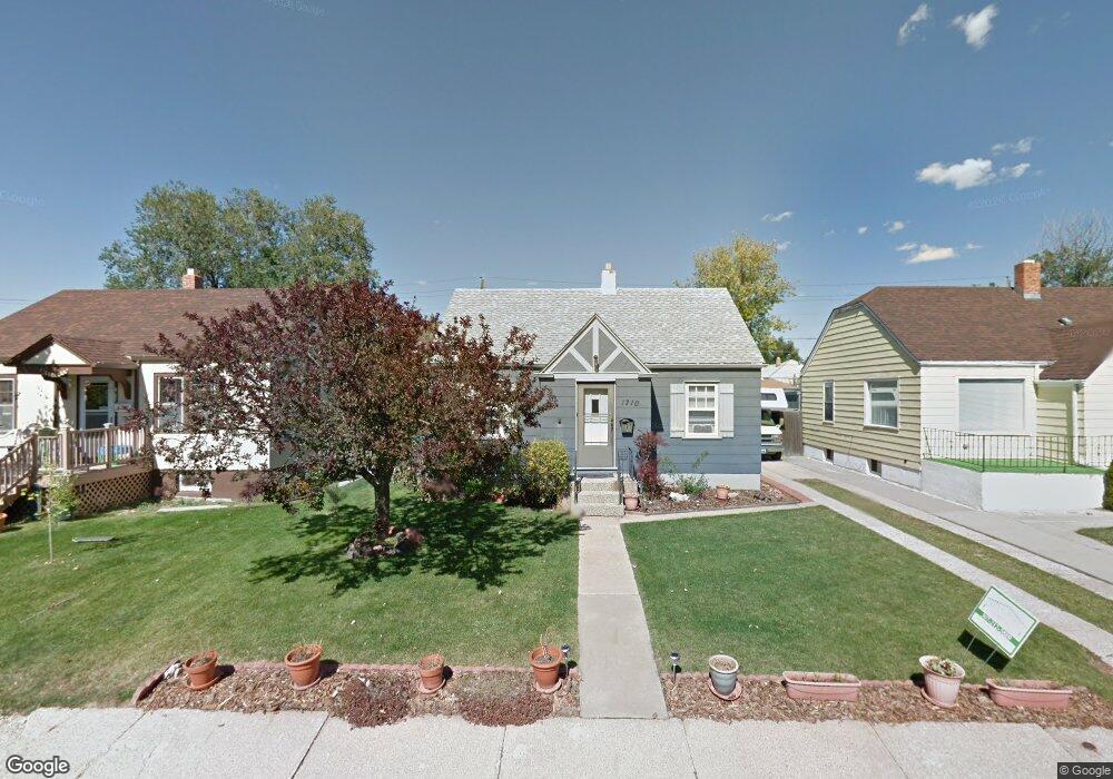
1710 E 21st St Cheyenne, WY 82001
Estimated Value: $236,000 - $310,000
Studio
1
Bath
865
Sq Ft
$324/Sq Ft
Est. Value
About This Home
This home is located at 1710 E 21st St, Cheyenne, WY 82001 and is currently estimated at $280,365, approximately $324 per square foot. 1710 E 21st St is a home located in Laramie County with nearby schools including Alta Vista Elementary School, Carey Junior High School, and East High School.
Ownership History
Date
Name
Owned For
Owner Type
Purchase Details
Closed on
Mar 24, 2023
Sold by
Befus Georgia K
Bought by
Georgia K Befus Irrevocable Trust
Current Estimated Value
Purchase Details
Closed on
Jul 17, 2002
Sold by
Miller David Sean and Miller Leigh Ann
Bought by
Befus Georgia K
Home Financials for this Owner
Home Financials are based on the most recent Mortgage that was taken out on this home.
Original Mortgage
$98,300
Interest Rate
6.69%
Purchase Details
Closed on
Sep 29, 1999
Sold by
Martin Patricia Kay
Bought by
Miller David Sean and Miller Leigh Ann
Home Financials for this Owner
Home Financials are based on the most recent Mortgage that was taken out on this home.
Original Mortgage
$74,700
Interest Rate
8.02%
Create a Home Valuation Report for This Property
The Home Valuation Report is an in-depth analysis detailing your home's value as well as a comparison with similar homes in the area
Purchase History
| Date | Buyer | Sale Price | Title Company |
|---|---|---|---|
| Georgia K Befus Irrevocable Trust | -- | None Listed On Document | |
| Befus Georgia K | -- | -- | |
| Miller David Sean | -- | -- |
Source: Public Records
Mortgage History
| Date | Status | Borrower | Loan Amount |
|---|---|---|---|
| Previous Owner | Befus Georgia K | $98,300 | |
| Previous Owner | Miller David Sean | $74,700 |
Source: Public Records
Tax History
| Year | Tax Paid | Tax Assessment Tax Assessment Total Assessment is a certain percentage of the fair market value that is determined by local assessors to be the total taxable value of land and additions on the property. | Land | Improvement |
|---|---|---|---|---|
| 2025 | $1,567 | $11,351 | $1,594 | $9,757 |
| 2024 | $1,567 | $22,158 | $3,187 | $18,971 |
| 2023 | $1,524 | $21,558 | $3,187 | $18,371 |
| 2022 | $1,406 | $19,479 | $3,187 | $16,292 |
| 2021 | $1,198 | $16,564 | $3,187 | $13,377 |
| 2020 | $1,111 | $15,399 | $3,187 | $12,212 |
| 2019 | $1,077 | $14,913 | $3,187 | $11,726 |
| 2018 | $937 | $13,099 | $2,404 | $10,695 |
| 2017 | $918 | $12,717 | $2,404 | $10,313 |
| 2016 | $876 | $12,137 | $2,325 | $9,812 |
| 2015 | $877 | $12,144 | $2,325 | $9,819 |
| 2014 | $882 | $12,132 | $2,325 | $9,807 |
Source: Public Records
Map
Nearby Homes
- 1608 E 21st St
- 2013 Dunn Ave
- 1851 E Pershing Blvd
- 1906 E 21st St
- 1406 E 19th St
- 1910 E 22nd St
- 1902 Cheyenne Place
- TBD Charles St
- 3341 Dunn Ave
- 1410 E 17th St
- 1911 E 17th St
- 3529 Amherst Rd
- 3520 Essex Rd
- 1763 Milton Dr
- 2111 Garrett St
- 2008 E 17th St
- 1605 E 16th St
- 1018 E 20th St
- 2123 E 18th St
- 1120 Black Ct
- 1706 E 21st St
- 1714 E 21st St
- 1718 E 21st St
- 1700 E 21st St
- 2109 Logan Ave
- 1722 E 21st St
- 1725 E 22nd St
- 1721 E 22nd St Unit 1-4
- 1721 E 22nd St
- 1729 E 22nd St
- 1731 E 22nd St
- 1717 E 22nd St
- 2021 Logan Ave
- 1726 E 21st St
- 1705 E 21st St
- 1735 E 22nd St
- 1713 E 22nd St
- 1709 E 21st St
- 1711 E 21st St
- 1730 E 21st St
Your Personal Tour Guide
Ask me questions while you tour the home.