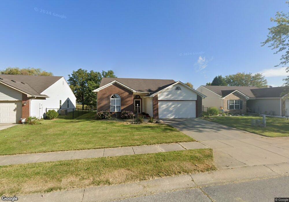
1710 E Fork Dr Brownsburg, IN 46112
Estimated Value: $264,000 - $331,000
3
Beds
2
Baths
1,480
Sq Ft
$194/Sq Ft
Est. Value
About This Home
This home is located at 1710 E Fork Dr, Brownsburg, IN 46112 and is currently estimated at $287,556, approximately $194 per square foot. 1710 E Fork Dr is a home located in Hendricks County with nearby schools including Brownsburg East Middle School, Brownsburg High School, and St Malachy Parish School.
Ownership History
Date
Name
Owned For
Owner Type
Purchase Details
Closed on
Jan 13, 2017
Sold by
Eastman Robert F
Bought by
Eastman Robert F and Eastman Suzannbe B
Current Estimated Value
Home Financials for this Owner
Home Financials are based on the most recent Mortgage that was taken out on this home.
Original Mortgage
$79,150
Outstanding Balance
$64,444
Interest Rate
4.13%
Mortgage Type
New Conventional
Estimated Equity
$223,112
Purchase Details
Closed on
Nov 19, 2007
Sold by
Jackson Alphonso and Secretary Of Hud
Bought by
Eastman Robert F
Home Financials for this Owner
Home Financials are based on the most recent Mortgage that was taken out on this home.
Original Mortgage
$90,250
Interest Rate
6.47%
Mortgage Type
New Conventional
Purchase Details
Closed on
May 17, 2007
Sold by
Miller Curtis T and Chase Home Finance Llc
Bought by
Secretary Of Hud
Create a Home Valuation Report for This Property
The Home Valuation Report is an in-depth analysis detailing your home's value as well as a comparison with similar homes in the area
Home Values in the Area
Average Home Value in this Area
Purchase History
| Date | Buyer | Sale Price | Title Company |
|---|---|---|---|
| Eastman Robert F | -- | First American Title | |
| Eastman Robert F | -- | Village Title Inc | |
| Secretary Of Hud | $85,740 | None Available |
Source: Public Records
Mortgage History
| Date | Status | Borrower | Loan Amount |
|---|---|---|---|
| Open | Eastman Robert F | $79,150 | |
| Previous Owner | Eastman Robert F | $90,250 |
Source: Public Records
Tax History
| Year | Tax Paid | Tax Assessment Tax Assessment Total Assessment is a certain percentage of the fair market value that is determined by local assessors to be the total taxable value of land and additions on the property. | Land | Improvement |
|---|---|---|---|---|
| 2025 | $2,446 | $251,700 | $44,100 | $207,600 |
| 2024 | $2,446 | $244,600 | $44,100 | $200,500 |
| 2023 | $2,073 | $207,300 | $37,400 | $169,900 |
| 2022 | $1,936 | $193,600 | $34,600 | $159,000 |
| 2021 | $1,693 | $169,300 | $31,500 | $137,800 |
| 2020 | $1,513 | $151,300 | $31,500 | $119,800 |
| 2019 | $1,482 | $148,200 | $31,500 | $116,700 |
| 2018 | $1,425 | $142,500 | $31,500 | $111,000 |
| 2017 | $1,369 | $136,900 | $31,500 | $105,400 |
| 2016 | $1,336 | $133,600 | $31,500 | $102,100 |
| 2014 | $1,267 | $126,700 | $30,600 | $96,100 |
Source: Public Records
Map
Nearby Homes
- 1844 Creekside Dr
- 1560 Cold Spring Dr
- 216 Rapid Rill Ln
- 168 Rapid Rill Ln
- 8903 Motorsports Way
- 3924 Castle Hill Dr
- 1635 Beacon Pointe Blvd
- 8562 Goldfinch Rd
- 8558 Goldfinch Rd
- 3959 Sandpiper Way
- 8538 Goldfinch Rd
- 3947 Sandpiper Way
- 3927 Sandpiper Way
- 8516 Goldfinch Rd
- 3857 Concord Point Way
- 3883 Wren Dr
- 3819 Castle Hill Dr
- 3780 Concord Point Way
- 1647 Gross Point Pass
- 17 Roselawn Ave
- 1710 Eastfork Dr
- 1730 Eastfork Dr
- 1690 E Fork Dr
- 1690 Eastfork Dr
- 1730 E Fork Dr
- 1750 E Fork Dr
- 1750 Eastfork Dr
- 1670 Eastfork Dr
- 1711 Eastfork Dr
- 1691 Eastfork Dr
- 1691 E Fork Dr
- 1770 Eastfork Dr
- 1770 E Fork Dr
- 1751 Eastfork Dr
- 1731 Eastfork Dr
- 1650 Eastfork Dr
- 1731 E Fork Dr
- 1671 E Fork Dr
- 1671 Eastfork Dr
- 1650 E Fork Dr
Your Personal Tour Guide
Ask me questions while you tour the home.