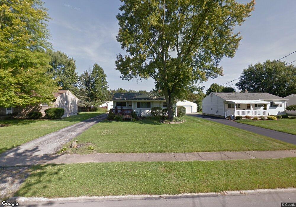
1710 Lealand Ave Youngstown, OH 44514
Estimated Value: $148,000 - $171,000
3
Beds
2
Baths
924
Sq Ft
$173/Sq Ft
Est. Value
About This Home
This home is located at 1710 Lealand Ave, Youngstown, OH 44514 and is currently estimated at $159,433, approximately $172 per square foot. 1710 Lealand Ave is a home located in Mahoning County with nearby schools including Robinwood Lane Elementary School, Boardman Glenwood Junior High School, and Boardman High School.
Ownership History
Date
Name
Owned For
Owner Type
Purchase Details
Closed on
Nov 14, 1997
Sold by
Ford John W and Ford Julie A
Bought by
Dovidio Terry L
Current Estimated Value
Home Financials for this Owner
Home Financials are based on the most recent Mortgage that was taken out on this home.
Original Mortgage
$56,000
Outstanding Balance
$9,312
Interest Rate
7.43%
Estimated Equity
$150,121
Purchase Details
Closed on
Jan 10, 1996
Sold by
Sharpe Michael L
Bought by
Ford John W and Ford Julie A
Home Financials for this Owner
Home Financials are based on the most recent Mortgage that was taken out on this home.
Original Mortgage
$69,000
Interest Rate
7.36%
Mortgage Type
New Conventional
Purchase Details
Closed on
Aug 21, 1991
Bought by
Sharpe Michael L
Create a Home Valuation Report for This Property
The Home Valuation Report is an in-depth analysis detailing your home's value as well as a comparison with similar homes in the area
Home Values in the Area
Average Home Value in this Area
Purchase History
| Date | Buyer | Sale Price | Title Company |
|---|---|---|---|
| Dovidio Terry L | $70,000 | -- | |
| Ford John W | $73,000 | -- | |
| Sharpe Michael L | $52,000 | -- |
Source: Public Records
Mortgage History
| Date | Status | Borrower | Loan Amount |
|---|---|---|---|
| Open | Dovidio Terry L | $56,000 | |
| Previous Owner | Ford John W | $69,000 |
Source: Public Records
Tax History Compared to Growth
Tax History
| Year | Tax Paid | Tax Assessment Tax Assessment Total Assessment is a certain percentage of the fair market value that is determined by local assessors to be the total taxable value of land and additions on the property. | Land | Improvement |
|---|---|---|---|---|
| 2024 | $2,050 | $39,840 | $6,380 | $33,460 |
| 2023 | $2,023 | $39,840 | $6,380 | $33,460 |
| 2022 | $1,787 | $26,840 | $6,020 | $20,820 |
| 2021 | $1,789 | $26,840 | $6,020 | $20,820 |
| 2020 | $1,798 | $26,840 | $6,020 | $20,820 |
| 2019 | $1,628 | $21,130 | $4,740 | $16,390 |
| 2018 | $1,380 | $21,130 | $4,740 | $16,390 |
| 2017 | $1,358 | $21,130 | $4,740 | $16,390 |
| 2016 | $1,604 | $24,770 | $6,980 | $17,790 |
| 2015 | $1,572 | $24,770 | $6,980 | $17,790 |
| 2014 | $1,576 | $24,770 | $6,980 | $17,790 |
| 2013 | $1,556 | $24,770 | $6,980 | $17,790 |
Source: Public Records
Map
Nearby Homes
- 0 Mathews Rd Unit 5149232
- 0 Mathews Rd Unit 5143059
- 1738 Island Dr
- 1859 Mathews Rd
- 1804 Alverne Dr
- 928 Edenridge Dr
- 1890 Mathews Rd
- 1827 Alverne Dr
- 0 Oles Ave
- 0 Woodlawn Ave
- 1841 Wingate Rd
- 0 Moyer Ave
- 857 Maple Ridge Dr
- 6229 Appleridge Dr
- 792 Forest Ridge Dr
- 1919 Wingate Rd
- 796 Edenridge Dr
- 1828 Basil Ave
- 2035 Woodward Ave
- 2061 Mathews Rd
- 1704 Lealand Ave
- 1716 Lealand Ave
- 1722 Lealand Ave
- 1700 Lealand Ave
- 1711 Lynn Mar Ave
- 1717 Lynn Mar Ave
- 1705 Lynn Mar Ave
- 1728 Lealand Ave
- 1723 Lynn Mar Ave
- 1701 Lynn Mar Ave
- 1729 Lynn Mar Ave
- 1711 Lealand Ave
- 1717 Lealand Ave
- 1705 Lealand Ave
- 1734 Lealand Ave
- 1723 Lealand Ave
- 1701 Lealand Ave
- 1735 Lynn Mar Ave
- 5970 Lightner Place
- 5980 Lightner Place