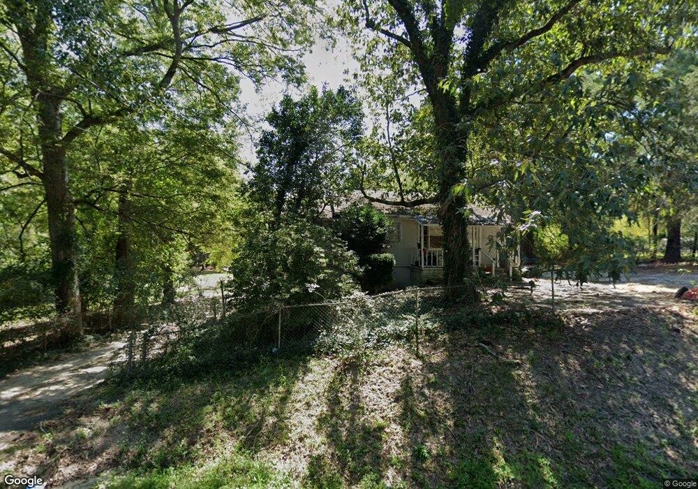
1710 Powell Rd Augusta, GA 30909
Belair NeighborhoodEstimated Value: $104,000 - $159,000
2
Beds
1
Bath
1,024
Sq Ft
$119/Sq Ft
Est. Value
About This Home
This home is located at 1710 Powell Rd, Augusta, GA 30909 and is currently estimated at $121,351, approximately $118 per square foot. 1710 Powell Rd is a home located in Richmond County with nearby schools including Johnson Magnet, Westside High School, and Greater Augusta Christian Academy.
Ownership History
Date
Name
Owned For
Owner Type
Purchase Details
Closed on
Oct 28, 2010
Sold by
Penley Thomas W and Penley Nellie R
Bought by
Laster Cecil T and Laster Cindy
Current Estimated Value
Purchase Details
Closed on
Oct 25, 2010
Sold by
Penley Nellie R
Bought by
Laster Cecil T
Purchase Details
Closed on
Sep 13, 2001
Sold by
Penley Thomas W
Bought by
Penley Nellie R
Purchase Details
Closed on
Jun 2, 1993
Sold by
Stetzler Lonnie Lee
Bought by
Penley Thomas W
Purchase Details
Closed on
Dec 18, 1992
Sold by
Channell Cliff
Bought by
Stetzler Lonnie Lee Stetzler Helen
Purchase Details
Closed on
Oct 28, 1992
Sold by
Channell Cliff
Bought by
Stetzler Lonnie Lee
Create a Home Valuation Report for This Property
The Home Valuation Report is an in-depth analysis detailing your home's value as well as a comparison with similar homes in the area
Home Values in the Area
Average Home Value in this Area
Purchase History
| Date | Buyer | Sale Price | Title Company |
|---|---|---|---|
| Laster Cecil T | $35,000 | -- | |
| Laster Cecil T | $35,000 | -- | |
| Penley Nellie R | -- | -- | |
| Penley Thomas W | $15,000 | -- | |
| Stetzler Lonnie Lee Stetzler Helen | -- | -- | |
| Stetzler Lonnie Lee | $10,000 | -- |
Source: Public Records
Tax History
| Year | Tax Paid | Tax Assessment Tax Assessment Total Assessment is a certain percentage of the fair market value that is determined by local assessors to be the total taxable value of land and additions on the property. | Land | Improvement |
|---|---|---|---|---|
| 2025 | $1,712 | $48,092 | $558 | $47,534 |
| 2024 | $1,712 | $46,480 | $558 | $45,922 |
| 2023 | $1,562 | $38,352 | $558 | $37,794 |
| 2022 | $815 | $18,023 | $558 | $17,465 |
| 2021 | $727 | $13,540 | $504 | $13,036 |
| 2020 | $719 | $13,540 | $504 | $13,036 |
| 2019 | $558 | $7,661 | $504 | $7,157 |
| 2018 | $560 | $7,661 | $504 | $7,157 |
| 2017 | $559 | $7,661 | $504 | $7,157 |
| 2016 | $559 | $7,661 | $504 | $7,157 |
| 2015 | $561 | $7,661 | $504 | $7,157 |
| 2014 | $559 | $7,594 | $504 | $7,090 |
Source: Public Records
Map
Nearby Homes
- 4128 Powell Mill Rd
- 3018, 3020 Carswell Dr
- 1609 Orange Ave
- 3950 Barrett St
- 2209 Jasmine Way
- 2215 Jasmine Way
- 2216 Jasmine Way
- 2222 Jasmine Way
- 736 Leela Ct
- 704 Leela Ct
- 3908 Carolyn St
- 1611 Bradley Way
- 532 Scenic Dr
- 3920 Carolyn St
- 515 Scenic Dr
- 3204 Pickens Way
- 3195 Waverly Ln
- 3201 Waverly Ln
- 419 Barrow Ln
- 3934 Grape Ave
- 1712 Powell Rd
- 1714 Powell Rd
- 1707 Powell Rd
- 1711 Powell Rd
- 4103 Rickerson Rd
- 1701 Powell Rd
- 1704 Powell Rd
- 4103 Rickerson Rd
- 4101 Powell Mill Rd
- 1713 Powell Rd
- 1731 Powell Rd
- 4115 Rickerson Rd
- 1734 Powell Rd
- 4015 Powell Mill Rd
- 1671 Powell Rd
- 1671 Powell Rd
- 4033 Powell Mill Rd
- 1670 Powell Rd
- 4018 Powell Mill Rd
- 4119 Powell Mill Rd
Your Personal Tour Guide
Ask me questions while you tour the home.