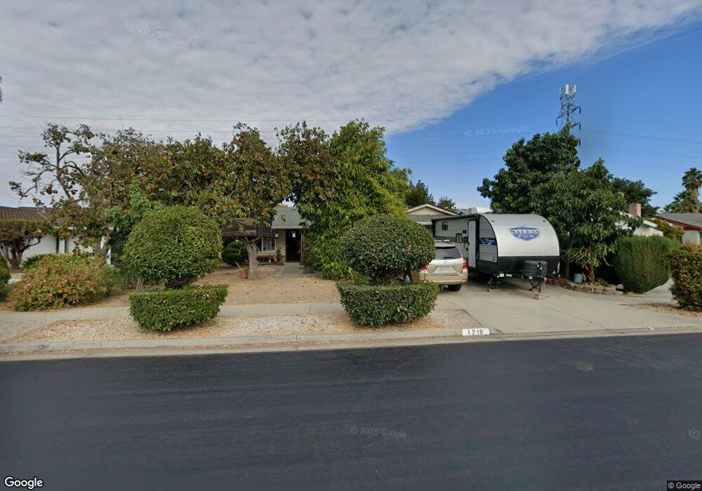
1710 Ramstree Dr San Jose, CA 95131
Brooktree NeighborhoodEstimated Value: $1,382,000 - $1,449,090
4
Beds
2
Baths
1,234
Sq Ft
$1,149/Sq Ft
Est. Value
About This Home
This home is located at 1710 Ramstree Dr, San Jose, CA 95131 and is currently estimated at $1,417,773, approximately $1,148 per square foot. 1710 Ramstree Dr is a home located in Santa Clara County with nearby schools including Brooktree Elementary School, Morrill Middle School, and Independence High School.
Ownership History
Date
Name
Owned For
Owner Type
Purchase Details
Closed on
Jul 9, 1999
Sold by
Truong John T and Margaret Chau
Bought by
Balallo Feliciano and Balallo Wendelin L
Current Estimated Value
Home Financials for this Owner
Home Financials are based on the most recent Mortgage that was taken out on this home.
Original Mortgage
$250,400
Interest Rate
7.4%
Mortgage Type
Stand Alone First
Create a Home Valuation Report for This Property
The Home Valuation Report is an in-depth analysis detailing your home's value as well as a comparison with similar homes in the area
Home Values in the Area
Average Home Value in this Area
Purchase History
| Date | Buyer | Sale Price | Title Company |
|---|---|---|---|
| Balallo Feliciano | $313,000 | Alliance Title Company | |
| Balallo Feliciano | $313,000 | Alliance Title Company |
Source: Public Records
Mortgage History
| Date | Status | Borrower | Loan Amount |
|---|---|---|---|
| Previous Owner | Balallo Feliciano | $250,400 | |
| Closed | Balallo Feliciano | $31,300 |
Source: Public Records
Tax History
| Year | Tax Paid | Tax Assessment Tax Assessment Total Assessment is a certain percentage of the fair market value that is determined by local assessors to be the total taxable value of land and additions on the property. | Land | Improvement |
|---|---|---|---|---|
| 2025 | $8,064 | $481,055 | $307,388 | $173,667 |
| 2024 | $8,064 | $471,623 | $301,361 | $170,262 |
| 2023 | $7,888 | $462,376 | $295,452 | $166,924 |
| 2022 | $7,828 | $453,310 | $289,659 | $163,651 |
| 2021 | $7,533 | $444,423 | $283,980 | $160,443 |
| 2020 | $6,753 | $439,867 | $281,069 | $158,798 |
| 2019 | $6,493 | $431,243 | $275,558 | $155,685 |
| 2018 | $6,393 | $422,788 | $270,155 | $152,633 |
| 2017 | $6,417 | $414,499 | $264,858 | $149,641 |
| 2016 | $6,148 | $406,372 | $259,665 | $146,707 |
| 2015 | $6,071 | $400,269 | $255,765 | $144,504 |
| 2014 | $5,466 | $392,429 | $250,755 | $141,674 |
Source: Public Records
Map
Nearby Homes
- 2272 Shadowtree Dr
- 2280 Zoria Cir
- 2088 Mckenzie Place
- 1638 Peachwood Dr
- 1976 Tradan Dr Unit 65
- 1788 Camino Leonor
- 1462 Goldrush Ct
- 1437 Marcello Dr
- 2501 Jubilee Ln
- 1388 Four Oaks Rd
- 0 Lundy Ave
- 1291 Marcello Dr
- 1287 Marcello Dr
- 1301 Marcello Dr
- 2559 Alveswood Cir
- 1357 Old Rose Place
- 2415 Stearman Ct Unit 7
- 2423 Stearman Ln Unit 2
- 1468 Leaftree Cir
- 1376 Yamada Dr Unit 157
- 1718 Ramstree Dr
- 1702 Ramstree Dr
- 1694 Ramstree Dr
- 1724 Ramstree Dr
- 1713 Ramstree Dr
- 1705 Ramstree Dr
- 1688 Ramstree Dr
- 1732 Ramstree Dr
- 1719 Ramstree Dr
- 1697 Ramstree Dr
- 1689 Coraltree Place
- 1727 Ramstree Dr
- 1683 Coraltree Place
- 1691 Ramstree Dr
- 1680 Ramstree Dr
- 1695 Coraltree Place
- 1677 Coraltree Place
- 2260 Shadowtree Dr
- 1701 Coraltree Place
- 1700 Goldentree Dr
