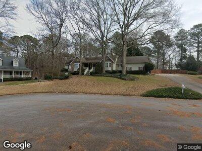
1710 Stonetrace Ct Unit 1 Lawrenceville, GA 30043
Estimated Value: $375,000 - $436,033
3
Beds
2
Baths
2,333
Sq Ft
$177/Sq Ft
Est. Value
About This Home
This home is located at 1710 Stonetrace Ct Unit 1, Lawrenceville, GA 30043 and is currently estimated at $412,258, approximately $176 per square foot. 1710 Stonetrace Ct Unit 1 is a home located in Gwinnett County with nearby schools including Taylor Elementary School, Creekland Middle School, and Collins Hill High School.
Ownership History
Date
Name
Owned For
Owner Type
Purchase Details
Closed on
Apr 26, 2002
Sold by
Starr James C Estate Of
Bought by
Reed Kelly C and Reed Philip T
Current Estimated Value
Home Financials for this Owner
Home Financials are based on the most recent Mortgage that was taken out on this home.
Original Mortgage
$151,600
Outstanding Balance
$68,269
Interest Rate
7.18%
Mortgage Type
New Conventional
Estimated Equity
$345,988
Create a Home Valuation Report for This Property
The Home Valuation Report is an in-depth analysis detailing your home's value as well as a comparison with similar homes in the area
Home Values in the Area
Average Home Value in this Area
Purchase History
| Date | Buyer | Sale Price | Title Company |
|---|---|---|---|
| Reed Kelly C | $189,500 | -- |
Source: Public Records
Mortgage History
| Date | Status | Borrower | Loan Amount |
|---|---|---|---|
| Open | Reed Kelly C | $151,600 | |
| Previous Owner | Starr James C | $152,000 |
Source: Public Records
Tax History Compared to Growth
Tax History
| Year | Tax Paid | Tax Assessment Tax Assessment Total Assessment is a certain percentage of the fair market value that is determined by local assessors to be the total taxable value of land and additions on the property. | Land | Improvement |
|---|---|---|---|---|
| 2023 | $4,555 | $145,320 | $31,200 | $114,120 |
| 2022 | $3,825 | $131,360 | $31,200 | $100,160 |
| 2021 | $2,906 | $84,840 | $16,960 | $67,880 |
| 2020 | $2,924 | $84,840 | $16,960 | $67,880 |
| 2019 | $2,848 | $84,840 | $16,960 | $67,880 |
| 2018 | $2,849 | $84,840 | $16,960 | $67,880 |
| 2016 | $2,457 | $65,800 | $12,400 | $53,400 |
| 2015 | $2,483 | $65,800 | $12,400 | $53,400 |
| 2014 | $2,440 | $63,320 | $13,280 | $50,040 |
Source: Public Records
Map
Nearby Homes
- 1812 Riverton Dr
- 77 Russell Rd
- 982 Sutherland Ln Unit LOT 30
- 986 Sutherland Ln Unit LOT 32
- 984 Sutherland Ln Unit LOT 31
- 345 Oak Springs Dr NW
- 1912 Riverton Dr
- 1924 Sidneys Cove
- 1931 Amber Dawn Way
- 12 Jacobs Farm Ln Unit 6
- 20 Jacobs Farm Ln Unit 10
- 1615 Cheshire Ct
- 1718 Country Park Way
- 1480 Bentridge Dr
- 1800 Jordan Brook Dr
- 1811 Jordan Brook Dr
- 300 Radner Run
- 488 Russell Rd
- 1710 Stonetrace Ct Unit 1
- 1720 Stonetrace Ct
- 241 Hambridge Ct
- 231 Hambridge Ct Unit 4
- 231 Hambridge Ct Unit 1
- 1721 Stonetrace Ct Unit 1
- 261 Hambridge Ct
- 221 Hambridge Ct
- 421 Hambridge Ct
- 411 Hambridge Ct Unit 1
- 271 Hambridge Ct
- 401 Hambridge Ct
- 211 Hambridge Ct
- 281 Hambridge Ct
- 240 Hambridge Ct
- 230 Hambridge Ct
- 351 Hambridge Ct
- 250 Hambridge Ct
- 341 Hambridge Ct
- 391 Hambridge Ct
