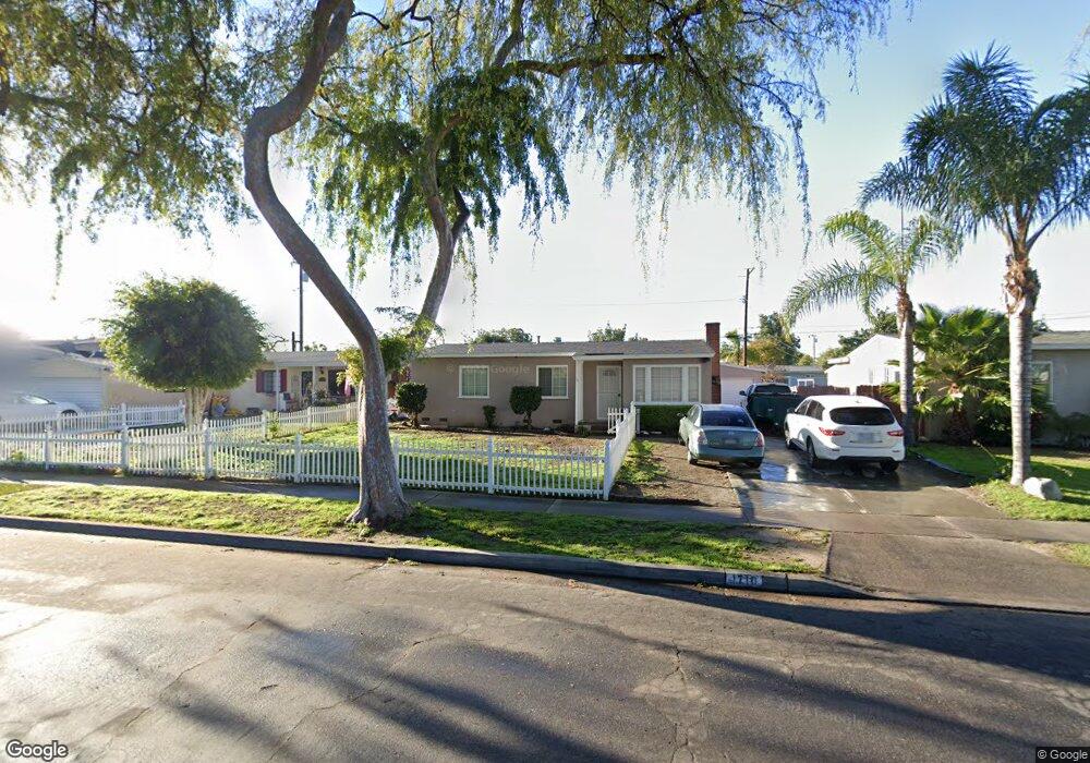
1710 W West Ave Fullerton, CA 92833
Estimated Value: $838,500 - $968,000
3
Beds
2
Baths
1,332
Sq Ft
$688/Sq Ft
Est. Value
About This Home
This home is located at 1710 W West Ave, Fullerton, CA 92833 and is currently estimated at $916,375, approximately $687 per square foot. 1710 W West Ave is a home located in Orange County with nearby schools including Pacific Drive Elementary School, Nicolas Junior High School, and Sunny Hills High School.
Ownership History
Date
Name
Owned For
Owner Type
Purchase Details
Closed on
Oct 10, 1994
Sold by
Turull Linda
Bought by
Turull Ronald R
Current Estimated Value
Home Financials for this Owner
Home Financials are based on the most recent Mortgage that was taken out on this home.
Original Mortgage
$154,857
Interest Rate
8.7%
Mortgage Type
FHA
Purchase Details
Closed on
Sep 7, 1994
Sold by
Turull Debra A and Turull Ronald R
Bought by
Abusham Hamed and Abusham Jaymi
Home Financials for this Owner
Home Financials are based on the most recent Mortgage that was taken out on this home.
Original Mortgage
$154,857
Interest Rate
8.7%
Mortgage Type
FHA
Create a Home Valuation Report for This Property
The Home Valuation Report is an in-depth analysis detailing your home's value as well as a comparison with similar homes in the area
Home Values in the Area
Average Home Value in this Area
Purchase History
| Date | Buyer | Sale Price | Title Company |
|---|---|---|---|
| Turull Ronald R | -- | North American Title Co | |
| Abusham Hamed | $158,000 | North American Title Co |
Source: Public Records
Mortgage History
| Date | Status | Borrower | Loan Amount |
|---|---|---|---|
| Previous Owner | Abusham Hamed | $154,857 |
Source: Public Records
Tax History Compared to Growth
Tax History
| Year | Tax Paid | Tax Assessment Tax Assessment Total Assessment is a certain percentage of the fair market value that is determined by local assessors to be the total taxable value of land and additions on the property. | Land | Improvement |
|---|---|---|---|---|
| 2025 | $3,167 | $265,375 | $197,804 | $67,571 |
| 2024 | $3,167 | $260,172 | $193,925 | $66,247 |
| 2023 | $3,089 | $255,071 | $190,122 | $64,949 |
| 2022 | $3,064 | $250,070 | $186,394 | $63,676 |
| 2021 | $3,012 | $245,167 | $182,739 | $62,428 |
| 2020 | $2,995 | $242,654 | $180,866 | $61,788 |
| 2019 | $2,922 | $237,897 | $177,320 | $60,577 |
| 2018 | $2,879 | $233,233 | $173,843 | $59,390 |
| 2017 | $2,832 | $228,660 | $170,434 | $58,226 |
| 2016 | $2,775 | $224,177 | $167,092 | $57,085 |
| 2015 | $2,700 | $220,810 | $164,582 | $56,228 |
| 2014 | $2,624 | $216,485 | $161,358 | $55,127 |
Source: Public Records
Map
Nearby Homes
- 600 S Brookhurst Rd
- 1636 W Valencia Dr
- 619 S Brookhurst Rd
- 1746 W Southgate Ave
- 1478 W Valencia Dr
- 1448 W West Ave
- 2013 W Porter Ave
- 2127 W Ash Ave
- 1850 W Orangethorpe Ave Unit 44
- 1850 W Orangethorpe Ave Unit 24
- 1850 W Orangethorpe Ave
- 1850 W Orangethorpe Ave Unit 1
- 1850 W Orangethorpe Ave Unit 25
- 2107 W Porter Ave
- 312 S Pine Dr
- 1601 W Baker Ave
- 1425 W Woodcrest Ave
- 2304 W Flower Ave
- 1201 W Valencia Dr Unit SPC 201
- 1201 W Valencia Dr Unit 138
- 1704 W West Ave
- 1714 W West Ave
- 1709 W Ash Ave
- 1713 W Ash Ave
- 1705 W Ash Ave
- 1700 W West Ave
- 1701 W Ash Ave
- 1709 W West Ave
- 1705 W West Ave
- 1713 W West Ave
- 1640 W West Ave
- 1701 W West Ave
- 1635 W Ash Ave
- 405 S Locust Dr
- 401 S Locust Dr
- 409 S Locust Dr
- 1643 W West Ave
- 315 S Locust Dr
- 411 S Locust Dr
- 1636 W West Ave